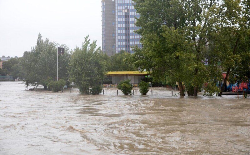
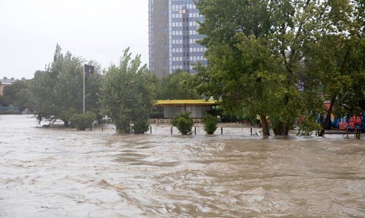
Powerful Storm Boris lashed central Europe over the weekend, bringing record-breaking rain, deadly flooding and up to 10 feet (3 meters) of snow in the mountains. At least 17 people have died since the rain began on September 13, officials said.
Storm Boris was formed by an unusual combination of meteorological factors, starting with an unusually strong cold front over Western Europe, clashing with unusually warm weather to the east, according to the Washington Post's weather report.
Storm Boris began as a blast of extremely cold Arctic air swept south into Europe. Some weather stations in Austria recorded record cold for the time of year, with temperatures of 10C (50F) lasting three days. Switzerland, Italy and Germany also saw historic cold.
The cold front is linked to normal warming and unusually high pressure in the polar stratosphere, according to Judah Cohen, a long-range weather forecaster at Verisk Atmospheric and Environmental Research.
As Arctic air rushed south across Western and Central Europe it collided with unusually warm, moist air to the east and south.
Weather historian Maximiliano Herrera points out that many temperature records have been set in Russia with temperatures soaring above 20 degrees Celsius. Moscow set a record for the hottest September night when the temperature was 19.2 degrees Celsius.
Low pressure forms near the intersection of cold and warm air masses, then becomes cut off from the Arctic air flow and trapped between high pressure to the west and east.
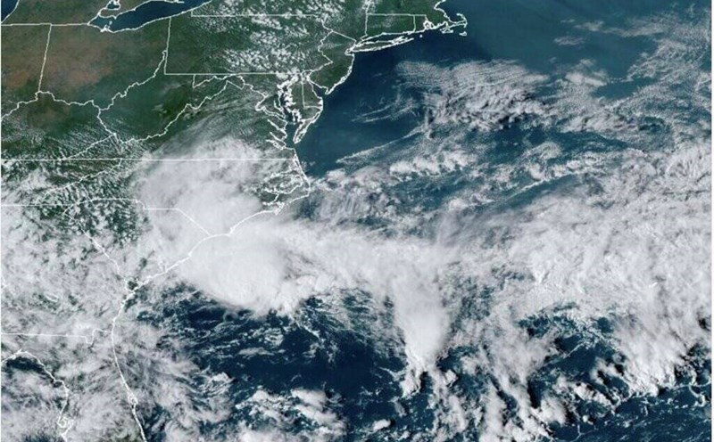
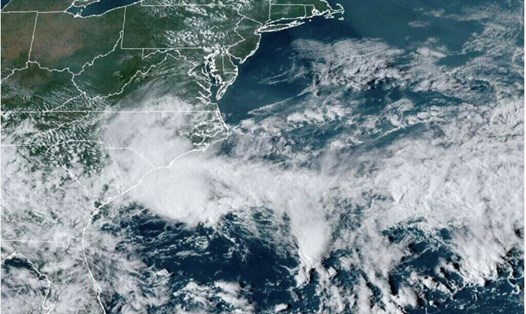
This caused Storm Boris to stall in central Europe, receiving moisture-laden air from the Mediterranean, which was already experiencing unprecedented heat, with average August sea surface temperatures the hottest on record.
The resulting heavy rains continued to fall in the same location, leading to catastrophic flooding in the Czech Republic, Austria and Romania. The storm also dumped record amounts of snow in the Alps.
The BBC explains that the record flooding in Central and Eastern Europe is due to a combination of factors, including climate change. Different weather factors combined to create a "perfect storm" in which very cold air from the Arctic meets hot air from the Mediterranean. Along with that, atmospheric pressure caused Storm Boris to stall in the region for a long time.
Floodwaters in central and eastern Europe will take several days to recede, but the weather is expected to improve from mid-week. However, Storm Boris is forecast to move further south into Italy, where it will strengthen again and bring heavy rain. Italy's Emilia-Romagna region is expected to be worst hit, with rainfall of 100-150mm expected.