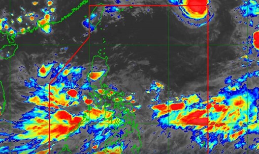
The Philippine Atmospheric, Geophysical and Astronomical Services Administration (PAGASA) forecast said that at 8:00 p.m. on September 15, the tropical depression outside the Philippine forecast area (PAR) had strengthened into tropical storm Pulasan.
At 4:00 a.m. on September 16, the center of storm Pulasan was at about 14.2 degrees north latitude, 144.7 degrees east longitude, 2,215 km east of Southeast Luzon.
Maximum sustained winds near the center of the storm are 65 km/h, gusting to 80 km/h, and the central pressure is 998 hPa. The storm is moving north-northeast at 20 km/h. Strong to gusty winds extend out to 380 km from the center of the storm.
Typhoon Pulasan is expected to move mainly north-northeast over the next 12 hours before turning northwest from the afternoon of September 16 to the afternoon of September 18. The storm is then expected to move west-northwest.
Pulasan is expected to enter the Philippine forecast area (PAR) around the evening of September 17 and exit the PAR around the morning of September 18.
Forecast times of entry and exit from the PAR are still likely to change depending on the storm's movement over the next 12 hours, but it is expected to remain at tropical storm intensity throughout the forecast period.
However, the possibility of the storm strengthening cannot be ruled out as it is still over the Pacific Ocean. Pulasan is the 14th named storm of the 2024 typhoon season in the Western Pacific.
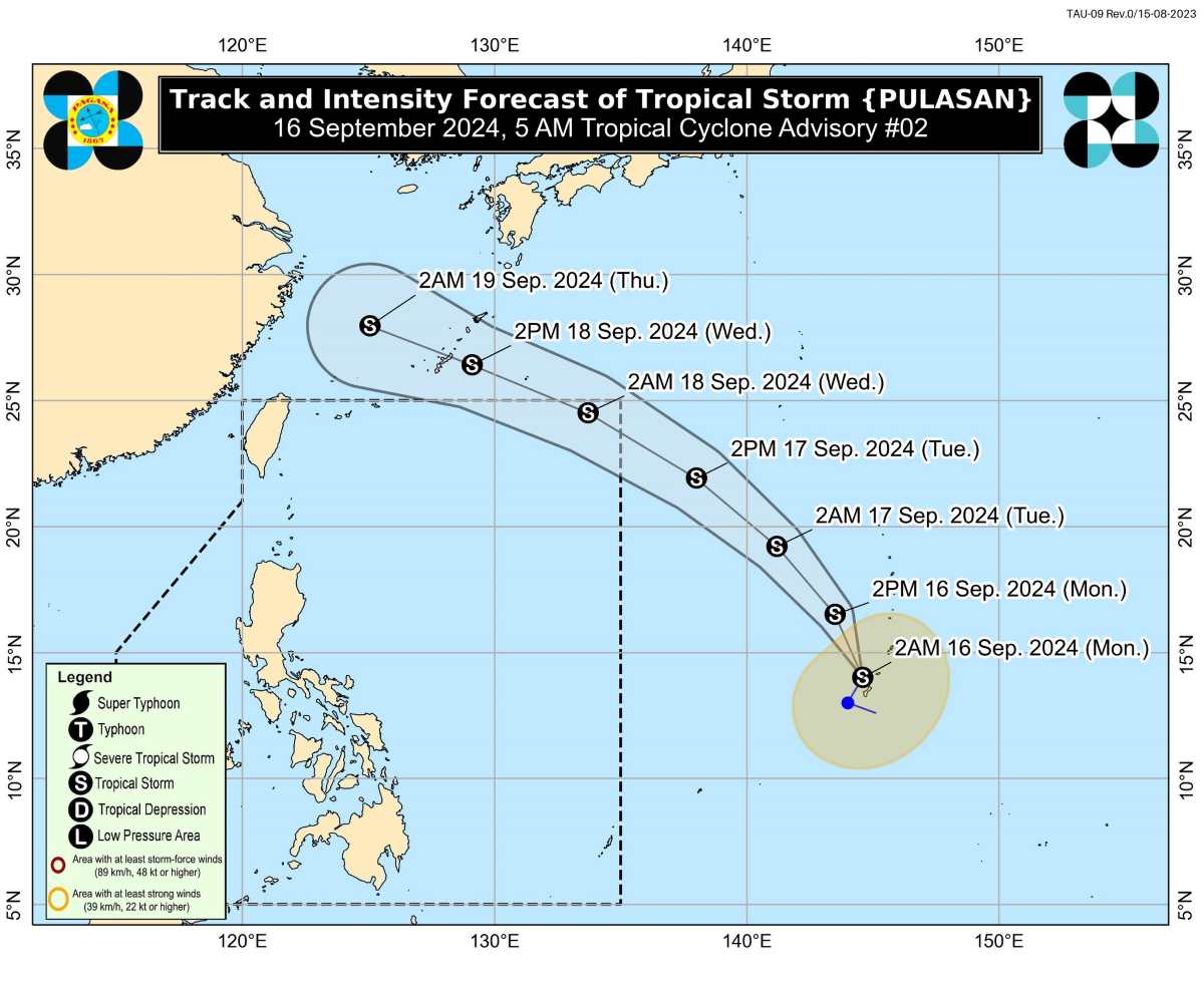
With a similar track to Typhoon Bebinca, the current track scenario suggests that Typhoon Pulasan will not directly impact any part of the Philippines during the forecast period, PAGASA said.
Regarding the remaining low pressure inside PAR, at 3:00 a.m. on September 16, the center of the low pressure was at about 17.3 degrees north latitude, 125.5 degrees east longitude, 375 km east-northeast of Casiguran, Aurora or 400 km east of Tuguegarao City, Cagayan.

PAGASA forecasts that the low pressure area is likely to strengthen into a tropical depression within 24 hours, at which point it will be locally named Gener.
A low-pressure trough has begun bringing heavy rains to some parts of Northern Luzon. Meanwhile, the southwest monsoon affects Southern Luzon, Visayas and Mindanao.