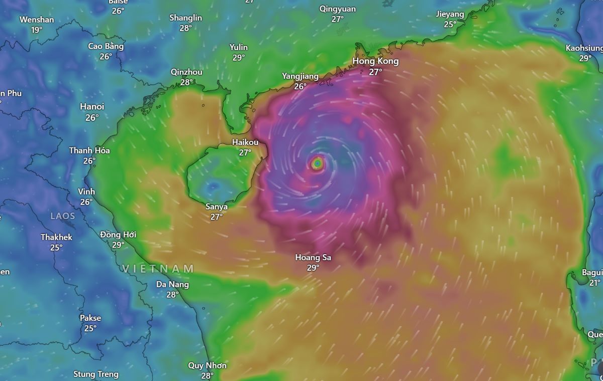
According to the storm forecast on September 6 by international organizations and observations on infrared satellite cloud images, it can be seen that the eye of Super Typhoon No. 3 Yagi is still extremely sharp with extremely strong convection around the storm center. According to the US Joint Typhoon Warning Center (JTWC), the storm's wind speed has strengthened again to 240km/h, gusting to 280km/h.
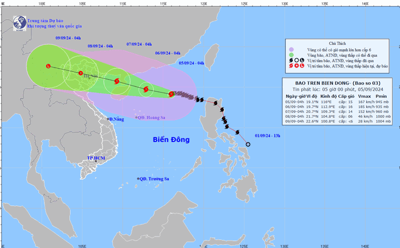
Previously, according to the Storms in the Northwest Pacific page, observations on satellite cloud images at 8:00 p.m. on September 5 showed that the storm cloud circulation had thickened again with extremely strong convection around the storm center, and the storm eye was sharper than at noon and afternoon of the same day.
In strong storms, the eye is characterized by clear clouds and light winds, surrounded by a tall, symmetrical eyewall. In weak storms, the eye is often less clear and may be obscured by a dense central cloud mass - a region of thick, high clouds that is clearly visible on satellite images.
On the morning of September 6, observations on infrared satellite cloud images clearly show that the far western circulation edge of the super typhoon has covered almost the entire Gulf of Tonkin, the Central Central Coast and part of the mainland coast of the northern and north central provinces of Vietnam.
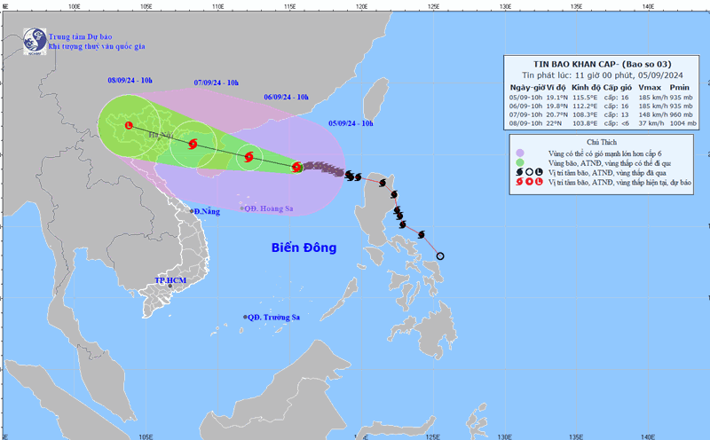
According to the Vietnam National Center for Hydro-Meteorological Forecasting, at 4:00 a.m. on September 6, the center of the super typhoon was located at about 19.2 degrees north latitude; 112.7 degrees east longitude, in the northern sea area of the North East Sea, about 200km east-southeast of Hainan Island (China); about 620km southeast of Quang Ninh. The strongest wind near the center of the super typhoon was level 16 (184-201km/h), gusting to level 17, moving westward at a speed of about 20km/h.
Forecast as of 4am on September 7, the center of the super storm is at about 20.6 degrees north latitude; 108.7 degrees east longitude, 160km east southeast of Quang Ninh. The strongest wind near the center of the storm is level 13, gusting to level 17, moving west-northwest at a speed of about 20km/h, entering the northern Gulf of Tonkin.
Hong Kong's RTHK newspaper (China) said that this special administrative region has avoided major damage as super typhoon Yagi slowly passed through the territory, bringing strong winds and heavy rain.
Schools and businesses were closed on the morning of September 6. The meteorological observatory said the first T8 signal of the year - issued at 6:20 p.m. on September 5 - would remain in effect until at least noon on September 6.
As of 6 a.m. on September 6, local time, the Hong Kong government (China) had received more than 40 reports of fallen trees; three people had sought help at the emergency departments of public hospitals and 260 people had sought shelter at 30 temporary shelters.

The observatory warned that heavy rain bands associated with Yagi would continue to bring heavy showers to the area and urged people to remain vigilant.
The observatory said the sea was rough with large waves and people should stay away from the shore and not engage in water sports.