
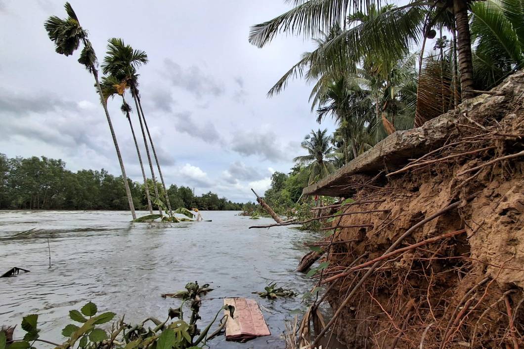
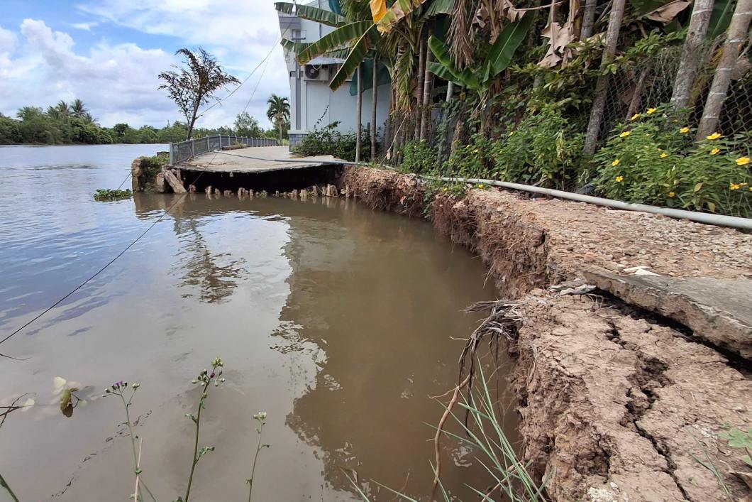
Can Tho has more than 35km of riverbank and coastline eroded along with dozens of storms from the beginning of the year to now, directly threatening people's safety. Facing the increasing risk of natural disasters, this locality has issued a comprehensive response plan, which considers remote sensing and AI technology as the core "weapon" to proactively forecast and relocate people to safe places early.
Accordingly, bringing the application of science and technology, innovation and digital transformation as breakthrough solutions is the key content in Plan No. 418/KH-UBND issued by Can Tho City People's Committee on September 4, 2026, to implement Resolution No. 116/NQ-CP of the Government and Plan No. 42-KH/TU of the Standing Committee of the City Party Committee.
The city will modernize the early warning and monitoring system; apply artificial intelligence (AI), remote sensing technology, unmanned aerial vehicles and big data (Big Data) to forecast, zone risks, and manage natural disasters in the digital environment.
In addition to technology solutions, Plan 418/KH-UBND sets out other key content groups: Strengthening leadership, enhancing the responsibility of heads, implementing decentralization according to the "four on-the-spot" motto; reviewing and perfecting mechanisms, policies, technical standards of infrastructure (dike, flood drainage, energy, information) and regularly updating scenarios for super typhoons, high tides, saltwater intrusion, and flooding.
The city also consolidates the civil defense command boards at all levels, consolidates shock forces and promotes training; mobilizes and uses resources effectively (the State plays a leading role in combining socialization and the Disaster Prevention and Control Fund); innovates propaganda, brings knowledge into schools; strengthens international cooperation and regional linkages; tightens inspection, examination, and handling of violations related to dike safety, riverbeds, and riverbanks.
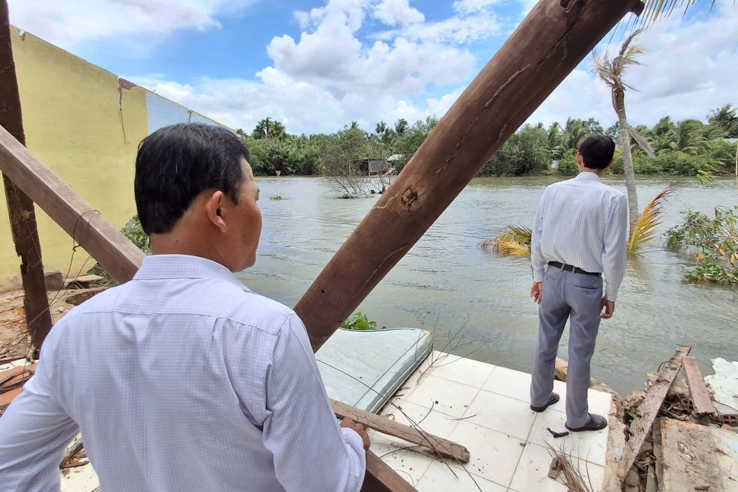
Directing the deployment work, Mr. Truong Canh Tuyen - Chairman of the City People's Committee, Head of the Civil Defense Command of Can Tho City - requested functional sectors and localities to focus on monitoring tides, proactively advising on flood control; inspect and review to soon come up with solutions to overcome landslide points to ensure people's safety.
At the same time, proactively develop a plan to respond to drought and saltwater intrusion in the dry season 2026-2027; organize rescue according to the "4 on-site" motto; establish inter-commune coordination mechanisms, improve forecasting quality and transmit information to people.
This large-scale response strategy stems from the complex reality of natural disasters in the locality. The Department of Agriculture and Environment of Can Tho City said that from the beginning of 2026 to now, the city has experienced 329 riverbank and coastal erosion points with a total length of over 35.5km, causing damage to 103 houses. In addition, 22 rainstorms also affected 117 houses, estimated property damage of over 2 billion VND.
Faced with the above situation, the Department has advised and submitted to the City People's Committee for approval 13 emergency decisions on landslides (including Nhon Ai commune) to urgently implement remedial works. The City People's Committee has approved support of nearly 5.4 billion VND from the Disaster Prevention and Control Fund (supporting affected households with more than 2.3 billion VND, overcoming landslides with over 2.9 billion VND; on August 28, 2026, consider supporting phase 3 of 677 million VND).


