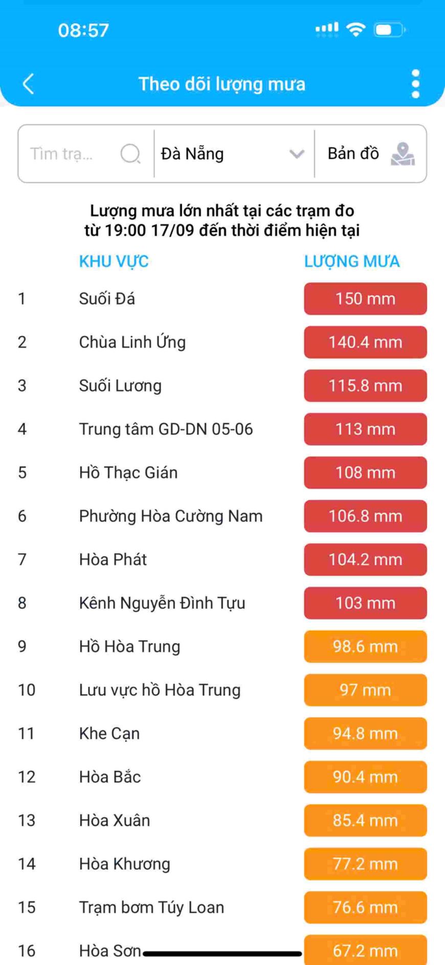
Many inner-city areas of Da Nang city have been flooded, causing traffic disruption and traffic jams on many roads since early morning. Especially at school gates, traffic congestion is serious.
Although in the early morning of September 18, the center of the tropical depression was still about 220km east of Hoang Sa archipelago with the strongest wind at level 7 (50-61km/h), gusting to level 9; moving mainly in a westerly direction at a speed of about 15km/h.
According to the authorities' forecast, in the next 24 to 48 hours, the center of the low pressure will be about 210km east-southeast of Quang Tri, about 120km east of Da Nang, moving in the West-Southwest direction, about 20km/h, strengthening into a storm, level 8, gusting to level 10.
In the next 48 hours, the low pressure will be on the Vietnam - Laos border area, moving West Northwest, 15km/h, entering the mainland and gradually weakening, level 6, gusting to level 8.
According to the report of the City Border Guard Command, the total number of registered and inspected vessels in the locality is: 1,159 vessels/8,316 workers. Of which, vessels anchored at ports: 1,097 vessels/7,699 workers. Number operating at sea: 62 vessels/617 workers.
Vehicles operating at sea have grasped the developments and movement direction of the tropical depression and storm No. 4; units and stations on duty of the Da Nang City Border Guard are maintaining information and communication with vehicles operating at sea, notifying, calling, and guiding them to avoid entering dangerous areas or to come ashore for safe shelter.
At Tho Quang Port, there are 590 ships anchored to take shelter from storms.
Da Nang seriously implements the official dispatches and instructions of the Central Government and the City People's Committee... Urgently complete the pruning and support of trees; complete the dredging and clearing of sewers within the management area.
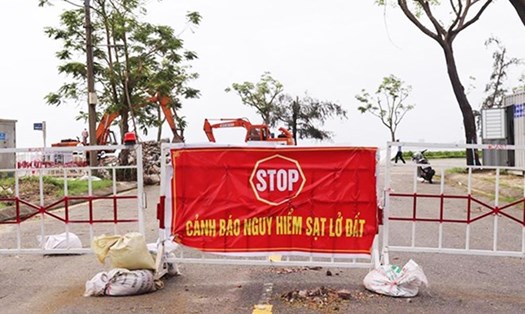
Deploy activities to respond to heavy rains, floods, flash floods, landslides, etc.; prepare for evacuation activities, especially in dangerous and deeply flooded areas according to the approved plan. Organize blockades in flooded areas, deep flooded areas, fast-flowing water areas, areas at risk of landslides, etc., not allowing people to enter dangerous areas. Strictly prohibit people and vehicles from traveling to areas along rivers, streams, dams, lakes and flooded areas for fishing, etc.