Currently, the tropical convergence zone with an axis through the Central region connecting with the tropical depression is likely to strengthen into storm No. 8 in the Northeast of the North East Sea. The southwest monsoon has an average intensity. Above, the subtropical high pressure with an axis through the North tends to encroach on the West.
It is forecasted that from September 20, the tropical convergence zone will slowly lift its axis to the North, while storm No. 8 active in the East Sea is likely to combine with another tropical depression forming off the eastern coast of the Philippines (expected to strengthen into a storm and enter the East Sea around September 23). The double impact of two tropical cyclones and the southwest monsoon that will gradually strengthen from September 23 will cause widespread bad weather.
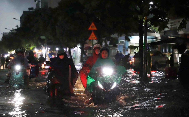
Therefore, in the next 2-3 days, Ho Chi Minh City and neighboring provinces and cities will continue to have moderate to heavy rain. The total rainfall for the entire period is commonly 80-140 mm, in some places over 150 mm.
Warning of the risk of heavy rain (over 80 mm/3 hours). Beware of thunderstorms accompanied by dangerous weather phenomena such as tornadoes and strong gusts of wind affecting agricultural production, breaking trees, damaging houses, traffic works, and infrastructure.