In the first week of the month, the first 2-3 days of the low pressure trough with an axis through the Central region will operate weakly, from October 3 to 6, forming a tropical convergence zone through the Central region connecting with a tropical cyclone (likely to become storm No. 11) in the Northeast of the East Sea. The southwest monsoon in the South will operate at a weak to moderate level.
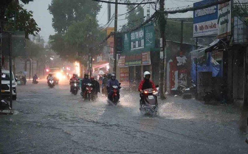
Therefore, in the first 3 - 4 days, the rain in the Southern region will decrease to scattered areas, the rain will gradually increase in the following days, with some places having moderate to heavy rain. During thunderstorms, beware of tornadoes and strong gusts of wind. Temperature increased slightly compared to last week.
In the middle of the month, the continental cold high pressure is weak in southern China. The tropical convergence zone continues to operate strongly through the Central region and the middle of the East Sea. The southwest monsoon will operate at medium to strong intensity.
The weather in the South, rain tends to increase, there is common rain in many places, mainly from noon to evening, some places have moderate rain, heavy rain.
In the last week of the month, the continental cold high pressure will gradually strengthen in the North and weaken in the Central region. The low pressure trough will lower its axis to the South, passing through the South Central and South regions. Beware of the possibility of 2 - 4 storms or tropical depressions appearing in the East Sea.
Therefore, rain tends to increase, commonly there is rain in many places, some places have moderate rain, heavy rain. During thunderstorms, beware of tornadoes and strong gusts of wind. Temperature tends to decrease slightly compared to the middle week.