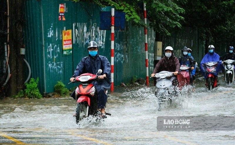
According to the National Steering Committee for Natural Disaster Prevention and Control, day and night of July 19, the Northern and North Central regions had showers and thunderstorms, with heavy rain in some places with a common rainfall of 10-40mm, locally in some places. over 80mm.
The Central and South Central regions have scattered showers and thunderstorms, with heavy rain in some places with rainfall from 10-30mm, locally over 50mm.

Day and night of July 19, in the sea area from Khanh Hoa - Binh Thuan, there was a strong southwest wind at level 5, sometimes level 6, gusting at level 7-8; Sea waves are 2.0-3.0m high.
In addition, the Middle and Southern areas of the East Sea (including the waters of the Truong Sa archipelago), the Gulf of Tonkin, the waters from Binh Thuan to Ca Mau, Ca Mau to Kien Giang and the Gulf of Thailand have showers and strong thunderstorms. . During thunderstorms, there is a possibility of tornadoes and strong winds of level 7-8.
Regarding the rain situation, from 7:00 p.m. on July 17 to 7:00 p.m. on July 18, areas across the country have moderate to heavy rain , common rainfall is from 50-70mm, some stations have heavier rainfall such as: Vu Quang (Ha Static) 181mm; Chi Ne (Hoa Binh) 125mm; Cam Pha (Quang Ninh) 125mm; Binh Lieu (Bac Giang) 120mm; Lieu De (Nam Dinh) 164mm; Dong Son (Nam Dinh) 147mm; Trung An (Thai Binh) 111mm; Huong Dien (Ha Tinh) 128mm; Ia Glai reservoir (Gia Lai) 106mm.
Night rain from 7:00 p.m. on July 18 to 7:00 a.m. on July 19, the Northern Delta and North Central regions have moderate rain, heavy to very heavy rain, common rainfall is from 40-60mm, some stations have heavier rainfall such as: An Binh (Hoa Binh) 94mm; Phinh Ho (Quang Ninh) 109mm; Quat Dong (Quang Ninh) 99mm; Trieu Ai (Quang Tri) 91mm; Tieu Can (Tra Vinh) 103mm; Ke Sach (Soc Trang) 78mm.
Regarding the hydrological situation, the water level of the rivers in the Northern region at 7:00 a.m. on July 19 on the Red River at Hanoi station was 5.16m; on Thai Binh river at Pha Lai station is 1.90m; on Hoang Long River at Gian Khau station is 2.62m, on Day River at Phu Ly station is 3.39m.
It is forecasted that the water level downstream of the Red River will rise after a slow change, by 7:00 a.m. on July 20 at Hanoi station it will likely be at 5.25m; In the next 36 hours, the highest water level at Pha Lai is likely to be at 2.00m and the lowest at 1.45m.
On July 19, floods on rivers in Ninh Binh province were approximately at alert level 1; On the Day River, the flood peak water level is likely to be below alert level 2 on the morning of July 19.
Rivers in the Central and Central Highlands regions, water levels on the Ma, Ca, and La rivers are falling; Other rivers change slowly, the water level in the lower reaches of the rivers fluctuates according to reservoir regulation and tides.
In the Southern rivers, the water level in the Mekong River's upstream fluctuates with the tide. By July 21, the highest daily water level in Tan Chau was 1.55m, in Chau Doc was 1.75m.