Weather forecast for the next 24-48 hours, the continental cold high pressure will strengthen and weaken, shifting eastward to the North of our country. The tropical convergence zone with its axis through the South connecting with storm Tra Mi in the Northeast of the Philippines tends to move into the Northeast of the East Sea, the high-altitude wind convergence will maintain strong activity in the South.
From 72 hours to the 10th day, the continental high pressure gradually weakened. The tropical convergence zone gradually lifted its axis to the North, connecting with storm Tra Mi moving to the North of the Hoang Sa archipelago, gradually becoming stronger. The high-altitude easterly wind disturbance continued to affect the weather in the Southern region.
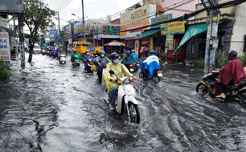
Therefore, the weather in the South is cloudy to cloudy, sunny days with scattered showers and thunderstorms, some places have moderate rain, heavy rain, locally very heavy rain. During thunderstorms, be on guard against tornadoes, lightning and strong gusts of wind.
The sea area from Ba Ria - Vung Tau to Ca Mau (including Ho Chi Minh City sea area) and the sea area from Ca Mau to Kien Giang and the Gulf of Thailand has West to Northwest wind level 4, sometimes level 5. Wave height 0.5-2.5m. In both sea areas, there will be showers and thunderstorms, during thunderstorms, beware of strong gusts of wind and whirlwinds.