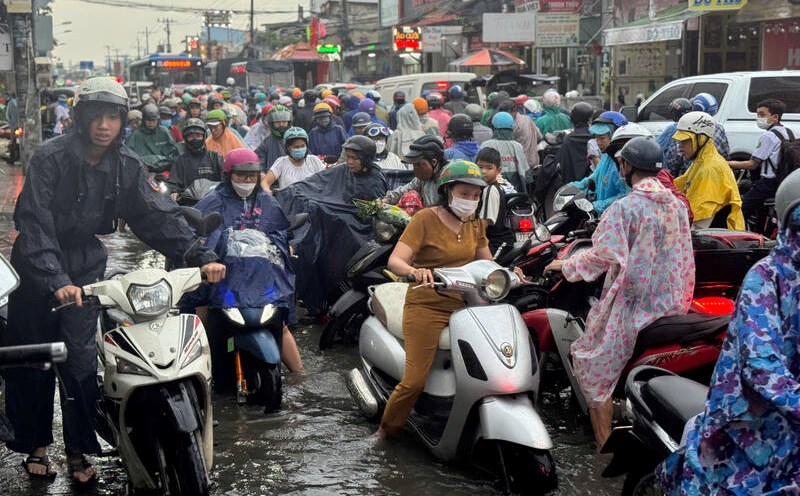
On October 22, Ho Chi Minh City and the Southern provinces and cities had thunderstorms from early morning that lasted all day.
By the afternoon of the same day, in Ho Chi Minh City, thunderstorms developed and caused rain with thunderstorms and lightning in Binh Thanh District, Thu Duc City, Go Vap District, District 12, and Hoc Mon District.
In the next 0 - 3 hours, thunderstorms will continue to develop, causing showers, accompanied by thunderstorms and lightning in the above districts, then expanding to other neighboring areas.
Rainfall is generally from 2-10mm, some places over 13mm. During thunderstorms, beware of tornadoes, hail and strong gusts of wind around level 5-7 (8-17m/s), heavy rain causing localized flooding.
According to the Southern Hydrometeorological Station, the cause of thunderstorms is the continental cold high pressure that is strengthening in the southern region of mainland China.
The tropical convergence zone has an axis through the South Central - Southern region connecting with storm Tra Mi operating in the East of the Philippines. The upper-level easterly wind disturbance is active and affects the weather in the Southern region.
In the next 24-48 hours, the continental cold high pressure will strengthen weakly and shift eastward to the North of our country. The tropical convergence zone has an axis through the South combined with strong high-altitude wind convergence. Above, the subtropical high pressure has an axis through the North Central region.
In the coming days, the Southern region will have variable clouds to cloudy, with intermittent sunny days. In the afternoon and evening, there will be widespread rain and scattered thunderstorms, with moderate to heavy rain in some places. At night, there will be scattered showers and thunderstorms in some places. During thunderstorms, be on guard against tornadoes, lightning, strong gusts of wind, and localized flooding. From October 25 to 27, the rain will decrease to scattered.