The Standing Committee of the Ho Chi Minh City Party Committee and the Executive Committee of the Ho Chi Minh City Party Committee recently approved the policy of the sea-crossing road project connecting Can Gio with Vung Tau in the form of public-private partnership (PPP), BT contract (build - transfer).
The project has a preliminary total capital of more than 104,400 billion VND, expected to start construction in 2026 and be completed and put into operation in 2029.
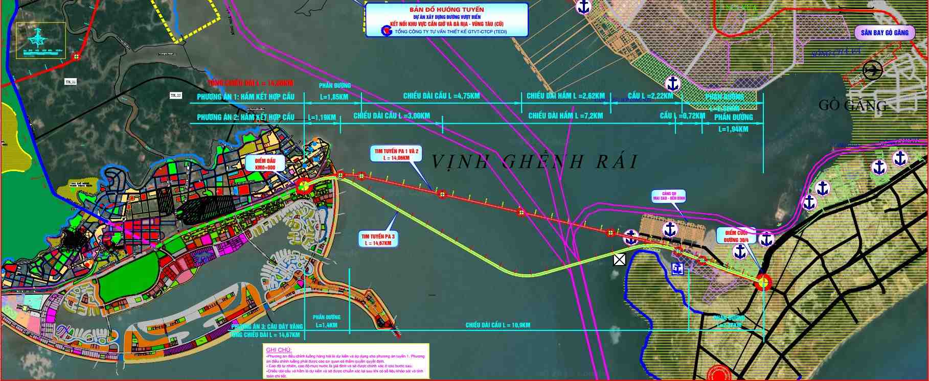
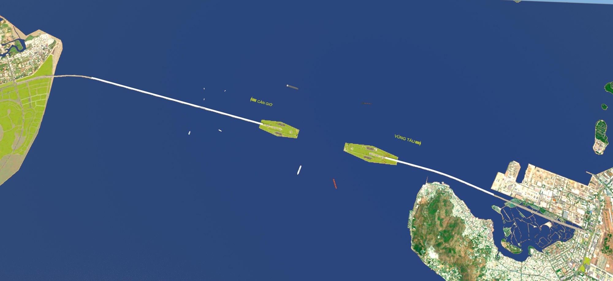
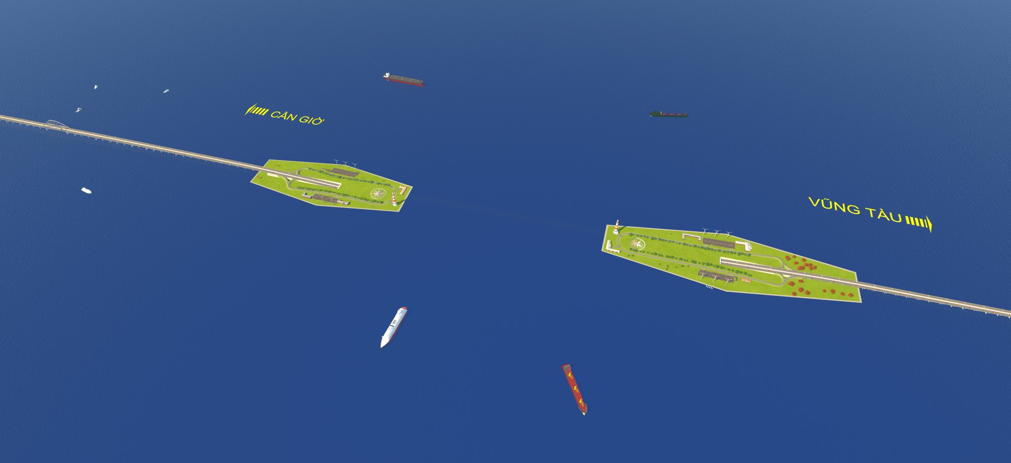
The Can Gio - Vung Tau sea route has a total length of more than 14 km.
The starting point of the project is on Bien Dong 2 road, belonging to Can Gio sea encroachment urban area; the ending point connects with the Mai Sao - Ben Dinh planned road, intersecting with 30/4 road in Vung Tau.
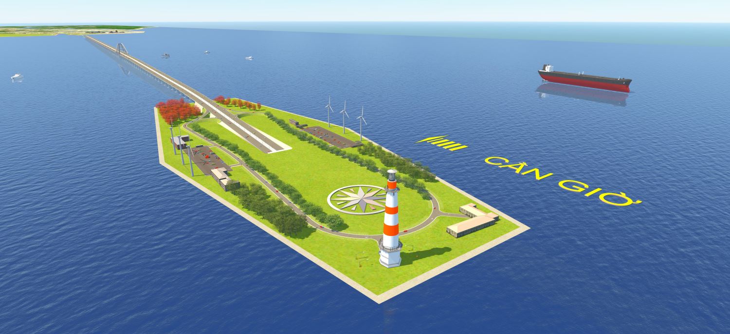
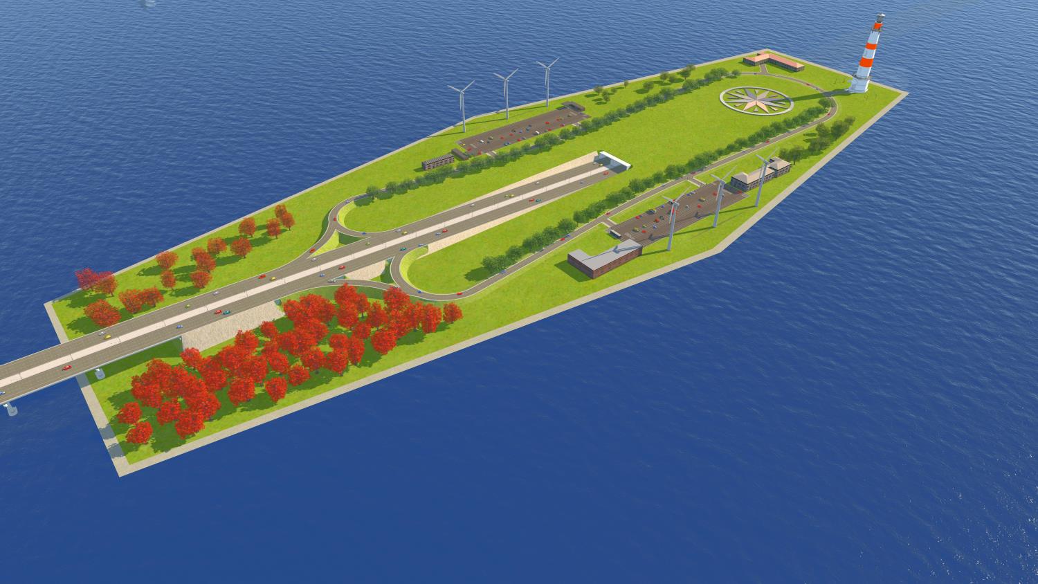
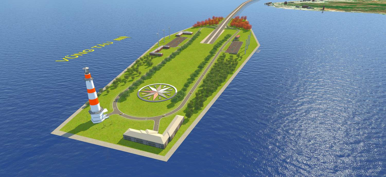
The entire route is designed with main items being access roads, overpasses combined with submersible tunnels. The transition section between the bridge and tunnels through two artificial islands is built in the middle of the sea.
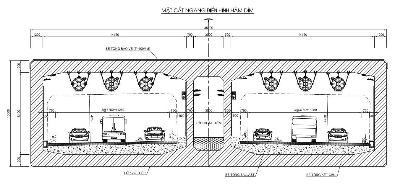
In which, the sea tunnel item has a total length of about 2.62 km, a cross-section of 35 m, meeting the scale of 6 lanes. The submerged tunnel section is about 2.1 km long, applying construction technology similar to the Thu Thiem tunnel over the Saigon River.
Thu Thiem tunnel is nearly 1,500 m long, with a total investment of more than 2,200 billion VND, inaugurated in 2011. This is Vietnam's first river tunnel and once the longest submerged tunnel in Southeast Asia.
The tunnel consists of 4 main sections, each section 93 m long, 9 m high, 33 m wide; the sections are pre-cast, towed on the river and accurately submerged to the riverbed for complete assembly.
In addition to the sea tunnel, the total length of the bridge on both sides leading to the tunnel is about 6.97 km (of which, the Can Gio side is about 4.47 km long, the Vung Tau side is about 2.22 km).
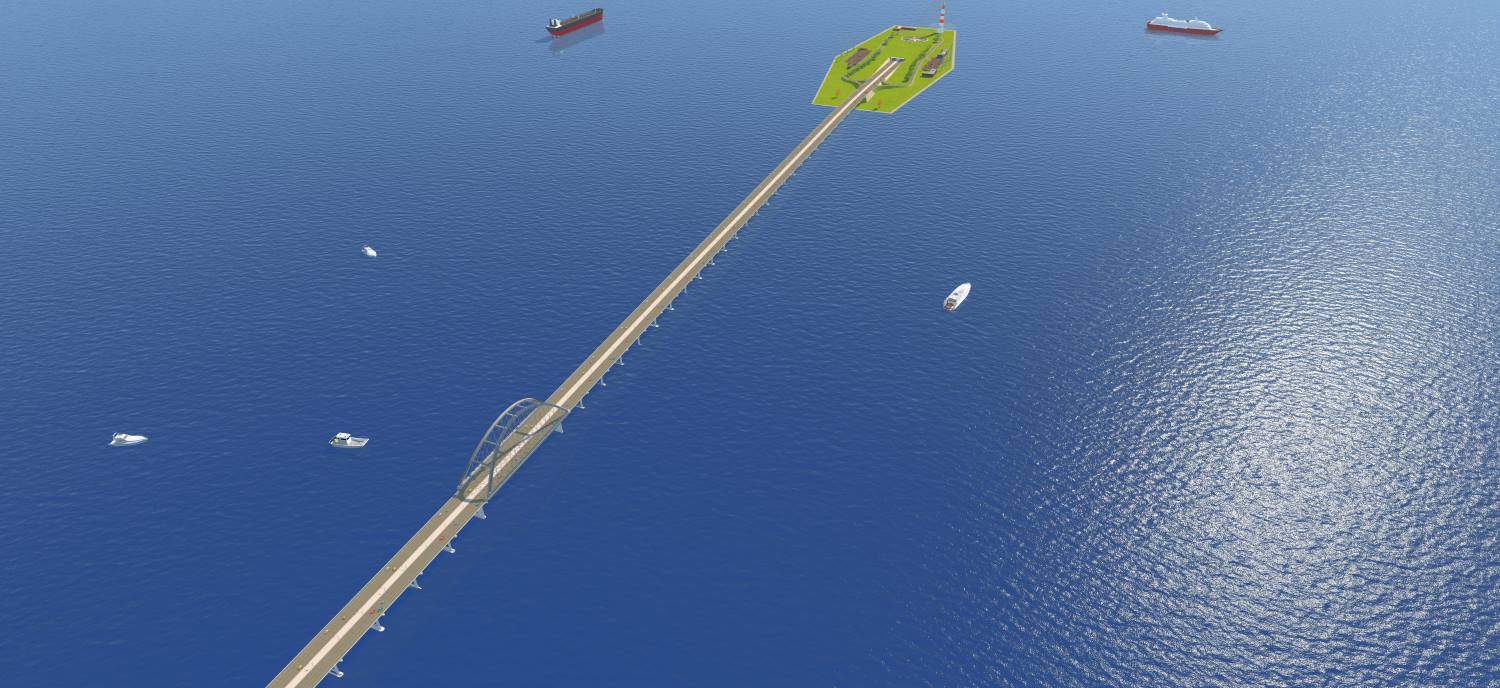
The access road section has a total length of about 4.47 km, including 1.85 km on Can Gio side and 2.62 km on Vung Tau side.
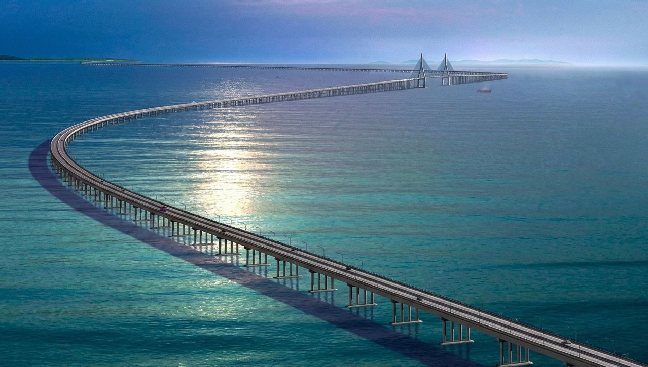
In addition to the option of combining bridges and underground tunnels, the Can Gio - Vung Tau sea-crossing route is also being studied for a plan to only build sea-crossing bridges, with a total length of about 14.67 km (of which, the sea-crossing bridge section is nearly 11 km long). The project uses a cable-stayed bridge structure, the main span is 600 m long, and the clearance for navigation is 55 m.
According to the assessment of the consulting unit, if choosing the option of a full-route sea bridge, the project must have a very large navigation span, high clear air and a long span aperture. This not only causes difficulties for the circulation of vehicles in conditions of storms and strong winds, but also creates a fixed airspace limit, potentially becoming a "block" for the maritime flow in the future, when the size of ships is increasing.
Conversely, the submersible plan located completely at the bottom of the maritime channel will release water surface space, without affecting the operation of ships.
Although the construction cost of the submersible hold accounts for the largest proportion of the total investment of the project, this is considered a necessary investment in exchange for long-term strategic benefits for the maritime transport system.
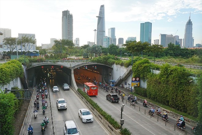
Currently, Ho Chi Minh City and the Ba Ria - Vung Tau area do not have direct road connection routes. People and businesses mainly have to travel around National Highway 51 or take the Can Gio - Vung Tau ferry, taking from 90 to 120 minutes.
When completed, the sea-crossing road will form a direct coastal connecting axis, shortening the travel time from the center of Ho Chi Minh City to Vung Tau to more than 60 minutes.
The project is expected to promote the development of Can Gio Sea Tourism Area, Long Son Industrial Park, improve the exploitation capacity of Cai Mep - Thi Vai port cluster, and reduce the load on National Highway 51 and Highway 965, creating new growth momentum for the entire Southeast region.


