On the evening of September 8, information from Lao Cai Hydrometeorological Station stated that in the past 12 hours, due to the impact of heavy rain in the basin combined with flood discharge regulation of upstream reservoirs, floods on the Red River in Bao Ha (Bao Yen district) and Lao Cai city; Nhu stream in Van Ban continued to rise rapidly.
Floods on the Red River at Bao Ha are currently at alert level 3 - dangerous level.
The water level observed at 8:00 p.m. on September 8 on the Red River at Bao Ha was 58.13m, 1.13m above alert level 3; on the Red River at Lao Cai city was 80.65m, 0.65m above alert level 1; on Nhu stream (Van Ban district) was 89.67m, 0.17m above alert level 2.
The flood peak on the Red River at Bao Ha is forecast to reach 59.2m, 2.2m above alert level 3; the flood peak on the Red River at Lao Cai city is forecast to reach 83.5m, reaching alert level 3; the flood peak on Nhu stream at Van Ban is forecast to reach 90.7m, 0.2m above alert level 3.
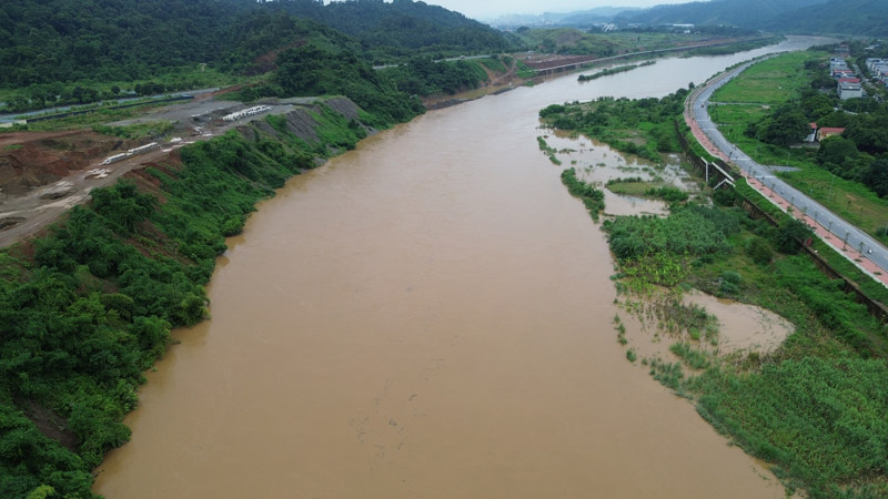
There is a high risk of flooding in low-lying areas and landslides on slopes and river banks downstream along the Red River in Cam Duong commune, Binh Minh ward, Bac Lenh (Lao Cai city); Thai Nien, Son Ha, Son Hai, Phu Nhuan communes, Pho Lu town (Bao Thang district); Bao Ha commune (Bao Yen district); Tan An, Tan Thuong, Son Thuy, Vo Lao communes (Van Ban district).
The level of natural disaster risk due to floods on the Red River at Bao Ha is level 3; the Red River at Lao Cai city and Nhu stream is level 2.
Large floods can inundate and damage crop areas along the Red River, erode and landslide along the river banks, narrowing the area of residential land, cultivation, agricultural production and causing damage to aquaculture of people in the downstream area of the Red River.