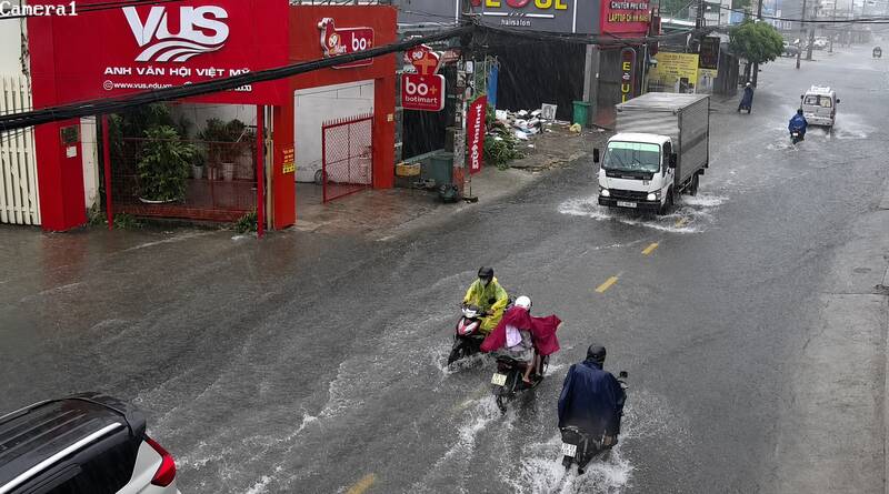
Recorded on the afternoon of June 16, widespread thunderstorms caused localized flooding on many roads in Ho Chi Minh City. On Quoc Huong street, water rose after about 30 minutes of heavy rain, many sections were deeply flooded, making it difficult for motorbikes to move, and some vehicles had to drive slowly to avoid stalling.
A similar situation also occurred on Nguyen Duy Trinh street, where rainwater flooded the road surface. Many people had to wade through the water or find other ways to move.
According to the Southern Regional Hydrometeorological Station, monitoring satellite cloud images, weather radar images and lightning positioning data shows that thunderstorm cloud areas are developing strongly, causing showers with thunderstorms and lightning in many areas of Dong Thap, Tay Ninh, Ho Chi Minh City, Dong Nai and Lam Dong.
In Ho Chi Minh City, thunderstorms appeared in some areas such as Xuan Son, Binh Tien, Phu Dinh, Tang Nhon Phu and areas bordering Binh Duong such as Di An, Dong Hoa, Tan Dong Hiep, Thuong Tan, Phuoc Hoa and Bac Tan Uyen. Many places recorded strong radar response intensity, showing the possibility of moderate to heavy rain with thunderstorms and lightning.
In the next 0-3 hours, thunderstorms will continue to develop, causing showers and thunderstorms in the above-mentioned areas, then tend to expand and spread to neighboring localities.
Common rainfall is from 5 - 20 mm, in some places over 30 mm. During thunderstorms, it is necessary to watch out for tornadoes, lightning, hail, strong gusts of wind at level 5 - 8 (8 - 21 m/s) and the risk of localized flooding in low-lying areas and urban areas.


