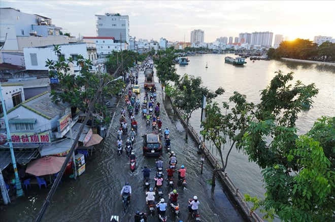
Ho Chi Minh City sinks second fastest in the world
According to the recent announcement of Associate Professor, Dr. Le Trung Chon - Director of the Institute for Sustainable Development Studies (Ho Chi Minh City University of Natural Resources and Environment) and his colleagues, the subsidence in Ho Chi Minh City is at an alarming level.
Ho Chi Minh City is currently in the group of 10 fastest sinking urban areas globally, even ranking 2nd in the list of "sinking cities".
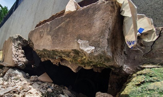
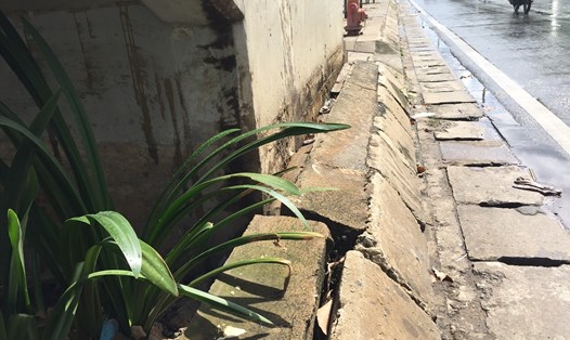
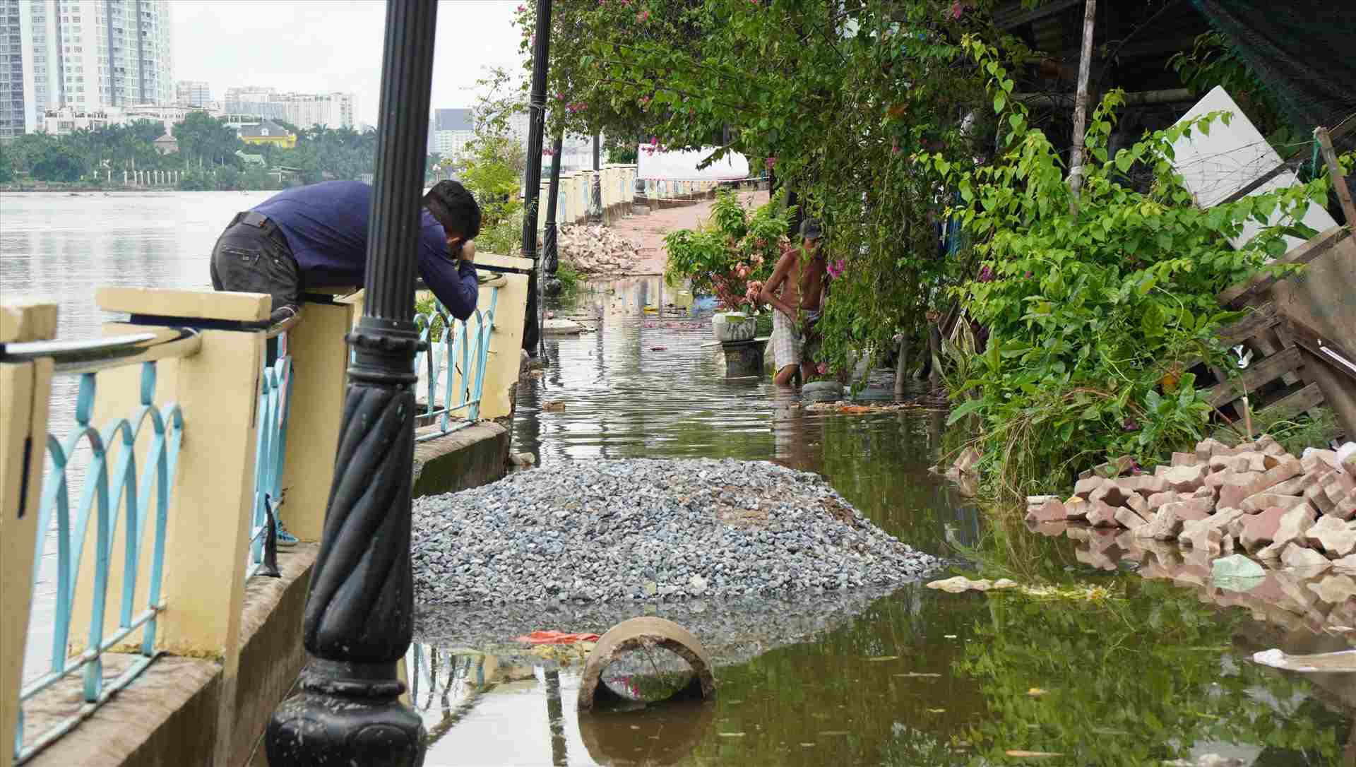
The survey shows that the subsidence is concentrated along the Saigon River (from Saigon Bridge to Ba Son Bridge) and the southern area of the city, especially in the former Binh Chanh and Binh Tan districts.
Data from the Japan International Cooperation Agency (JICA) shows that subsidence has occurred continuously since 1990, with an accumulated subsidence of about 100 cm.
Currently, the average sinking speed is 2 - 5 cm/year, especially in areas with commercial facilities up to 7 - 8 cm/year, twice as high as the sea level (about 1 cm/year).
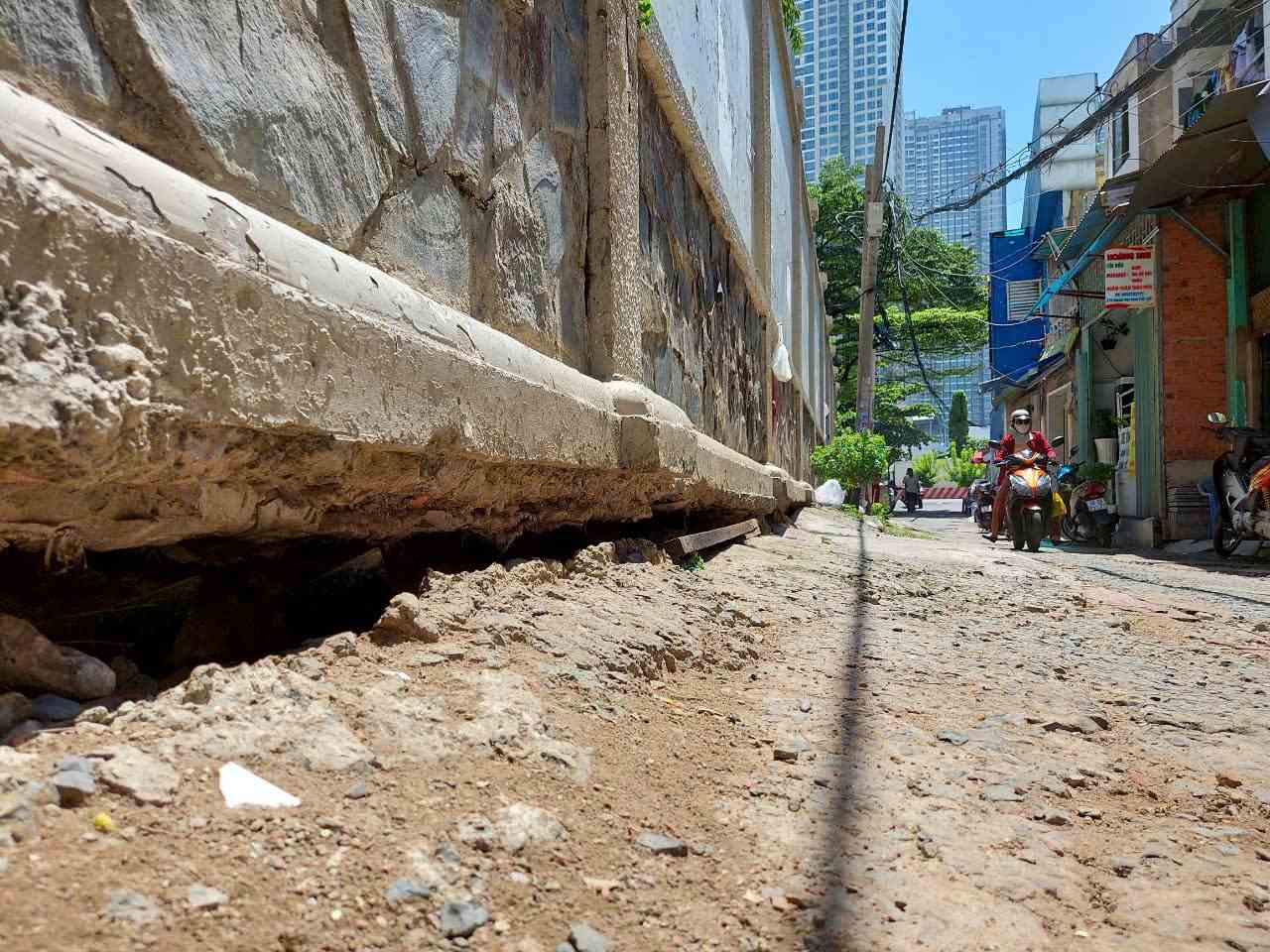
The main causes were identified as weak geological foundations, loads from construction works, transport infrastructure, rapid urbanization and especially excessive groundwater exploitation.
Sinking combined with high tides and rising sea levels puts Ho Chi Minh City at risk of sinking. This is not only an environmental risk, but also a vital challenge for the sustainable development of the city - Mr. Le Trung Chon emphasized.
According to Mr. Chon, Ho Chi Minh City needs to soon build a system to monitor and forecast frequent land subsidence using modern technology. This system not only records the rate of subsidence over time but also simulates the impact of urban planning, traffic or construction expansion.
Simulated and forecasted information on land changes will help the city have timely response solutions, support quick decision-making, improve urban management capacity and adapt to climate change, said Mr. Chon.
Green planning and satellite urban areas to escape the " sink trap"
Dr. Vo Kim Cuong - former Deputy Chief Architect of Ho Chi Minh City also acknowledged that Ho Chi Minh City can hardly completely eliminate subsidence because this is a synthetic result of weak geology, rapid urbanization and climate change.
Therefore, it is important to change the mindset from absolutely preventing to control and adapting.
According to Mr. Vo Kim Cuong, Ho Chi Minh City needs to gradually reduce groundwater exploitation, adjust urban planning to allocate load appropriately, increase the area of natural water-absorbed land and build a modern monitoring and forecasting system.
When there is a "clear picture" of the speed and scope of subsidence, Ho Chi Minh City can proactively adjust the planning and infrastructure design in accordance with the changing land level.
From a planning perspective, Architect Ngo Viet Nam Son pointed out that the nature of Ho Chi Minh City is a river city. However, the development process has caused many canals to be filled to build roads and works.
As a result, the risk of flooding and subsidence is increasingly serious under the impact of high tides and climate change.
Mr. Son suggested that the city should have green planning, develop water space and apply sustainable urban criteria.
Green space is a water reserve space, helping to reduce the pressure of flooding and subsidence. The city needs to limit the elevationation of weak land areas, while preserving and connecting the river system" - Mr. Son emphasized.
In particular, after Ho Chi Minh City expands administrative boundaries (merging with Binh Duong and Ba Ria - Vung Tau) and forms a central multipolar structure, this is a favorable time to deploy the satellite urban model.
"S extending people to satellite areas will reduce the burden on the inner city, increase green areas, parks and balance urban development in a sustainable way" - Mr. Son said.