The People's Committees of Nha Trang City and Dien Khanh District are organizing a public consultation on the zoning plan (scale 1/2000) for the Chin Khuc mountain area.
According to the Department of Construction of Khanh Hoa province, in December 2024, the Provincial People's Committee approved the task of the zoning plan (scale 1/2000) of Chin Khuc mountain area, Nha Trang city and Dien Khanh district, the Department of Construction has organized the preparation of the planning project dossier.
To have a basis for appraisal and submit to the Provincial People's Committee for approval, the Department of Construction sent the planning project dossier and related documents to the Nha Trang City People's Committee and the Dien Khanh District People's Committee to organize the collection of relevant community opinions on the 1/2000 zoning plan for the Chin Khuc mountain area.
The community's comments on the zoning plan for Chin Khuc mountain area, Nha Trang city and Dien Khanh district have 5 contents including: Reasons and necessity of establishing the plan; boundary scope, area, nature, current status of the planning area; master plan; traffic planning plan; technical infrastructure planning plan.
The results of the consultation with the relevant community community community will be sent to the Department of Construction before February 27 for synthesis and implementation.
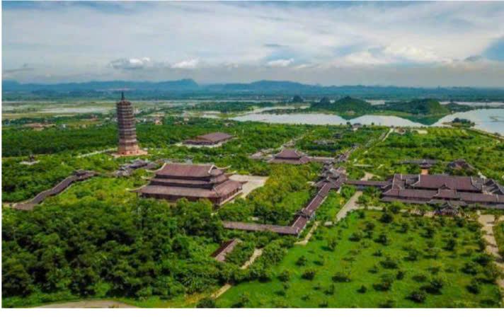
According to the Chin Khuc mountain zoning plan informed by the Department of Construction, the planning area has a total area of 972.9 hectares, belonging to Vinh Trung commune (Nha Trang city, area of about 734.5 hectares) and Dien An commune (Dien Khanh district, area of about 238.4 hectares).
Based on the traffic planning network, land functional characteristics in approved general planning projects, and natural land shape characteristics, the planning land is divided into 3 sub-areas.
Sub-zone A has an area of about 184.82 hectares, and is a resort and commercial service tourism area.
In which, area A1 is a key subdivision, developing high-end resorts, ecological resorts and outdoor tourism areas, commercial services, tourism services, restaurants, hotels, and entertainment centers... taking advantage of the mountainous terrain and natural landscape.
Plan a commercial center with a moderate scale, not too dense, arrange it reasonably with main traffic routes and near tourist and resort areas.
Area A2 is a tourist area combined with ecological agricultural development. With the main function of combining experiential tourism with local agricultural development.
Sub-area B has an area of about 200,35, with the nature of a cultural - sports center and a theme park.
With an altitude of more than 500m above sea level, this area is oriented to plan a highlight of the spiritual and cultural center of the Chin Khuc mountain pagoda on the top of the mountain, cultural service areas at the foot of the mountain and is expected to be the place to organize large-scale cultural and religious festival events.
At the same time, there will be small stadium areas, parks, golf courses, children's playgrounds, and adventure sports activities such as mountain climbing, rope swing, and cable skating.
The works and infrastructure in this area must be designed to be environmentally friendly, ensuring harmony with the natural landscape.
Sub-zone C has an area of about 587.73 hectares, with the nature of a nature reserve and natural forest. The main function is to preserve and manage areas with specific ecosystems, natural forests and upstream forests, to protect the environment and balance the ecosystem in the area.
Development activities must strictly comply with regulations on environmental protection, limit intervention in natural forests and not build solid structures in conservation areas. This area can be combined with the development of ecotourism routes, environmental education, or scientific research on ecosystems.


