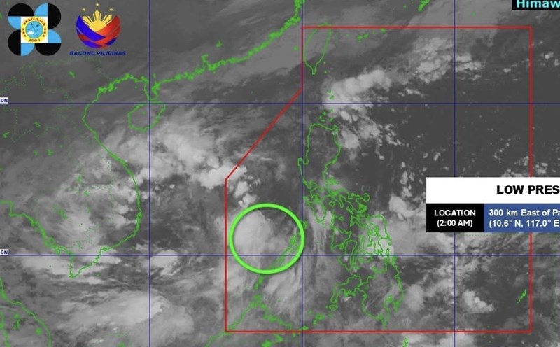
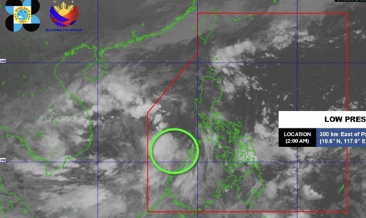
According to a new weather forecast from the Joint Typhoon Warning Center (JWTC), low pressure Invest 98W is currently located south of Guam in the western Pacific Ocean.
Maximum sustained winds are currently around 30 km/h.
The low pressure is unlikely to form into a tropical depression in the next 24 hours.
The new low pressure is forecast to enter the Philippine Area of Responsibility (PAR) on November 4.
There are currently no warnings or recommendations issued regarding Invest 98W.
However, there are currently many posts on social networks from unofficial and unverified sources, spreading information about a storm or super typhoon moving west.
These posts are based on weather models predicted from online sources, predicting that a typhoon or super typhoon will pass through the central Philippines (Southern Luzon - Visayas) between November 5 and 7, 2025.
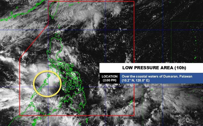
The Philippine Atmospheric, Geophysical and Astronomical Services Administration (PAGASA) has denied unofficial reports of the possibility of a "super typhoon" in November, advising residents and tourists to only follow official forecasts.
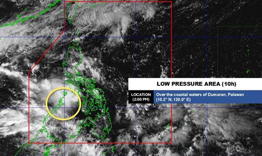
The tropical depression forecast bulletin from PAGASA shows an average chance of a new low pressure forming outside the Philippine Area of Responsibility (PAR) in the week of October 29 - November 4.
This potential low pressure may move into the central part of the island nation and the East Sea in the following week (5 - 11.11).
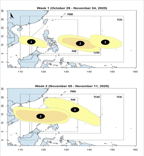
However, the Philippine Meteorological Agency emphasized that because this forecast is still within the two-week time frame, the level of uncertainty is still high, especially related to the specific trajectory and intensity of the tropical cyclone that may form.
According to the National Center for Hydro-Meteorological Forecasting, from October 21 to November 20, 2025, it is forecasted that there will be 2 - 3 storms or tropical depressions in the East Sea and there will be 1 - 2 storms affecting the mainland of Vietnam.
The area most likely to be strongly affected is the Central region, especially in October and November, when storm activity typically peaks at the end of the season.
Tourists planning to travel through the Philippines and the central Vietnamese sea and islands in the early to mid-November period should regularly check the weather situation and flexibly adjust their schedule if a new weather warning is issued.