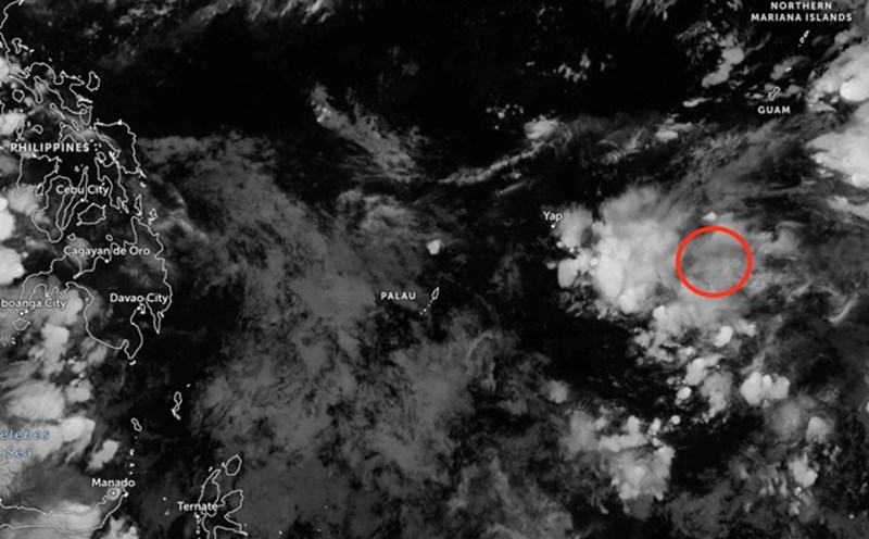
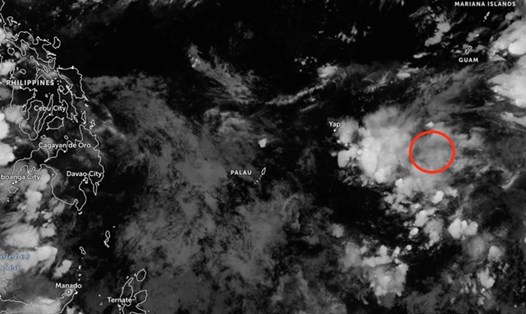
The low pressure currently operating in the Philippine Area of Responsibility (PAR) is no longer likely to strengthen into a tropical depression in the East Sea in the next 24 hours, according to the Philippine Atmospheric, Geophysical and Astronomical Services Administration (PAGASA).
On the morning of October 28, the center of the low pressure area was recorded about 250 km east of Pag-Asa Island (in the Kalayaan Islands, Palawan Province). The system is still in the tropical convergence zone, affecting the weather in Palawan, Visayas and Mindanao.
In Palawan, scattered showers and thunderstorms are forecast during the day due to the influence of the low pressure area. The Central and Eastern Visayas regions, along with Dinagat Island, continue to have moderate rain, heavy rain with thunderstorms. Meanwhile, the eastern part of Northern Luzon is affected by a wind convergence zone, causing cloudy skies with possible localized showers and thunderstorms.
In Batanes and the surrounding area, the northeast monsoon is active, bringing cloudy weather, scattered rain and high waves. The rest of Luzon, including the Manila capital, is forecast to see moderate to light showers, with occasional thunderstorms.
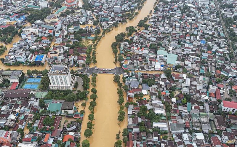
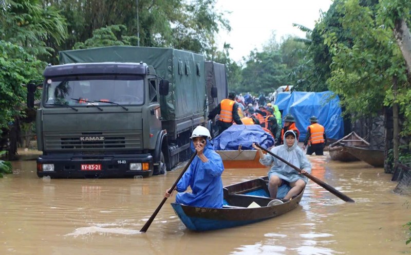
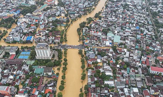
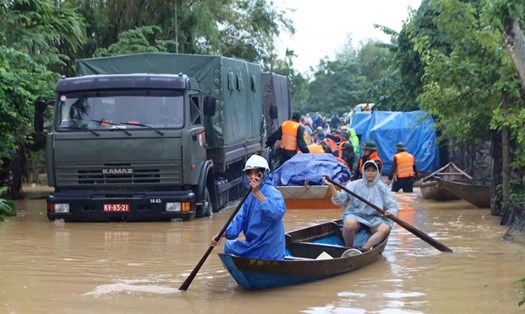
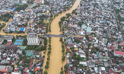
PAGASA warns that moderate to very heavy rains can cause the risk of flash floods and landslides, especially in mountainous areas or along rivers. The sea in northern Luzon may be rough, while other parts of the Philippines will have moderately rough seas.
Tourists planning to travel or relax in Palawan, Visayas or Mindanao should regularly update weather information. If you are planning to visit the island or participate in sea activities, your trip should be postponed when there is a warning of high waves.
In the coming days, the weather will generally be cloudy and there will be scattered showers, so visitors should bring raincoats, umbrellas and arrange flexible schedules. When traveling in mountainous areas or areas with steep terrain, you need to pay attention to safety and avoid areas at risk of landslides.
According to the National Center for Hydro-Meteorological Forecasting, on the day and night of October 28, the sea area north of the North East Sea (including the sea area north of Hoang Sa special zone) is forecast to have strong northeast winds of level 6-7, gusting to level 8-9; rough seas, waves from 3.0-5.0m high.
The Gulf of Tonkin and the sea area from South Quang Tri to Quang Ngai will have strong northeast winds of level 5, sometimes level 6, gusting to level 7-8; rough seas, waves 1.5-3.0m high; the area from South Quang Tri to Quang Ngai will have waves from 2.5-3.5m high, high tides.
In addition, during the day and night of October 28, in the southern Gulf of Tonkin, the sea area from South Quang Tri to Ca Mau, from Ca Mau to An Giang, the Gulf of Thailand, the North and Central East Sea (including the special area of Hoang Sa), as well as the South East Sea (including the special area of Truong Sa), there will be scattered showers and thunderstorms. During thunderstorms, there is a possibility of tornadoes and strong gusts of wind of level 6-7, waves over 2.0m high.