According to the latest storm forecast from the Philippine Atmospheric, Geophysical and Astronomical Services Administration, on the morning of November 4, a tropical depression formed outside the Philippine Area of Responsibility (PAR).
As of 10am this morning (local time), the center of the tropical depression was at about 9.9 degrees North latitude - 143.6 degrees East longitude, about 1,985 km northeast of Mindanao. The strongest wind near the center of the tropical depression reached 55 km/h, gusting up to 70 km/h.
The tropical depression is moving westward at a speed of about 20 km/h and is forecast to continue to strengthen.
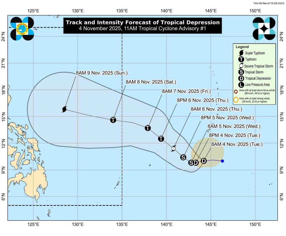
In the next 24 hours, this tropical depression is forecast to move slowly to the West. The tropical depression will then gradually accelerate northwestward over the Philippine Sea until Friday (7.11) before turning northwestward on 8.11. According to the forecast, the tropical depression may enter the PAR area on the evening of November 7 or the morning of November 8.
In terms of intensity, this tropical depression is forecast to strengthen while in the Philippine Sea throughout the forecast period. The depression could eventually strengthen into a typhoon on November 6 and become a typhoon by the end of the week.
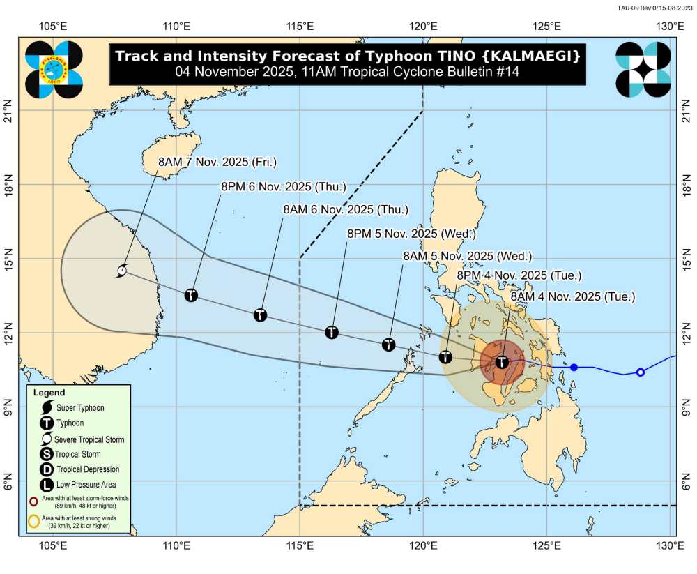
Meanwhile, tropical storm Kalmaegi is still strengthening as it approaches the East Sea.
As of 10:00 a.m. this morning (local time), the center of the storm was at about 10.6 degrees North latitude - 122.9 degrees East longitude, near Bacolod city, Negros Occidental province.
The strongest wind near the center of the storm reached 140 km/h, gusting up to 195 km/h. The storm is moving west at a speed of 25 km/h; the strong wind area is expanding about 300 km from the center of the storm.
The directly affected areas are currently under a level 4 strong wind warning, the highest in the Philippine typhoon warning system. Winds are forecast to reach 118 to 184 km/h, posing a serious threat to life and property.
Affected areas include: Cuyo Islands (Luzon) and a series of localities in the Visayas, including North Negros Oriental, North Negros Occidental, Guimaras, Capiz, Iloilo, Central and South Antique, South Aklan.
Several other areas are classified as level 3 warning, with winds of 89-117 km/h, including Southwest Masbate, North Palawan ( El Nido, Taytay, Dumaran, Araceli, Calamian Islands), and many localities of concededor, Negros and neighboring islands.
Typhoon Kalmaegi is forecast to cross the Philippine mainland and enter the East Sea tomorrow morning, November 5. At that time, this will be the 13th storm to make landfall in the East Sea this year.
The meteorological agency warns residents and tourists not to go to sea or conduct activities at sea, especially in the Central and Western Visayas.
Local authorities are required to proactively evacuate people from low-lying areas, along rivers and coastal areas, and activate disaster prevention plans to ensure safety when storms approach the mainland.
People and tourists planning to visit the Philippines or areas where the storm passes should pay attention to weather forecasts. Check flight schedules and follow local instructions to avoid dangerous storms.


