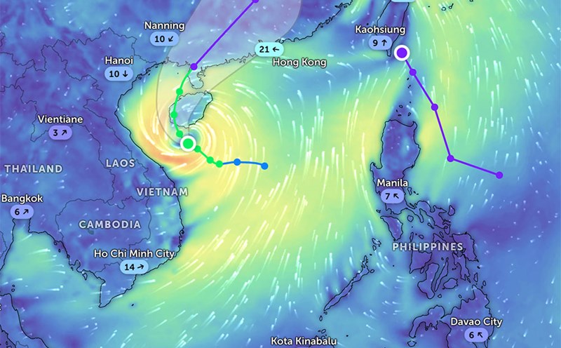
According to the latest storm forecast from the National Center for Hydro-Meteorological Forecasting, at 7:00 a.m. on June 13, the center of storm No. 1 was at about 18.2 degrees North latitude; 108.7 degrees East longitude, in the sea southwest of Hainan Island (China).
The strongest wind near the storm center is level 10 (89-102 km/h), gusting to level 13. The storm is moving north-northeast at a speed of about 10-15 km/h.
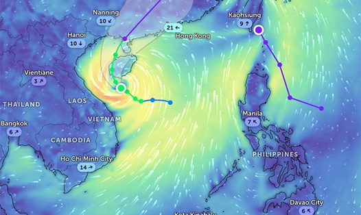
At 7:00 a.m. on June 14, storm No. 1 moved in the North-Northwest direction, then moved to the North Northeast at a speed of 10-15 km/h.
The center of the storm is located at about 20.5 degrees North latitude; 109.3 degrees East longitude, in the eastern sea of the North Gulf of Tonkin. Strong wind level 10, gust level 13.
Dangerous sea area: North latitude 16.0 degrees North latitude; from 106.5 to 111.0 degrees East longitude.
Disaster risk level: Level 3 - affecting the northwest of the North East Sea, the offshore waters from Quang Tri to Da Nang and the Gulf of Tonkin.
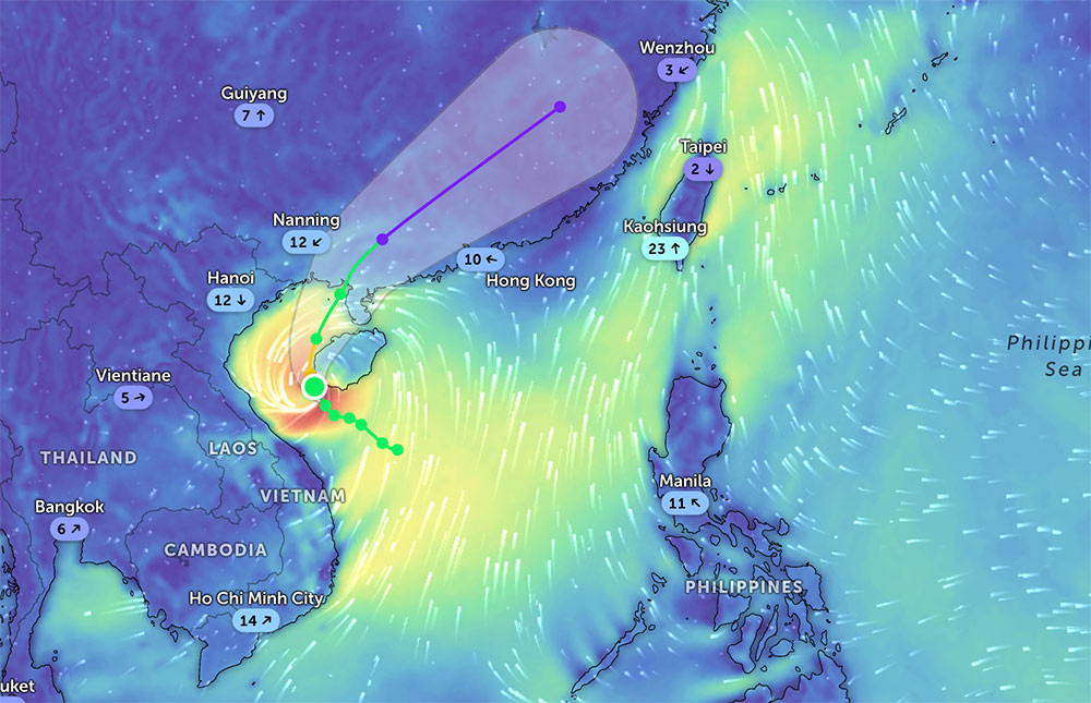
By 7:00 a.m. on June 15, storm No. 1 changed direction, moving mainly in the North Northeast direction at a speed of about 15 km/h and gradually weakening into a tropical depression. The location is currently around 23.2 degrees North latitude; 111.6 degrees East longitude, in the southwest of Guangdong province (China). Strong wind level 7, gust level 9.
Dangerous area: North latitude 18.5 degrees North latitude; from 106.5 to 113.0 degrees East longitude.
Disaster risk level: Level 3 - continues to affect the northwest of the North East Sea and the sea area north of the Gulf of Tonkin.
At 7:00 a.m. on June 16, the tropical depression moved northeast at a speed of 20-25 km/h and continued to weaken into a low pressure area.
The location is currently around 26.5 degrees North latitude; 115.6 degrees East longitude, in mainland southern China. The wind speed drops below level 6.
The Northwest of the North East Sea and the offshore waters from Quang Tri to Da Nang will have strong winds of level 6-8, near the storm's eye will have strong winds of level 9-10, gusting to level 13. Waves are 3.0-5.0m high, with the area near the center of the storm being 4.0-4.0m high. The sea is very rough.
The Gulf of Tonkin has strong winds of level 6-7, near the center of the storm level 8-10, gusting to level 13. Waves are 2.0-4.0m high, with the East alone being 3.0-5.0m high. The sea is very rough.
Due to the impact of high tides combined with rising water due to storms, from the evening of June 13 to 14, coastal provinces from Hai Phong to Nghe An are likely to have high sea levels: Hon Dau about 3.9m, Hon Ngu about 2.8m.
Low coastal areas and river mouths are at risk of local flooding from 5:00 p.m. to 7:00 p.m. on June 13 and 14.
On June 13, the area from Quang Binh to Thua Thien Hue will have heavy to very heavy rain, with common rainfall of 50-120mm, some places over 250mm. The provinces of South Nghe An and Ha Tinh, from Da Nang to Quang Nam and Kon Tum, will have moderate rain, heavy rain, locally very heavy rain with thunderstorms, with common rainfall from 20-40mm, some places over 120mm.
Given the complicated developments of storms and dangerous weather at sea and on land, tourists planning to travel or stay in coastal areas from Quang Tri to Nghe An, Da Nang, Quang Nam, Hue, as well as on islands and bays of the North, should closely monitor weather forecasts and warnings from authorities.
Limit waterway travel, avoid outdoor activities, especially mountain climbing, swimming, and camping from June 13 to 15.
Ship operating in the above dangerous areas are at high risk of being affected by strong winds, large waves, tornadoes and dangerous thunderstorms.