According to the National Center for Hydro-Meteorological Forecasting, today's weather forecast 6.10, storm No. 11 Matmo officially made landfall in Vietnam.
It is forecasted that at 7:00 a.m. this morning, the center of the storm will be at about 21.9 degrees North latitude - 107.3 degrees East longitude, in the mainland of Guangxi province (China). The storm is moving west-northwest at a speed of about 20 km/h. The strongest wind near the storm center is level 8, gusting to level 10.
Disaster risk level: Level 3 for the Northwest of the East Sea, the North of the Gulf of Tonkin, the mainland along the coast from Quang Ninh to Hung Yen, Lang Son province, the Northeast of Bac Ninh province, the East of Cao Bang province.
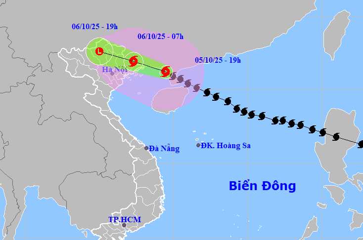
At 7:00 p.m. on October 6, the storm moved in a West-Northwest direction at a speed of about 20 km/h. The center of the storm is located at about 22.6 degrees North latitude - 105.0 degrees East longitude, in the mountainous areas of Northern Vietnam. The storm will gradually weaken into a low pressure area, with a wind intensity lower than level 6.
Disaster risk level: Level 3 for the Northern Gulf of Tonkin, coastal mainland from Quang Ninh to Hung Yen, Lang Son province, Northeast of Bac Ninh, East of Cao Bang province.
Due to the influence of the storm, the northwestern sea area of the North East Sea will have strong winds of level 8-9, gusts of level 11, waves 4.0-6.0 m high, and very rough seas. The North Gulf of Tonkin (including Bach Long Vi, Van Don, Co To, Cat Hai, Hon Dau) has strong winds of level 7-9, near the storm's eye level 10-12, gusts of level 15, waves 2.0-5.0 m high, and rough seas.
The coastal areas and islands of Quang Ninh - Hai Phong have storm surges of 0.4-0.6 m high. Risk of flooding in low-lying coastal areas, river mouths due to rising water combined with large waves on the night of October 5 and early morning of October 6.
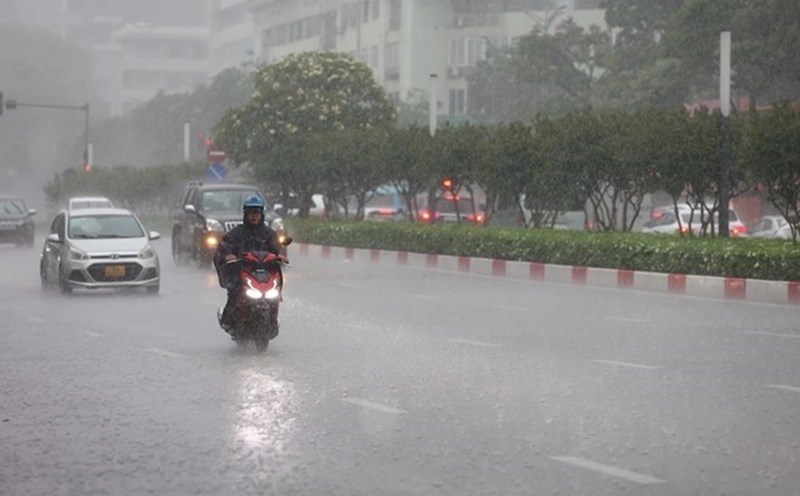
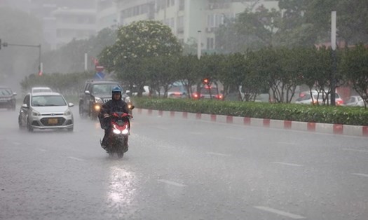
From the night of October 5 to noon of October 6, coastal areas from Quang Ninh to Hung Yen and Lang Son province will have winds gradually increasing to level 6-7, near the storm center level 8-9, gusting to level 11-12 (the wind breaks tree branches, blows roofs, causes heavy damage, cannot go back to the wind). The deep inland areas of the Northeast will have strong winds of level 4-5, some places will have level 6, gusting to level 7-8.
Northeast of Quang Ninh (Mong Cai, Hai Ha, Dam Ha) there will be winds of level 8-9, gusting to level 11-12, risk of roofs blown off, trees fallen, damage to temporary works and power lines.
The remaining areas of Quang Ninh, Hai Phong coastal areas will have winds of level 7-8, gusts of level 10, and the possibility of damage to weak houses, trees, coastal areas and Cat Hai island.
Hung Yen, the Northeast of Bac Ninh (old Bac Giang) has winds of level 6-7, gusting to level 9, affecting electricity, crops and transportation.
Lang Son, the East of Cao Bang province has winds of level 6-7, gusting to level 9-10, mountainous areas may experience strong gusts of wind, locally tornadoes.
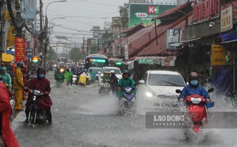
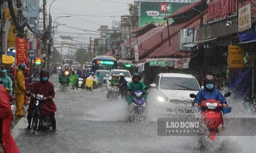
From now until the end of the night of October 7, the mountainous and midland areas of the North will have heavy rain of 150-250 mm, locally over 400 mm. Warning of the risk of heavy rain (>150mm/3 hours). The Northern Delta and Thanh Hoa will have rain of 70-150 mm, locally over 200 mm.
Hanoi weather forecast: Hanoi weather is less affected by storms and winds, beware of thunderstorms, tornadoes and strong gusts of wind. From early morning of October 6 to the end of October 7, there will be moderate rain, heavy rain (70-120 mm, some places over 150 mm).
Due to the wide circulation of storms, it is necessary to be on guard against thunderstorms, whirlwinds, and strong gusts of wind before, during, and after the storm makes landfall. People and tourists should avoid going out during harsh weather and heavy thunderstorms to ensure safety.
Hanoi City
Lowest temperature: 24-26°C.
Highest temperature: 27-29°C, some places above 29°C.
Cloudy, moderate rain, heavy rain and scattered thunderstorms, locally very heavy rain.Northwest to north wind level 4.During thunderstorms, there is a possibility of tornadoes, lightning and strong gusts of wind.
Northwest
Lowest temperature: 22-25°C, some places below 21°C.
Highest temperature: 27-30°C.
Cloudy, scattered showers and thunderstorms at night, locally heavy rain; during the day, there will be heavy rain, locally very heavy rain.Light wind.During thunderstorms, there is a possibility of tornadoes, lightning and strong gusts of wind.
Northeast
Lowest temperature: 23-26°C, some places below 23°C.
Highest temperature: 26-29°C, some places above 29°C.
Cloudy, heavy rain, locally very heavy rain; the plains and Thanh Hoa have moderate rain, heavy rain and thunderstorms, locally very heavy rain.
Northwest to north wind level 4-5, some places level 6, gust level 7-8; especially from Quang Ninh to Hung Yen and Lang Son, strong winds level 6-7, gust level 8-9, coastal areas level 8-10, gust level 11-12. During thunderstorms, there is a possibility of tornadoes, lightning and strong gusts of wind.
Thanh Hoa to Hue
Lowest temperature: 25-28°C.
Highest temperature: 31-34°C, some places above 34°C.
Cloudy, scattered showers and thunderstorms.West to southwest wind level 2-3.During thunderstorms, there is a possibility of tornadoes, lightning and strong gusts of wind.
South Central Coast
Lowest temperature: 24-27°C.
Highest temperature: 31-34°C.
Cloudy, scattered showers and thunderstorms.Southwest wind level 2-3.During thunderstorms, there is a possibility of tornadoes, lightning and strong gusts of wind.
Central Highlands
Lowest temperature: 20-23°C, some places below 20°C.
Highest temperature: 27-30°C.
Cloudy, with showers and thunderstorms in some places; in the late afternoon and evening, there will be scattered showers and thunderstorms in some places.Southwest wind level 2-3.During thunderstorms, there is a possibility of tornadoes, lightning and strong gusts of wind.
Southern region
Lowest temperature: 24-27°C.
Highest temperature: 31-34°C.
Cloudy, with showers and thunderstorms in some places; in the late afternoon and evening, there will be scattered showers and thunderstorms in some places.Southwest wind level 2-3.During thunderstorms, there is a possibility of tornadoes, lightning and strong gusts of wind.
Ho Chi Minh City
Lowest temperature: 24-26°C.
Highest temperature: 32-34°C.
Cloudy, scattered showers and thunderstorms tonight and tomorrow evening; scattered showers and thunderstorms at night, sunny during the day.Southwest wind level 2-3.During thunderstorms, there is a possibility of tornadoes, lightning and strong gusts of wind.