According to the bulletin issued at 3:32 p.m. on September 10 by the National Center for Hydro-Meteorological Forecasting, the flood on Thao River in Lao Cai City continues to slowly recede; at Bao Ha it peaked at 61.95m (7:00 a.m. on September 10), 4.95m above alert level 3, 1.02m above the historical flood level in 2008 (60.93m).
In Yen Bai, the flood peak is fluctuating at 35.70m, above alert level 3: 3.70m, 1.28m above the historical flood level in 1968 (34.42m) and is slowly decreasing.
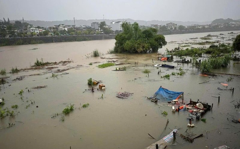
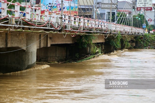
In Phu Tho, the flood is rising rapidly. The flood on Lo River (Tuyen Quang, Phu Tho), Cau River (Bac Ninh), Thuong River (Bac Giang), Thai Binh River (Hai Duong), Red River (Hanoi), Hoang Long River (Ninh Binh) is rising; Luc Nam River (Bac Giang) is falling slowly.
In the next 12 to 24 hours, the water level at downstream stations of the Red River - Thai Binh River system is likely to rise to level 3 and above. Rising flood water levels will cause flooding in low-lying areas along the river, alluvial areas outside the main dike, causing the riverside dikes to overflow, and landslides to seriously affect vulnerable locations in the dike system, embankments, and riverside works in the provinces of Hanoi, Ha Nam, Nam Dinh, Hai Duong, Hung Yen, Thai Binh, and Ninh Binh.
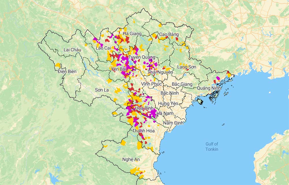
The risk of flooding in low-lying riverside areas in the provinces of Lang Son, Cao Bang, Lao Cai, Yen Bai, Phu Tho, Bac Giang, Bac Kan, Thai Nguyen, Hoa Binh, Ninh Binh and Thanh Hoa is very high. Steep slopes in the mountainous areas of the North and Thanh Hoa also face the risk of flash floods and landslides. The level of natural disaster risk due to floods is warned at level 3.
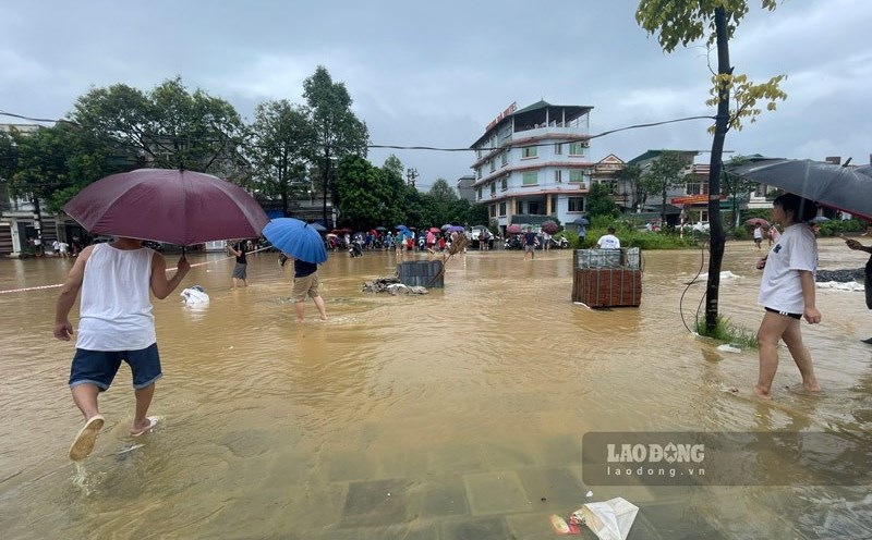
Nine provinces and cities have been warned of the risk of flooding in low-lying areas, including Yen Bai, Bac Giang, Thai Nguyen, Bac Ninh, Phu Tho, Tuyen Quang, Hanoi and Ninh Binh.
Specifically, localities in Yen Bai at high risk include Yen Bai city, Tran Yen, Van Yen, Van Tran, Luc Yen, Yen Binh, Tram Tau.
Bac Giang: Bac Giang City, Hiep Hoa, Viet Yen, Luc Ngan, Lang Giang, Luc Nam.
Phu Tho: Tan Son, Thanh Son, Tam Nong, Yen Lap, Ha Hoa, Thanh Ba, Cam Khe, Lam Thao.
Tuyen Quang: Ham Yen, Chiem Hoa, Tuyen Quang City.
Hanoi: The middle bank of the Red River belongs to Tay Ho, Long Bien, Hoan Kiem and Gia Lam districts.
Ninh Binh: Nho Quan, Gia Vien, Ninh Binh City.
Residents and tourists in areas expected to be affected need to closely monitor weather forecasts, update flood and rain situations... and follow instructions from authorities to ensure safety.