Storm No. 3 to make landfall in the next 48 hours
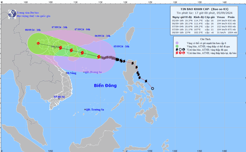
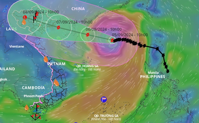
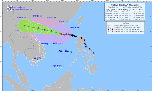
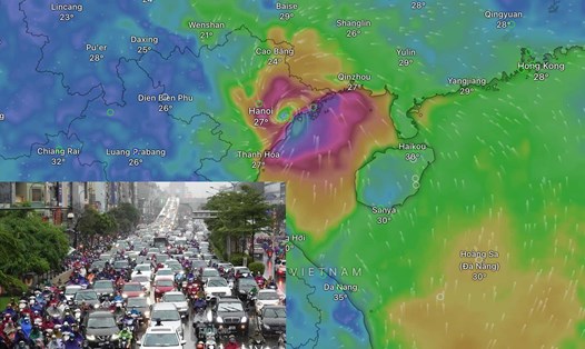
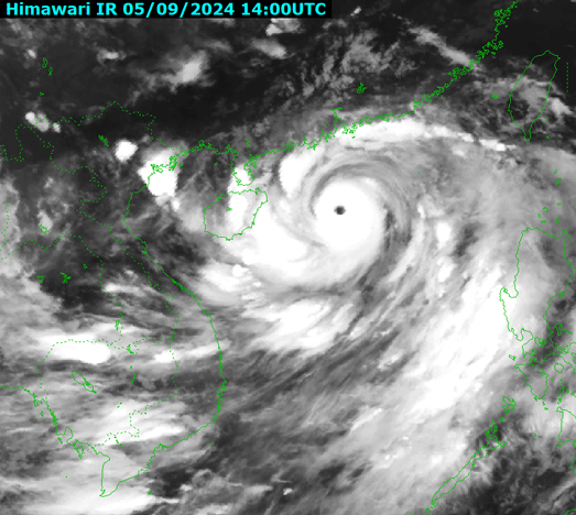
Latest update from the National Center for Hydro-Meteorological Forecasting, at 7:00 p.m. on September 5, the center of super typhoon No. 3 was located in the northern sea area of the North East Sea, about 380km east of Hainan Island (China).
The strongest wind near the center of the super typhoon is level 16 (184-201km/h), gusting over level 17, moving west at a speed of about 15km/h.
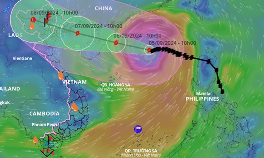
It is forecasted that in the next 24 hours , storm No. 3 will move west-northwest at a speed of about 15km/h. At 7:00 p.m. on September 6, the center of storm No. 3 will be at about 20.2 degrees north latitude - 110.9 degrees east longitude; in the sea northeast of Hainan Island (China), about 400km east-southeast of Quang Ninh.
The strongest wind near the storm center is level 16, gusting over level 17.
Dangerous area due to storm No. 3 is north of latitude 16; longitude 108.5 - 118.
It is forecasted that in the next 36 hours , storm No. 3 will move west-northwest at a speed of about 20km/h, enter the Gulf of Tonkin and gradually weaken. At 7:00 a.m. on September 7, the center of the storm will be located in the northern waters of the Gulf of Tonkin, about 140km east-southeast of Quang Ninh.
The strongest wind near the storm center is level 13 - 14, gusting to level 17.
Dangerous area due to storm No. 3 is north of latitude 16; west of longitude 113.5.
Forecast in the next 48 hours , storm No. 3 will move west-northwest at a speed of about 20km/h and gradually weaken. At 7:00 p.m. on September 7, the center of the storm will be on land in the Northeast region of the North.
The strongest wind near the storm center is level 8 - 9, gusting to level 11.
Danger zone due to storm No. 3 is north of latitude 17; west of longitude 109.
It is forecasted that in the next 72 hours , storm No. 3 will move west-northwest at a speed of about 20km/h; move inland and gradually weaken into a low pressure area. At 7:00 p.m. on September 8, the center of the low pressure area will be over the Vietnam-Laos border area.
Rainy season in the North is concentrated from September 7 to 8.
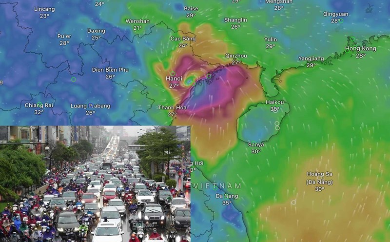
From the night of September 6 and early morning of September 7, coastal areas from Quang Ninh to Thanh Hoa will have winds gradually increasing to level 6-7, then increasing to level 8-9, near the storm center level 10-12, gusting to level 14; inland areas in the Northeast region will have strong winds of level 6-8, gusting to level 9-11. The strongest winds will be from noon to evening of September 7.
From the night of September 6 to the morning of September 9, the Northern region and Thanh Hoa are likely to experience heavy rain, some places will have very heavy rain and thunderstorms with total rainfall ranging from 100-350mm, some places will have over 500mm. The heaviest rain in the Northeast will be concentrated during the day and night of September 7; in the Northwest from the evening of September 7 to the night of September 8. Heavy rain is likely to cause flooding in low-lying areas; flash floods on small rivers and streams, landslides on steep slopes.
Due to the influence of the wide storm circulation, it is necessary to be on guard against the risk of thunderstorms, tornadoes and strong gusts of wind both before and during the storm's landfall.