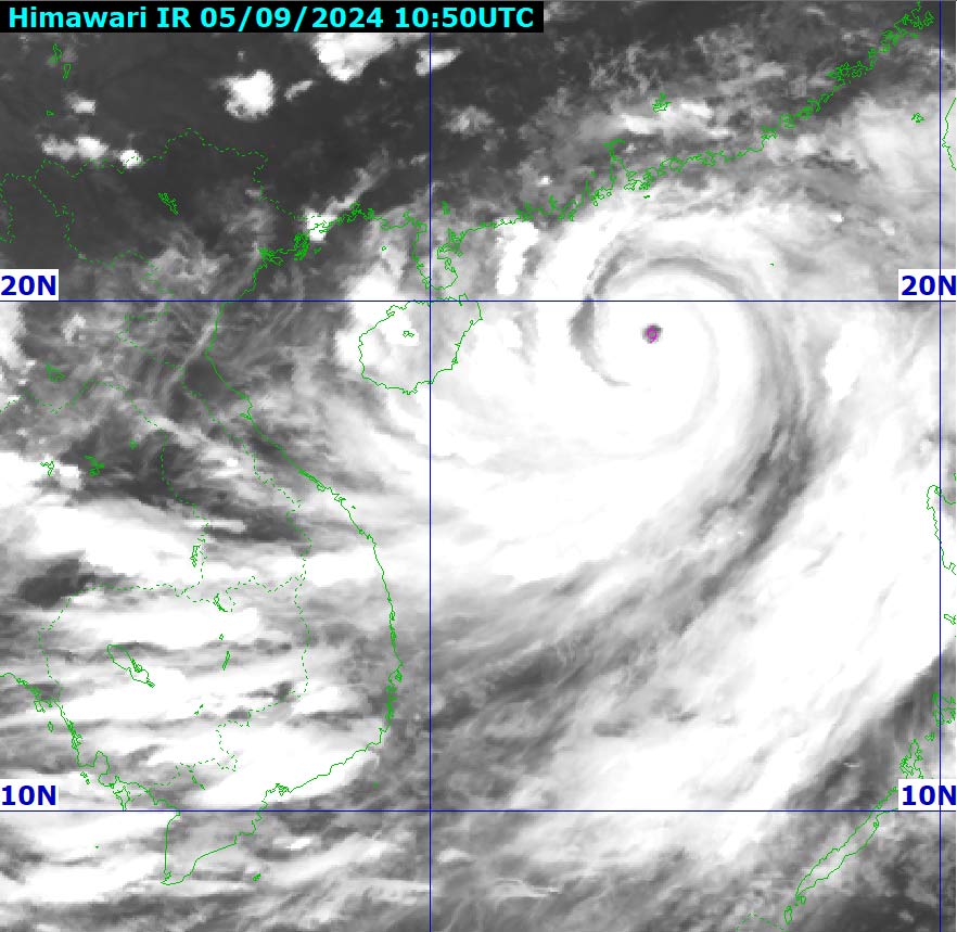
Storm No. 3 maintains super storm level in the next 24 hours
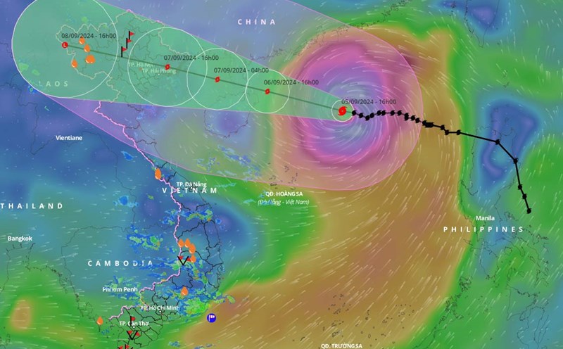
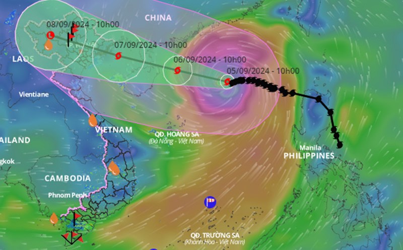
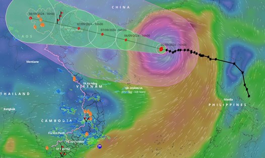
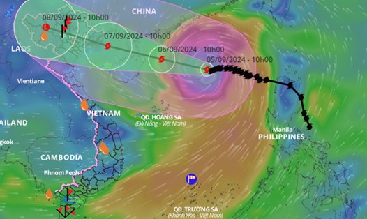
It is forecasted that in the next 24 hours , storm No. 3 will move west-northwest at a speed of about 15km/h. At 4:00 p.m. on September 6, the center of storm No. 3 will be at about 20.1 degrees north latitude - 111.4 degrees east longitude; in the sea northeast of Hainan Island (China), about 450km east-southeast of Quang Ninh.
The strongest wind near the storm center is level 16, gusting over level 17.
It is forecasted that in the next 48 hours , storm No. 3 will move west-northwest at a speed of about 20km/h and gradually weaken. At 4:00 p.m. on September 7, the center of storm No. 3 will be at about 21.1 degrees north latitude - 107 degrees east longitude; on the mainland along the coast from Quang Ninh to Nam Dinh.
The strongest wind near the storm center is level 10 - 11, gusting to level 14.
It is forecasted that in the next 72 hours , storm No. 3 will move west-northwest at a speed of about 20km/h and gradually weaken into a low pressure area. At 4:00 p.m. on September 8, the center of storm No. 3 will be at about 22 degrees north latitude - 102.5 degrees east longitude; in the northwest region of the North.
Waves near the storm center can be 10 - 12m high.
Regarding the impact of the storm, at sea, the North East Sea area has strong winds of level 11 - 14, near the eye of the super storm level 15 - 16, gusting over level 17; the sea is very rough. Waves are 7 - 9m high, near the eye of the super storm 10 - 12m.
From around noon on September 6, the eastern sea of the Gulf of Tonkin (including Bach Long Vi island district) will have winds gradually increasing to level 6-7. From the evening and night of September 6, the Gulf of Tonkin (including Bach Long Vi island district and Co To) will have winds gradually increasing to level 8-9, then increasing to level 10-12, near the eye of the storm will have winds of level 13-14, gusting to level 17; the sea will be very rough. Waves will be 2-4m high, then increasing to 3-5m, near the eye of the storm will have winds of 6-8m.
From the night of September 6 and early morning of September 7, coastal waters from Quang Ninh to Thanh Hoa had waves 2-3m high, later increasing to 2-4m, and 3-5m near the storm center.
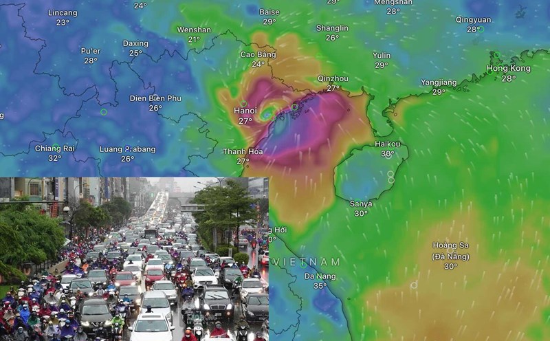
Northern rain center from 7 - 8.9
From the night of September 6 and early morning of September 7, coastal areas from Quang Ninh to Thanh Hoa will have winds gradually increasing to level 6-7, then increasing to level 8-9, near the storm center level 10-12, gusting to level 14; inland areas in the Northeast region will have strong winds of level 6-8, gusting to level 9-11. The strongest winds will be from noon to evening of September 7.
From the night of September 6 to the morning of September 9, the Northern region and Thanh Hoa are likely to experience heavy rain, some places will have very heavy rain and thunderstorms with total rainfall ranging from 100-350mm, some places will have over 500mm. The heaviest rain in the Northeast will be concentrated during the day and night of September 7; in the Northwest from the evening of September 7 to the night of September 8. Heavy rain is likely to cause flooding in low-lying areas; flash floods on small rivers and streams, landslides on steep slopes.
Due to the influence of the wide storm circulation, it is necessary to be on guard against the risk of thunderstorms, tornadoes and strong gusts of wind both before and during the storm's landfall.