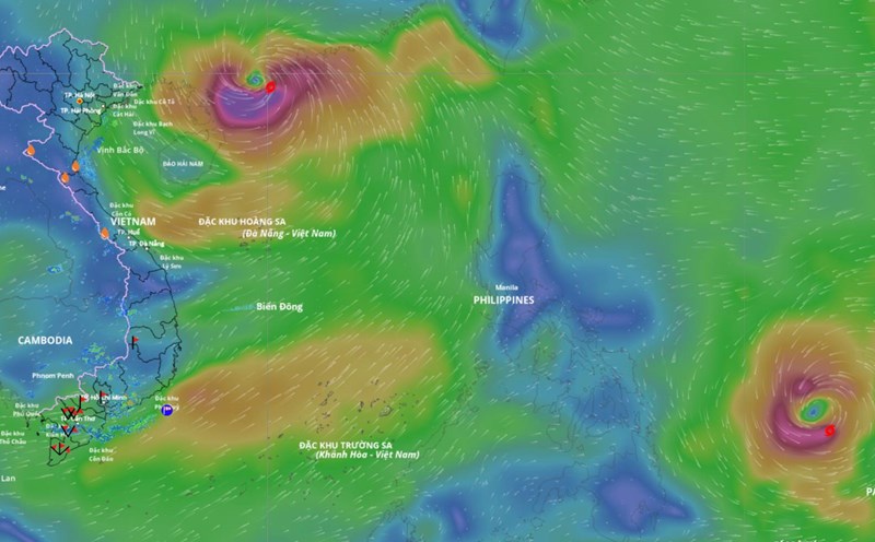
According to the National Center for Hydro-Meteorological Forecasting, at 7:00 p.m. on September 24, the center of storm Bualoi was at about 10.7 degrees north latitude - 131.0 degrees east longitude, with the strongest wind near the center of the storm at level 10 (89-102 km/h), gusting to level 12. The storm is moving west-northwest at a speed of 15-20 km/h.
It is forecasted that around the night of September 26, storm Bualoi will enter the eastern sea area of the central East Sea, becoming the 10th storm of 2025.
It is forecasted that in the next 24 hours, the storm will continue to move west-northwest at a speed of 15-20 km/h, with the possibility of strengthening.
At 7:00 p.m. on September 25, the center of the storm was at about 12.3 degrees north latitude - 127.2 degrees east longitude, level 11, gust level 14.
It is forecasted that in the next 48 hours, the storm will continue to move west-northwest at a speed of 20-25 km/h.
At 7:00 p.m. on September 26, the center of the storm was at about 14.1 degrees north latitude - 121.3 degrees east longitude, level 11, gust level 14.
It is forecasted that in the next 72 hours, the storm will continue to move west-northwest at a speed of 25 km/h, moving into the East Sea
At 7:00 p.m. on September 27, the center of the storm was at about 15.3 degrees north latitude - 114.0 degrees east longitude, level 11, gust level 14.
The danger zone is located from latitude 13 degrees north to 18 degrees north, east of longitude 112 degrees east. The natural disaster risk level is level 3 for the northern and central East Sea, including the Hoang Sa special zone.
It is forecasted that in the next 72 to 120 hours, the storm will continue to move rapidly in the west-northwest to northwest direction at a speed of 20-25 km/h and is likely to strengthen.
Due to the influence of storm Bualoi, from the evening and night of September 26, the northeastern and central East Sea will have winds gradually increasing to level 6-7, then increasing to level 8-9. The area near the storm's eye has strong winds of level 10-11, gusts of level 14, waves 5-7 m high, and rough seas, especially dangerous for ships operating in the northern and central East Sea.