Storm Tra Mi is forecast to move quickly and continuously strengthen in the East Sea

AN AN |

The meteorological agency forecasts that after entering the North East Sea, storm Tra Mi is likely to strengthen.

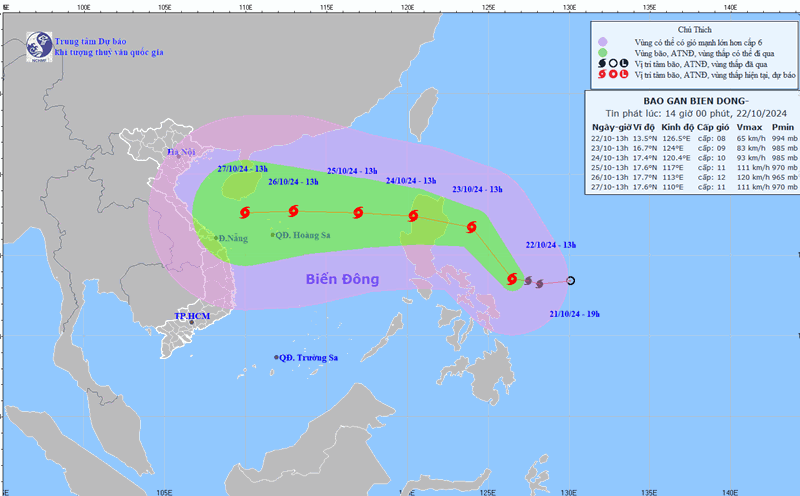
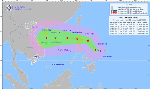
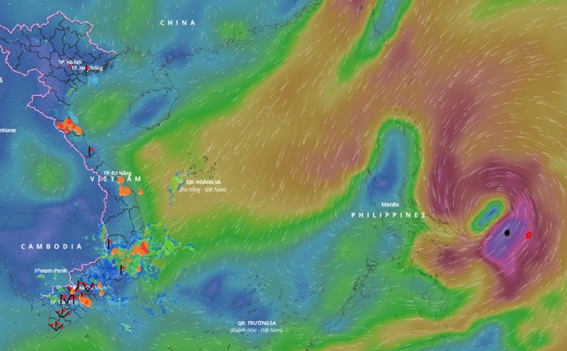
Latest update from the National Center for Hydro-Meteorological Forecasting, at 7:00 p.m. on October 22, storm Tra Mi was centered at about 14.5 degrees north latitude; 126 degrees east longitude, in the sea east of the central Philippines.

The strongest wind near the storm center is level 8 (62-74km/h), gusting to level 10. The storm moves northwest at a speed of about 20km/h.

In the next 24 hours, the storm is forecast to move northwest at a speed of about 15km/h. At 7:00 p.m. on October 23, the center of the storm will be at about 17 degrees north latitude - 123 degrees east longitude; in the sea east of Luzon Island (Philippines).

The strongest wind near the storm center is level 9, gusting to level 11.

It is forecasted that in the next 48 hours, the storm will move westward at a speed of about 15 - 20 km/h, entering the East Sea. At 7:00 p.m. on October 24, the center of the storm will be at about 16.9 degrees north latitude - 119.3 degrees east longitude; in the eastern sea area of ​​the North East Sea.

The strongest wind near the storm center is level 10, gusting to level 12.

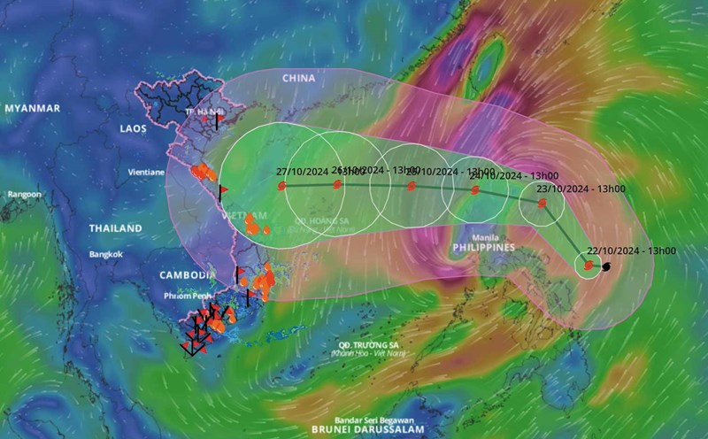
Update on the path of storm Tra Mi from now until October 24, 2024. Source: Vietnam Disaster Monitoring System

It is forecasted that in the next 72 hours, the storm will move west-northwest at a speed of about 15. At 7:00 p.m. on October 25, the center of the storm will be at about 17.3 degrees north latitude - 116.1 degrees east longitude; 450km east-northeast of the Hoang Sa archipelago.

The strongest wind near the storm center is level 11, gusting to level 14.

From the next 72 to 120 hours, the storm will move mainly westward, traveling 15 - 20km per hour, and continue to strengthen.

Regarding the impact of the storm at sea, the sea area east of the North East Sea has strong winds of level 6 - 7. From the morning of October 24, strong winds increased to level 8 - 9 (62 - 88 km/h), the area near the storm's eye has level 10 - 11 (89 - 117 km/h), gusts of level 14, waves 4 - 6m high, the area near the storm's eye has 6 - 8m; the sea is very rough.

Ships operating in the above mentioned dangerous areas are likely to be affected by storms, whirlwinds, strong winds and large waves.

AN AN
RELATED NEWS

Forecast of dangerous areas affected by storm Tra Mi

|

A representative of the meteorological agency said that after entering the East Sea, storm Tra Mi is likely to strengthen and head towards the coast of the Central provinces.

The time when storm Tra Mi entered the East Sea, changed direction and strengthened

|

A representative of the meteorological agency provided information on the time when storm Tra Mi entered the East Sea.

Latest forecast of storm Tra Mi's path approaching the East Sea

|

The meteorological agency said that this morning (October 22), the tropical depression in the sea east of the Philippines has strengthened into a storm and is named Tra Mi.

Merging E Hospital into Bach Mai, will the rights of patients be affected?

|

The proposal to merge E Hospital into Bach Mai Hospital has made many patients wonder about whether their medical examination and treatment benefits will be affected.

Football review Nepal vs Vietnam in the 2027 Asian Cup qualifiers

|

Football commentary on the match between Nepal and Vietnam in the 2027 Asian Cup qualifiers.

The country with nearly 600,000 people has won tickets to the 2026 World Cup

|

The Cape Verde team made history when participating in the World Cup for the first time.

Instructions for management and use of general education teachers' staff after the merger

|

Arrange teachers to teach in 2025 - 2026; Recruit teachers from the total assigned staffing quota; Implement solutions to ensure recruitment sources,...

Forecast of dangerous areas affected by storm Tra Mi

AN AN |

A representative of the meteorological agency said that after entering the East Sea, storm Tra Mi is likely to strengthen and head towards the coast of the Central provinces.

The time when storm Tra Mi entered the East Sea, changed direction and strengthened

NHÓM PV |

A representative of the meteorological agency provided information on the time when storm Tra Mi entered the East Sea.

Latest forecast of storm Tra Mi's path approaching the East Sea

AN AN |

The meteorological agency said that this morning (October 22), the tropical depression in the sea east of the Philippines has strengthened into a storm and is named Tra Mi.