Due to the influence of storm Tra Mi, Con Co island (Quang Tri) has strong winds of level 8, gusting to level 9; Cu Lao Cham island (Quang Nam) has strong winds of level 8, gusting to level 10; Ly Son island (Quang Ngai) has level 6, gusting to level 7; Le Thuy (Quang Binh) has strong winds of level 7, gusting to level 9; Nam Dong (Thua Thien Hue) has strong winds of level 8, gusting to level 10; Cam Le (Da Nang) has strong winds of level 8, gusting to level 9; Son Tra (Da Nang) has strong winds of level 9, gusting to level 10.
From last night to this afternoon (October 27), the area from Ha Tinh to Quang Nam has had heavy to very heavy rain. The total rainfall as of 4 p.m. on October 27 is generally 150-250mm, locally over 400mm.
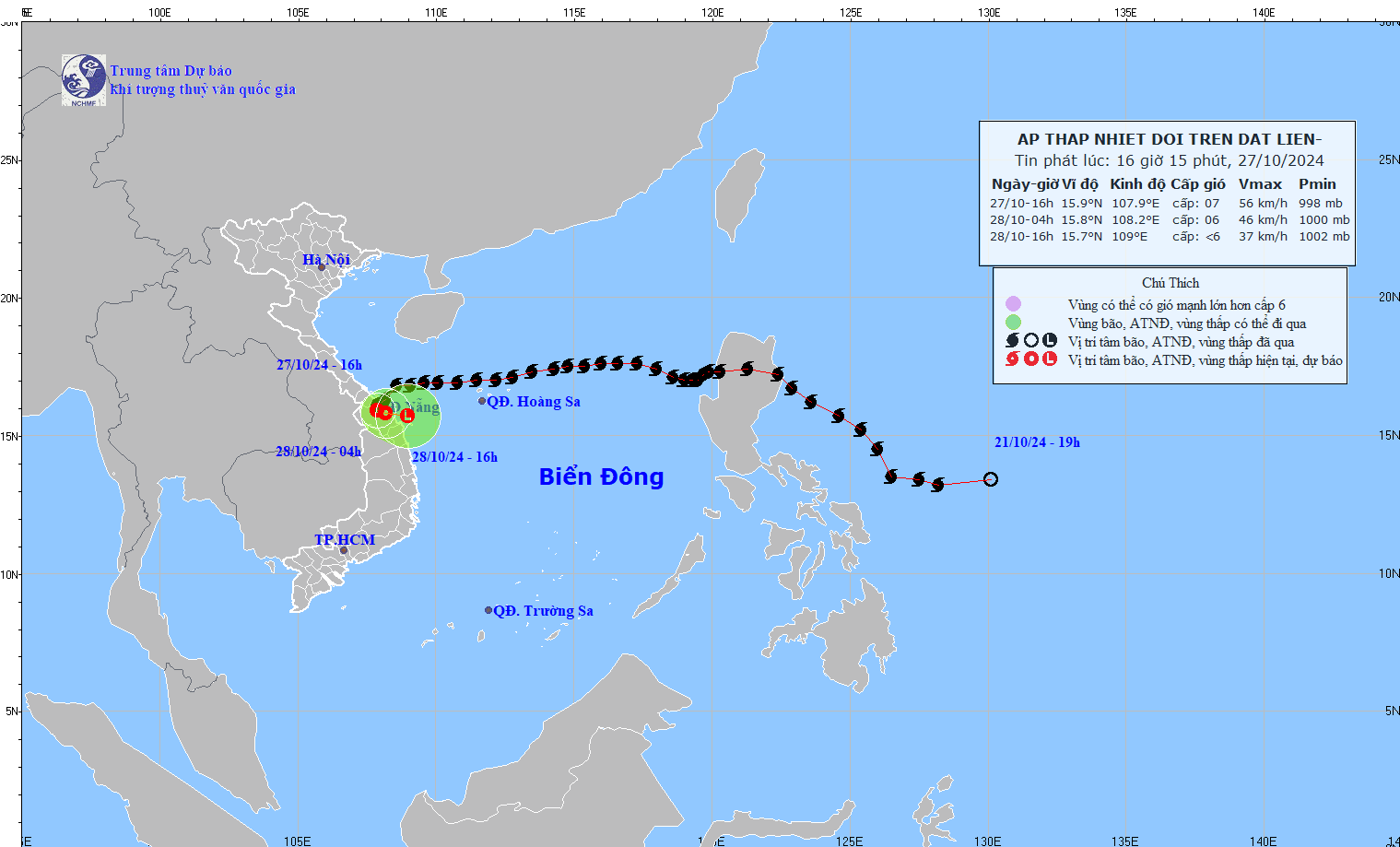
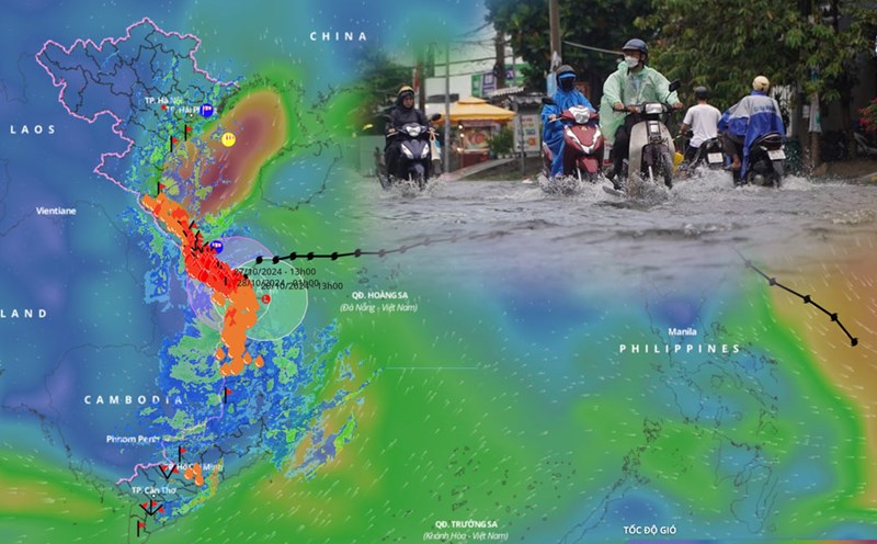
This afternoon (October 27), after moving deep into the mainland of Thua Thien Hue, Quang Nam - Da Nang provinces, storm No. 6 weakened into a tropical depression.
At 4:00 p.m. on October 27, the center of the tropical depression was at about 15.9 degrees north latitude; 107.9 degrees east longitude, on the mainland of Thua Thien Hue, Quang Nam - Da Nang provinces. The strongest wind near the center of the tropical depression was level 7 (50-61 km/h), gusting to level 9. The tropical depression moved in a south-southwest direction, at a speed of about 5 km/h.
It is forecasted that in the next 12 hours, the tropical depression will move southeast at a speed of 3 - 5 km/h. At 4:00 a.m. on October 28, the center of the tropical depression will be at about 15.8 degrees north latitude - 108.2 degrees east longitude; on the mainland of Thua Thien Hue, Quang Nam - Da Nang.
The strongest wind near the center of the tropical depression is level 6, gusting to level 8.
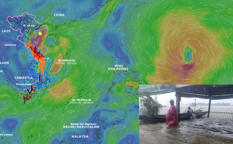
It is forecasted that in the next 21 hours, the tropical depression will move eastward at a speed of 5km/h, weakening into a low pressure area. At 13:00 on October 28, the center of the low pressure area will be at about 15.7 degrees north latitude - 109 degrees east longitude; in the coastal waters of Thua Thien Hue - Quang Nam.
The strongest wind near the center of the low pressure area is below level 6.
Regarding the impact of the tropical depression, the sea area of provinces from Quang Binh to Quang Ngai (including Con Co Island and Cu Lao Cham) has strong winds of level 6-7, gusts of level 8-9, waves 2-4m high; rough seas.
On land, from Quang Binh to Quang Nam provinces, there will be strong gusts of wind at level 6-8; areas near the center of the tropical depression will have strong winds at level 6-7, gusts at level 8-9.
From now until the end of the night of October 28, the area from South Ha Tinh to Thua Thien Hue will have heavy to very heavy rain with rainfall from 150 - 250mm, locally over 400mm. Warning of the risk of local heavy rain (greater than 100mm within 3 hours).
The area from Da Nang to Quang Ngai and Kon Tum has heavy rain, locally very heavy rain with rainfall from 70-150mm, locally over 200mm.