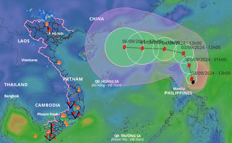
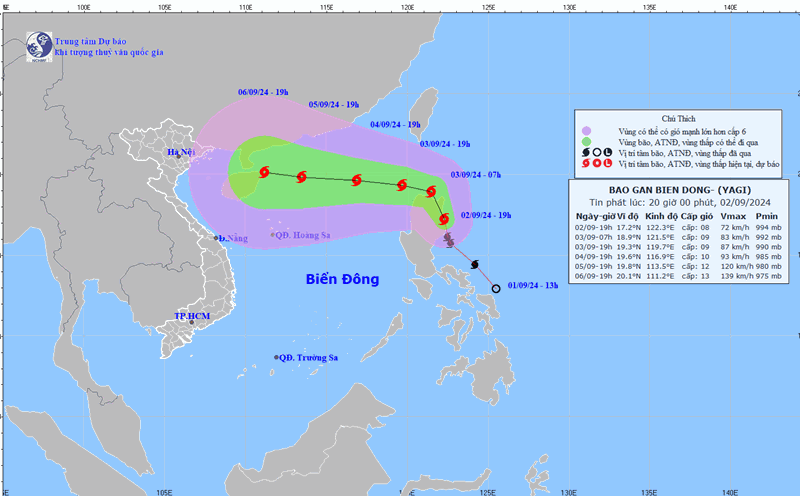
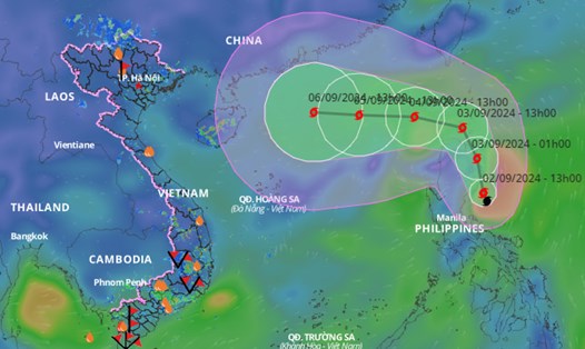
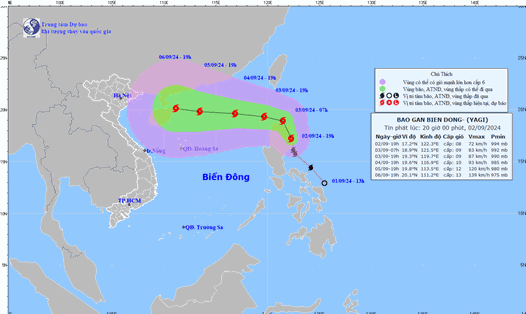
Latest update from the National Center for Hydro-Meteorological Forecasting, at 7:00 a.m., the center of storm No. 3 was located at about 18.4 degrees north latitude; 119.8 degrees east longitude, in the northeastern sea area of the North East Sea. The strongest wind near the center of the storm is level 8 (62-74 km/h), gusting to level 11, moving west-northwest, about 20-25 km/h.
It is forecasted that in the next 24 hours , storm No. 3 will move west-northwest at a speed of about 10km/h. At 7:00 a.m. on September 4, the center of the storm will be at about 19.3 degrees north latitude - 117.5 degrees east longitude; about 740km east of Hainan Island (China).
The strongest wind near the storm center is level 9 - 10, gusting to level 12.
It is forecasted that in the next 48 hours , storm No. 3 will move westward at a speed of about 10 km/h. At 7:00 a.m. on September 5, the center of the storm will be at about 19.2 degrees north latitude - 114.5 degrees east longitude; about 400 km east of Hainan Island (China).
The strongest wind near the storm center is level 11 - 12, gusting to level 14.
It is forecasted that in the next 72 hours , storm No. 3 will move westward at a speed of about 10 km/h. At 10:00 a.m. on September 6, the center of the storm will be at about 19.4 degrees north latitude - 111.3 degrees east longitude; in the sea east of Hainan Island (China).
The strongest wind near the storm center is level 13, gusting to level 16.
From the next 72 to 120 hours , the storm will move mainly in the west-northwest direction, traveling 10-15km per hour, with the possibility of strengthening.
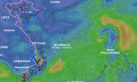
Regarding the impact of the storm , from September 3, the northeastern sea area of the North East Sea will gradually increase to level 6, near the storm center, level 8-9, gusting to level 11-12; rough seas.
In the next 24 hours, the eastern sea of the North East Sea, the waves are 2 - 4m high, the area near the storm center is 3 - 5m.