
Updated bulletin issued at 4:30 PM on September 13 from the National Center for Hydro-Meteorological Forecasting, in the past 24 hours (from 4:00 PM on September 12 to 4:00 PM on September 13), the area of provinces/cities from Ha Tinh to Da Nang had heavy rain, with very heavy rain in some places such as Ky Son observation station 177.6mm (Ha Tinh); Ta Long 59.2mm (Quang Tri); Rao Trang Hydropower Basin 463.8mm (Hue); Ba Na 184.4mm (Da Nang);...
The soil moisture model shows that some areas in the above provinces have been near saturation (over 85%) or reached saturation status.
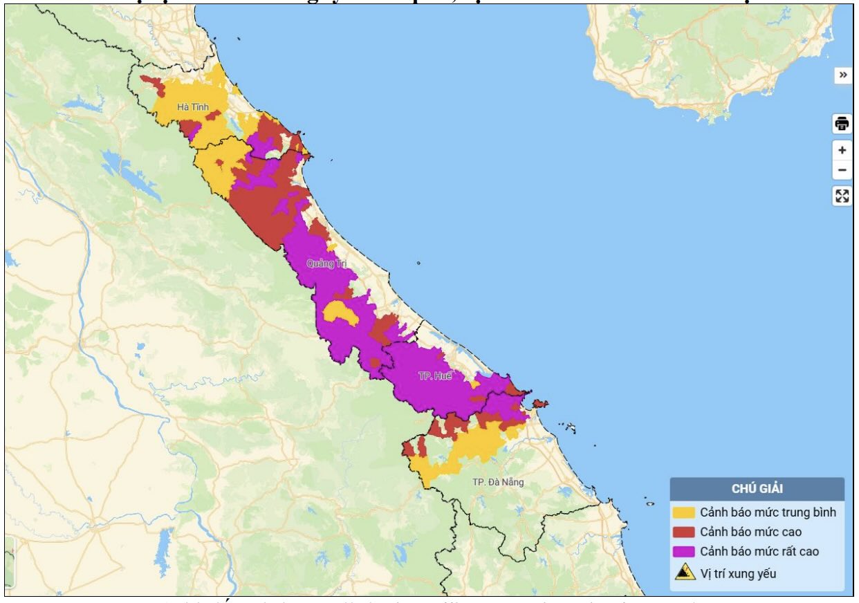
Warning in the next 6 hours, the above provinces/cities will continue to have rain with accumulated rainfall commonly in Ha Tinh with rain from 20-40mm, in some places over 90mm; Quang Tri from 20-50mm, in some places over 100mm; Hue and Da Nang from 10-20mm, in some places over 70mm.
Risk of flash floods on small rivers and streams, landslides on slopes in many communes/wards.
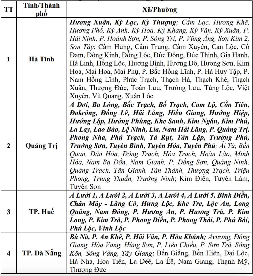
Warning level of natural disaster risk due to flash floods, landslides, subsidence due to rain, floods or currents is level 1; Quang Tri and Hue are level 2.
Flash floods and landslides can have very negative impacts on the environment, causing local traffic congestion, affecting the movement of vehicles; civil and economic works causing damage to production activities and socio-economic activities.
The meteorological agency recommends that functional agencies in localities pay attention to reviewing flow bottlenecks and key locations in the area to have preventive and response measures.


