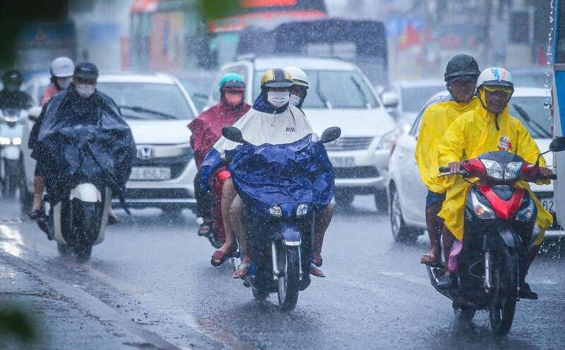
According to the National Center for Hydro-Meteorological Forecasting, in the past 24 hours (from 8:00 a.m. on June 11 to 8:00 a.m. on June 12), in the provinces from Ha Tinh to Binh Dinh and the Central Highlands, there has been moderate to heavy rain, such as: Ky Lien 88mm (Ha Tinh); Quang Minh 157.6mm (Quang Binh); La To Hydropower Dam 230.6mm (Quang Tri); Bach Ma 641.6mm (Hue City); Hoa Hai 510.4mm (Da Nang City); Can Hau Lake 71.6mm (Binh Dinh); Dak Ha 176.2mm ( Kon Tum); Dam Rong 102.6mm (Lam Dong);...
Soil moisture models show that some areas in the above provinces are nearly saturated (over 85%) or have reached a saturated state.
In the next 3 - 6 hours (from 8:40 a.m. on June 12), the provinces from Ha Tinh to Binh Dinh will continue to have rain with common accumulated rainfall from 40 - 90mm, some places over 180mm; the provinces in the Central Highlands will generally have from 20 - 50mm, some places over 70mm.
In the next 6 hours (from 8:40 a.m. on June 12), there is a risk of flash floods on small rivers and streams, landslides on steep slopes in many districts.
The warning level of natural disaster risk due to flash floods, landslides, and land subsidence due to floods or water flow is level 1, with Thua Thien Hue, Da Nang City and Quang Nam provinces being level 2.
Mr. Hoang Van Dai - Deputy Director of the National Center for Hydro-Meteorological Forecasting commented that flash floods, and landslides are very dangerous types of natural disasters and often occur in a short time.

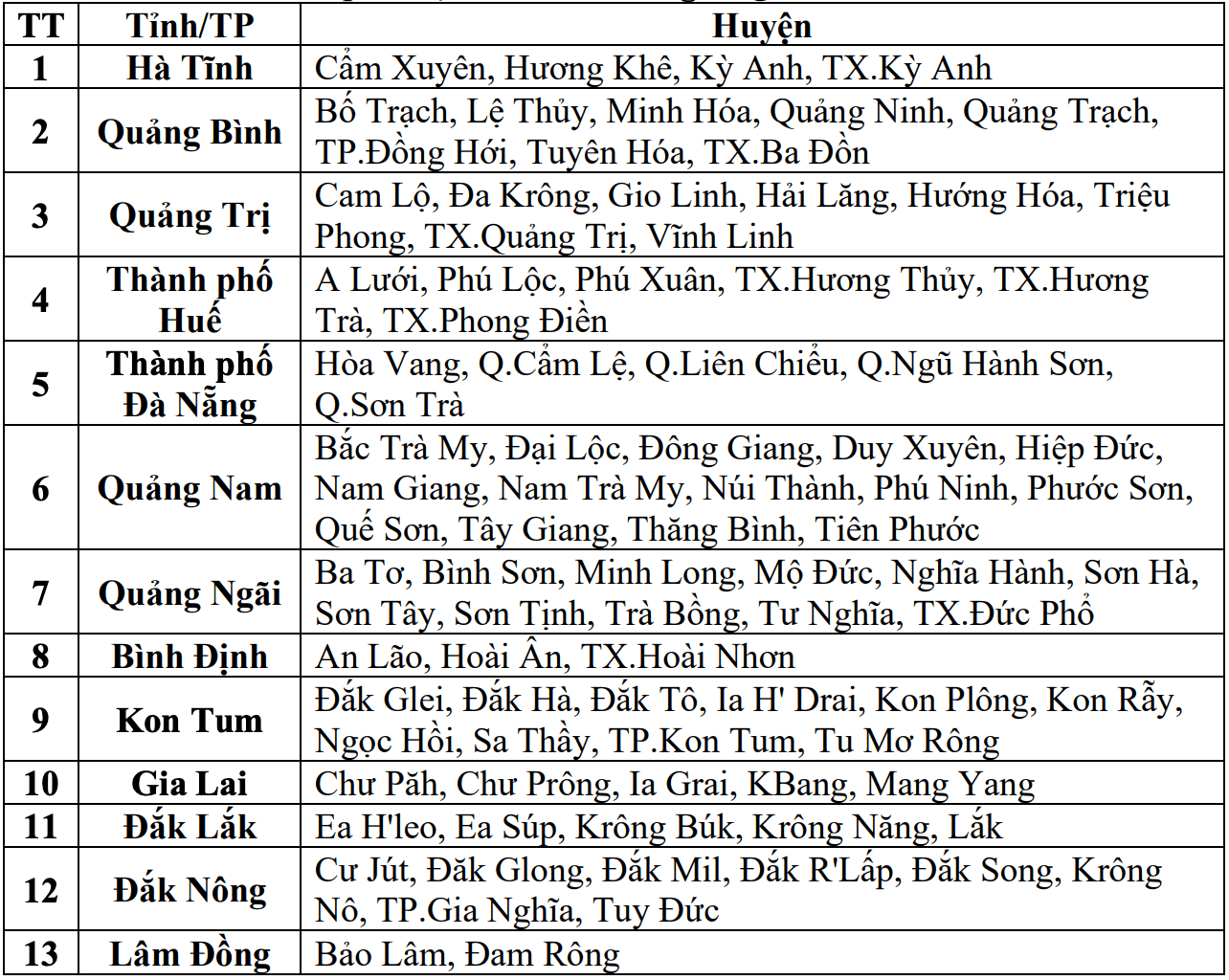
"For the midland and mountainous areas of Vietnam, from 2023 to now, we have also deployed a warning information system according to the time of flash floods and landslides.
This is a very important information system and is updated every hour, covering all provinces in the midland and mountainous areas of Vietnam" - Mr. Hoang Van Dai said.
According to Mr. Dai, this system is giving detailed warnings to the commune level. People and local authorities can refer to this system at the link http://luquetsatlo.nchmf.gov.vn.
Flash floods and landslides can have a very negative impact on the environment, threatening people's lives; causing local traffic congestion, affecting the movement of vehicles; destroying civil and economic works, causing damage to production activities and socio-economic activities.
The meteorological agency recommends that local authorities pay attention to reviewing bottlenecks and vulnerable locations in the area to take preventive and response measures.
Regarding the hydrological situation, the water level on rivers in Thua Thien Hue and Quang Nam is rising at an amplitude of 1 - 3m; the water level on rivers in Quang Binh, Quang Tri, Quang Ngai is fluctuating.
Water levels on rivers are still below alert level 1.
From today, June 12 to June 14, a flood will occur on rivers from Quang Binh to Quang Ngai. During this flood, the peak flood level on rivers fluctuated at alert level 1 and above alert level 1; the Vu Gia River (Quang Nam) alone increased to alert level 1 - alert level 2.
There is a high risk of flooding in low-lying areas along rivers, flash floods and landslides on steep slopes of provinces from Quang Binh to Quang Ngai. The warning level of natural disaster risk due to floods is level 1.