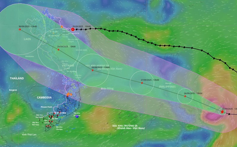
According to the National Center for Hydro-Meteorological Forecasting, at 1:00 a.m. on September 26, the center of the storm was at about 11.9 degrees north latitude; 125.2 degrees east longitude, in the central Philippines. The strongest wind near the storm center is level 11 (103-117 km/h), gusting to level 14.
The storm is moving west-northwest at a speed of 25-30 km/h. It is forecasted that around the night of September 26, storm Bualoi will enter the eastern sea area of the central East Sea, becoming the 10th storm of 2025.
It is forecasted that in the next 24 hours, the storm will move west-northwest at a speed of 25-30 km/h and enter the East Sea. At 1:00 a.m. on September 27, the center of the storm was at about 13.8 degrees north latitude; 118.9 degrees east longitude. Strong intensity level 11, gust level 14.
The danger zone is from latitude 11.5 to 16.5 degrees north, east of longitude 116.5 degrees east. Level 3 natural disaster risk for the eastern part of the northern and central East Sea.
It is forecasted that in the next 48 hours, the storm will continue to move west-northwest at a speed of 25-30 km/h and is likely to strengthen. At 1:00 a.m. on September 28, the center of the storm was at about 15.8 degrees north latitude; 112.5 degrees east longitude. Strong intensity level 12, gust level 15.
The danger zone is from latitude 12 to 19 degrees north, east of longitude 110 degrees east. Level 3 natural disaster risk for the northern and central East Sea, including the Hoang Sa archipelago.
It is forecasted that in the next 72 hours, the storm will move west-northwest at a speed of about 25 km/h and continue to strengthen. At 1:00 a.m. on September 29, the center of the storm was at about 18.3 degrees north latitude; 107.4 degrees east longitude, strong intensity level 12-13, gust level 16.
The danger zone is from latitude 12.5 to 21 degrees north, west of longitude 115 degrees east. Level 3 natural disaster risk for the western part of the northern and central East Sea (including the Hoang Sa archipelago), the southern Gulf of Tonkin, and the sea area from Quang Tri to Quang Ngai.
It is forecasted that in the next 72 to 120 hours, the storm will continue to move rapidly in the west-northwest direction, traveling 20-25 km per hour, gradually weakening.
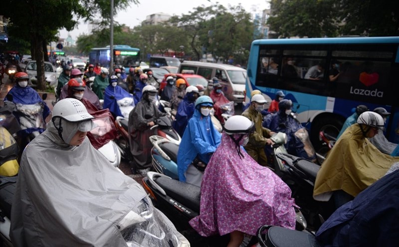
Regarding the impact of the storm, from the evening of September 26, the sea area east of the northern and central East Sea will have strong winds of level 6-7, then increase to level 8-9, the area near the storm's eye will have level 10-12, gusting to level 15. Waves are 5-7m high, the sea is rough. Ship operating in the above-mentioned dangerous areas are likely to be affected by thunderstorms, whirlwinds, strong winds, and large waves.