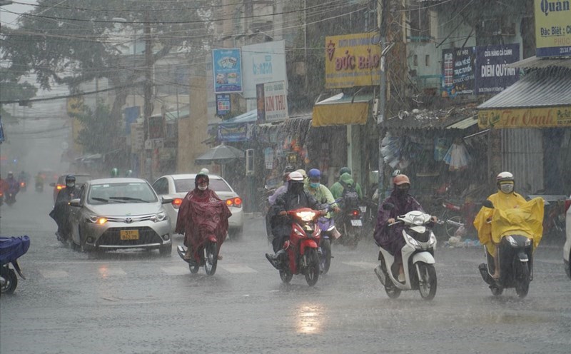
According to the National Center for Hydro-Meteorological Forecasting, last night and this morning (October 16), the area from Quang Tri to Da Nang city had moderate rain, locally heavy to very heavy rain. Rainfall from 7pm on October 15 to 10am on October 16 locally has monitoring stations measuring over 200mm such as: La To Hydropower Dam station (Quang Tri) 200.8mm; Bach Ma National Park station (Hue city) 398mm; Que Thuan station (Da Nang city) 209.4mm,...

According to Mr. Mai Van Khiem - Director of the National Center for Hydro-Meteorological Forecasting, from noon on October 16 to noon on October 18, the area from Quang Tri to Quang Ngai will have moderate rain, heavy rain and thunderstorms with common rainfall of 70 - 150mm, locally very heavy rain over 350mm.
"In Hue city alone, there are locally over 500mm. This rain warns of the risk of heavy rain with over 200mm of rain in 3 hours" - Mr. Khiem especially warned.
According to Mr. Khiem, from noon on October 18 to noon on October 19, the area from Quang Tri to Quang Ngai will continue to have moderate rain, heavy rain and thunderstorms with common rainfall of 50 - 100mm, locally very heavy rain over 150mm. This heavy rain is likely to continue.
"The cause of the rain is due to cold air combined with winter wind disturbances, combined with terrain, so there is heavy local rain" - Mr. Khiem said.
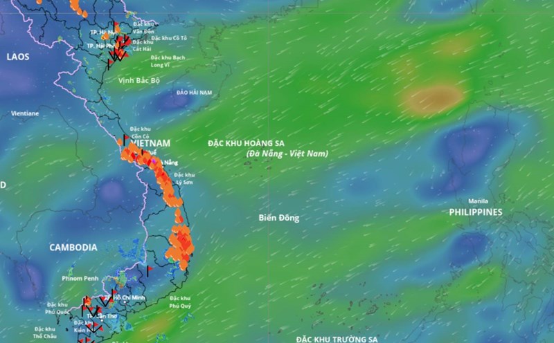
The Central region has a narrow terrain, located between the Truong Son range in the west and the East Sea in the east. When the northeast monsoon overflows, it blows through the East Sea and carries a large amount of moisture. Truong Son range is like a retaining wall, when the humid air flows, it meets a mountain range that is pushed up high, blocked, formed into clouds and caused heavy rain, lasting on the banks to catch the wind
The meteorological agency warns that thunderstorms may cause tornadoes, lightning, hail and strong gusts of wind. The warning level of natural disaster risk due to heavy rain, tornadoes, lightning, and hail is level 1.
Heavy rain is likely to cause flooding in low-lying areas, urban areas, industrial parks; flash floods on small rivers and streams, landslides on steep slopes.
Real-time warning information for areas at risk of flash floods and landslides is provided online on the website of the Department of Hydrometeorology at: https://luquetsatlo.nchmf.gov.vn and in separate bulletins warning of flash floods and landslides.
Analysis data from the National Center for Hydro-Meteorological Forecasting also shows that in the next month, total rainfall in areas will generally be approximately the same as the average of many years. In particular, the provinces from Ha Tinh to Quang Ngai have total rainfall generally 20 - 40% higher than the average of many years in the same period.
From now until November 10, it is forecasted that there will be widespread heavy rain in the early stages in the Northern region and Thanh Hoa and Nghe An provinces. The provinces from Ha Tinh to Quang Ngai are likely to experience some widespread heavy rains. Other areas will have many days of showers and thunderstorms; some days may have moderate to heavy rain.