The National Center for Hydro-Meteorological Forecasting said that the natural disaster situation in the last months of the year will be complicated due to many dangerous forms. October is still the peak of the storm season and also the time when the cold air strengthens.
Reporter of Lao Dong Newspaper discussed with Mr. Mai Van Khiem - Director of the National Center for Hydro-Meteorological Forecasting, Department of Hydro-Meteorology - about the upcoming notable weather situation.

Mr. Mai Van Khiem, in the next 10 days, is there any notable weather forecast?
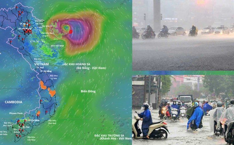
- Through monitoring and analysis of the current status of the weather system and forecast products, it is shown that in the next 10 days (from October 16 to October 25), on land as well as in the East Sea, there is a possibility of being affected by some dangerous natural disasters such as storms and cold air.
When is the East Sea forecast to welcome storm No. 12 and will this storm make landfall or not, sir?
- Currently, a new tropical depression has formed in the eastern sea of the Philippines. It is forecasted that in the next 1-2 days, this tropical depression is likely to strengthen into a storm with a probability of about 70 - 80%; it is likely to move into the northeastern area of the northern part of the East Sea around October 19 - 20.
Due to the influence of the tropical depression, which is likely to strengthen into a storm, from the afternoon of October 18 in the North and Central East Sea (including the special area of Hoang Sa), the wind will gradually strengthen, the sea will be rough.
When the storm moves into the East Sea, there will be a cold air mass moving down from the north, so there is a possibility that the storm will weaken at sea.
During the recent cold air mass, the temperature in the North did not fluctuate significantly. It is forecasted that in the coming cold air, will the North turn cold or not, sir?
- From the night of October 18, the North will start to be affected by cold air, then it will be strengthened during October 20 - 25, the weather will be cold at night and in the morning, the mountainous areas are likely to get cold.
In the Gulf of Tonkin sea area from October 20, the northeast wind is likely to strengthen to level 6 - 7, gusting above level 8, waves from 2 - 4 m high, rough seas.
In the next 10 days, there is little chance of heavy rain and flooding in the North on rivers.
How will the upcoming cold air affect the weather in the Central region, sir?
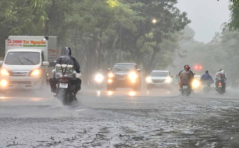
- From October 16 to 18, the area from Quang Tri to Quang Ngai will have moderate rain, heavy rain and thunderstorms with common rainfall of 70 - 150 mm, locally very heavy rain over 350 mm, especially in Hue city, locally over 500 mm.
After October 19, moderate rain, locally heavy rain will continue. In particular, it is forecasted that around October 23 - 26, the provinces in the Central region will be affected by a combination of cold airforms and high-altitude easterly wind disturbances. This is a typical weather pattern combined with terrain characteristics that can cause heavy rain and floods in river basins from Ha Tinh to Quang Ngai. Information on rainfall and flood warnings will be updated in short-term forecasts according to regulations.
Sincerely thank you!