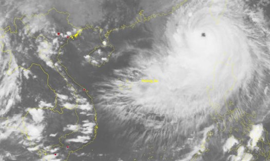
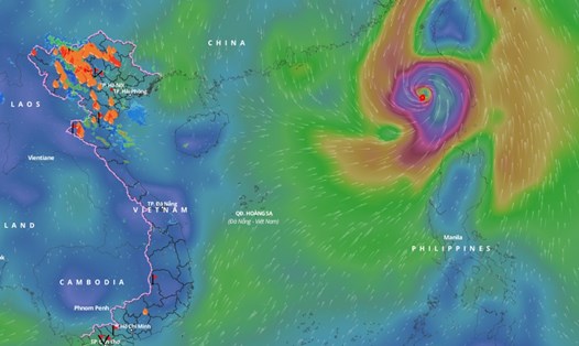
Latest update from the National Center for Hydro-Meteorological Forecasting, at 7:00 p.m. on October 1, the center of storm No. 5 was at about 21.3 degrees north latitude; 119.4 degrees east longitude, in the northeastern sea of the North East Sea area.
The strongest wind near the storm center is level 15 - 16 (167-201km/h), gusting over level 17; moving west-northwest, speed about 5km/h.
According to current forecasts, the storm is unlikely to affect coastal and inland areas of our country.
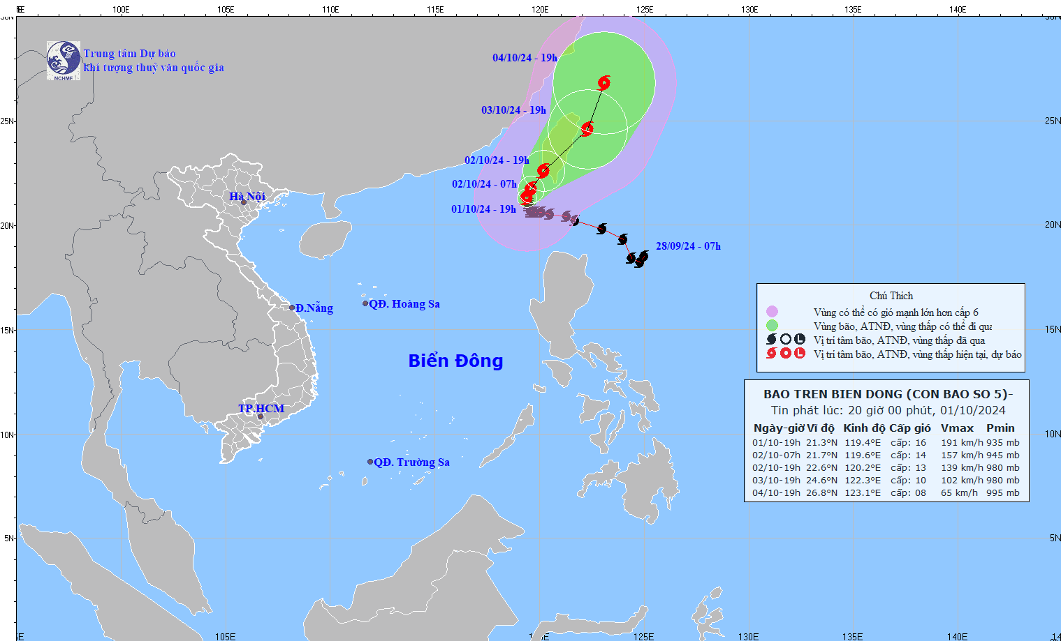
In the next 24 hours, storm No. 5 is forecast to move north-northeast at a speed of about 5km/h. At 7:00 p.m. on October 2, the center of the storm was at about 22.6 degrees north latitude - 120.2 degrees east longitude; in the sea southwest of Taiwan (China).
The strongest wind near the storm center is level 13, gusting to level 16.
It is forecasted that in the next 48 hours, storm No. 5 will move northeast at a speed of about 10km/h. At 7:00 p.m. on October 3, the center of the storm will be at about 24.6 degrees north latitude - 122.3 degrees east longitude; in the sea northeast of Taiwan (China).
The strongest wind near the storm center is level 10, gusting to level 13.
It is forecasted that in the next 72 hours, storm No. 5 will move north-northeast at a speed of about 10km/h and weaken further. At 7:00 p.m. on October 4, the center of the storm will be at about 26.8 degrees north latitude - 123.1 degrees east longitude; in the sea northeast of Taiwan (China).
The strongest wind near the storm center is level 8, gusting to level 11.
From the next 72 to 96 hours, the storm will move mainly north at about 10km per hour, and its intensity will continue to weaken.
Regarding the impact of storm No. 5, the northeastern sea area of the North East Sea (north of latitude 18; east of longitude 116.5) has strong winds of level 10 - 13, near the storm center level 14 - 16, gusts above level 17, waves 9 - 11m high; rough seas.
Ships operating in the above dangerous areas are affected by storms, whirlwinds, strong winds and big waves.