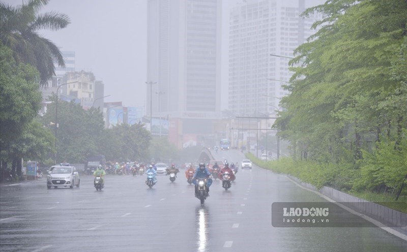
The heavy rain situation from the beginning of 2025 to now has many complicated developments. Information on rainfall forecasts in the coming months is of interest to the people. Mr. Mai Van Khiem - Director of the National Center for Hydro-Meteorological Forecasting has had notable analysis related to this type of weather.

Sir, this year there will be little heat while continuously welcoming the rains. So according to statistics from the meteorological agency, has heavy rain broken records in the history of observation since the beginning of the year?
- According to our statistics, in May, Ky Giang commune, Ha Tinh recorded 601.4mm of rain - the highest ever in the same period in month2; in Ky Hoa commune, the rainfall in 1 hour reached 172.8mm - a record in the monitoring data series.
Following the heavy rain from June 4 to June 5 in Viet Bac region, Bac Quang station (Tuyen Quang) reached 631mm/2 days - an extremely rare value in the June data series.
The particularly serious period is the natural disaster from June 11 to June 14 due to the impact of storm No. 1 Wutip - the first storm to form in the East Sea in June in more than 40 years. The storm did not make landfall but the circulation caused particularly heavy rain from South Ha Tinh to Da Nang, with common rainfall of 250-550mm, many places exceeding 800mm. Bach Ma Station (Hue City) reached 1,203mm/3 days - the highest in June history.
What is the forecast for heavy rain in the coming months, sir?
- This year, looking at the overall weather patterns including heavy rain affected by ENSO in a neutral state. In most ENSO neutral years, the total rainfall is not too much, at the same level as the average of many years.
However, the rainfall may be concentrated at some times. Extreme rain in a short period of time in a narrow range is something we have especially warned of. Therefore, it is not only about the total rainfall, because the abnormality is not only in the rainfall but also in the intensity and intensity of rain.
According to our statistics, over the past 20 years, the number of rains with rainfall of over 50mm within 1 hour in the North and some localities has tended to increase.
The Northern and Southern regions are in the rainy season. The rainy season in the Central region is usually from September to November. However, although it is not the peak of the rainy season in the Central region, we warn that there may still be unusually heavy rain from now until the main rainy season begins.
So with unusual heavy rains, how is the forecasting and early warning work implemented, sir?
- Currently, the work of forecasting and warning of hydrometeorological diseases is being implemented continuously and increasingly soon.
For the phenomenon of heavy rain, thanks to forecast models - reasons and monitoring systems such as satellites and radar, we can early identify the possibility of widespread or local heavy rains in the next few days. This is very important information to help the government and people prepare for appropriate response.
However, determining exactly how much rain in which area, at which time of the day, or even every hour can now only be predicted with high confidence about 24 hours in advance.
Therefore, we regularly update short-term information and have begun to make detailed rainfall forecasts by area, from 6 to 12 hours in advance.
It is difficult to warn of rain 1 week or 1-2 days in advance if it is not raining according to the law. Therefore, continuously updating warnings during the day is extremely necessary to respond promptly.
Sincerely thank you!