
The National Center for Hydro-Meteorological Forecasting has issued a noteworthy weather trend forecast for the next month (from August 21 to September 20).
Regarding the temperature trend, during the forecast period, the average temperature nationwide is generally 0.5 - 1 degree Celsius higher than the multi-year average, especially in the South Central Coast region, some places are 1 degree Celsius higher than the multi-year average of the same period.
Hot weather continues to appear in the Central region and is more concentrated in the South Central Coast region with the number of hot days likely to be higher than the multi-year average.
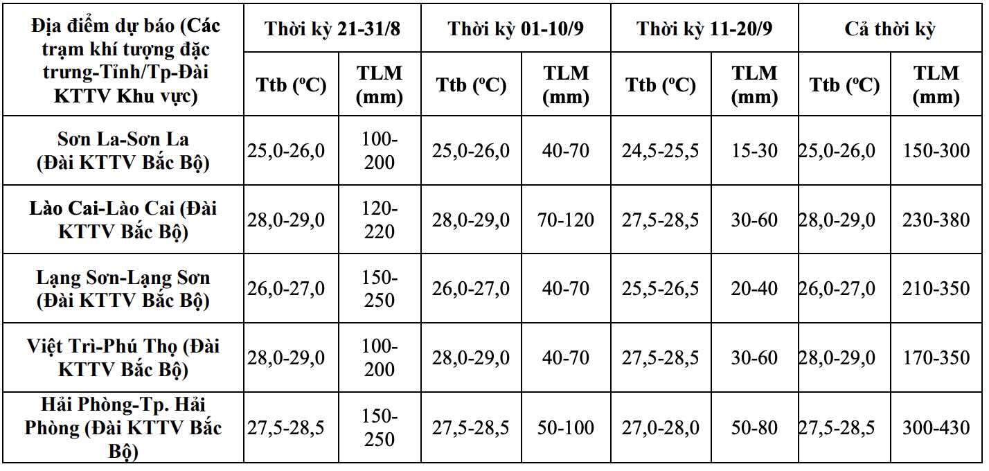
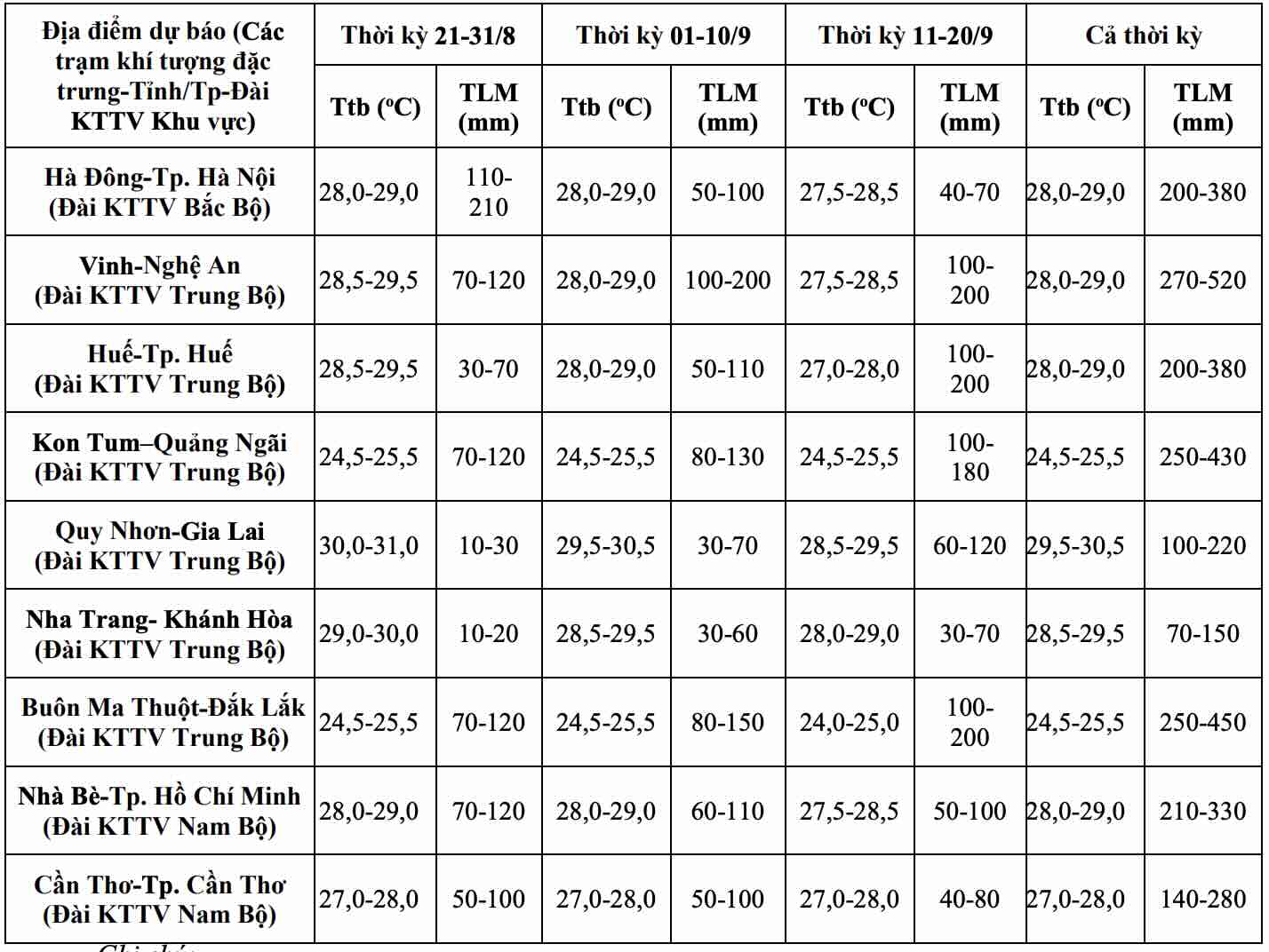
Total rainfall in the period from August 21st to September 20th in the Northern region, provinces from Thanh Hoa to Quang Tri are generally 10 - 30% higher than the multi-year average of the same period.
The remaining area of the Central region includes Hue city and the South Central Coast provinces, the Southwest provinces are generally lower by 5 - 20% compared to the multi-year average of the same period. The Central Highlands region and the Southeast region have common rainfall approximately equal to the multi-year average of the same period.
During the forecast period, widespread heavy rain will mainly concentrate in the Northern region and provinces from Thanh Hoa to Hue city.
The Central Highlands and Southern regions will experience showers and thunderstorms for many days, with moderate to heavy rain in some days, with rain concentrated in the afternoon and night.
Dangerous weather phenomena such as thunderstorms, tornadoes, lightning, hail and strong gusts of wind are likely to continue to appear throughout the country.
Regarding the sea weather trend, in the period from August 21 - September 20, 2026, storms/tropical depressions operating in the East Sea area and making landfall in Vietnam are likely to be equivalent to the multi-year average. According to average data, the multi-year average in the East Sea area is 2.4 storms and making landfall in Vietnam is 1.1 storms.
Currently, storm No. 4 is operating in the sea area of Quang Ninh - Hai Phong. Previously, in the period from July 21st to August 20th, 2026, 4 storms and tropical depressions appeared in the East Sea area, including storm No. 2 Noul, storm No. 3 Kujira and 2 tropical depressions.
The monthly climate forecast bulletin is for trend forecasting. The meteorological agency recommends that in the context of climate change, weather, and climate are increasingly complicated with many dangerous and extreme forms.
Therefore, it is proposed that all levels of government and people regularly update and integrate forecast information and hydrometeorological warnings in 1-3-day short-term bulletins, to promptly adjust production plans and appropriate response plans to ensure safety for production and people's livelihoods.


