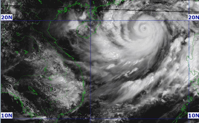
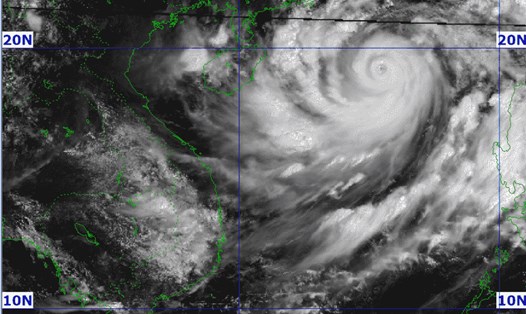
As of noon today, September 5, storm No. 3 Yagi continues to strengthen to level 16 (super typhoon level). Although still quite far from the mainland, according to the meteorological agency, with a wide circulation, the storm is likely to cause heavy rain even before making landfall.
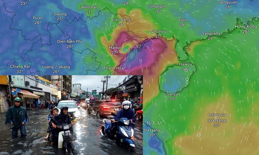
The areas directly affected on a large scale are the Northern and North Central regions, with strong winds of level 6 or higher accompanied by heavy rain. The focus is on the provinces of Quang Ninh - Hai Phong - Thai Binh - Nam Dinh - Ninh Binh, with the strongest winds and heaviest rain. The two provinces of Quang Ninh - Hai Phong are the focus of impact.
The National Center for Hydro-Meteorological Forecasting said that from the night of September 6 to the morning of September 9, the Northern and North Central regions are likely to experience widespread heavy rain with total rainfall ranging from 100 - 300mm, with some places over 500mm.
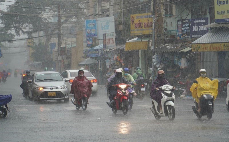
Although not the area most affected by storm No. 3 Yagi, Hanoi will also face a huge change in the situation.
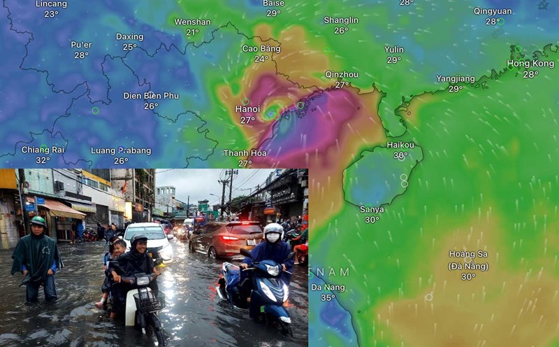
According to Mr. Dinh Huu Duong - Head of the Weather Forecast Department of the Northern Delta and Midland Hydrometeorological Station, because Hanoi is located deep inland, it may begin to be affected by storm No. 3 Yagi from the night of September 6 or the morning of September 7. Winds in the Hanoi area are likely to reach level 5 - level 6 and at the time of the strongest storm impact, it may reach level 7, gusting to level 9.
"Also due to the impact of the storm, Hanoi will face a heavy rainstorm, mainly concentrated in 2 days from September 7 to 8. However, according to the note from the National Center for Hydro-Meteorological Forecasting, it is necessary to be vigilant due to the impact of the far edge of the storm, from the night of September 6, there is a possibility of sudden strong thunderstorms appearing in the Hanoi area. Strong thunderstorms before the storm have occurred in history, which can cause electric poles and trees to fall, which is very dangerous" - Mr. Duong emphasized.
Mr. Dinh Huu Duong further warned that the rain in Hanoi is forecast to be concentrated in a short period of time, which could cause overload in drainage; there is a possibility of flooding in the inner city. The duration could last from 30 - 40 minutes or longer depending on the actual situation. Suburban areas and low-lying areas may also experience flooding.
"We especially note that with such rainfall intensity, intra-provincial rivers such as Ca Lo, Bui and Tich rivers in Hanoi are at high risk of flooding with a flood amplitude of 1-3m. Tich and Bui rivers may experience level 3 floods. Low-lying areas in Chuong My may experience prolonged deep flooding as occurred due to the impact of storm No. 2," Mr. Duong warned.