
Hanoi city last night, August 17, had scattered showers, locally heavy rain. Rainfall in many places was generally less than 20mm, in some places larger such as Son Tay 51.2mm; Phuc Tho 51.8mm, Thach That 45mm.
This afternoon, August 18, the Northern Hydrometeorological Station provided forecast information on the upcoming rain developments in Hanoi.
The reason is due to the influence of a low pressure trough with its axis through the Northern region, which tends to slowly move southward after forming a tropical convergence zone with its axis passing through between the Northern Delta and North Central region, combined with wind convergence up to 5000m in the Northern region operating gradually stronger.
From tonight to the morning of August 20, Hanoi city will have moderate rain, heavy rain and thunderstorms, followed by showers and scattered thunderstorms. During thunderstorms, there is a possibility of tornadoes, lightning, hail and strong gusts of wind. Common rainfall is from 50 - 100mm, in some places over 150mm.
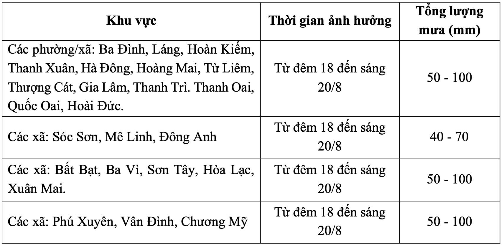
On the night of August 20 - August 21, Hanoi city will have scattered showers and thunderstorms in some places. Common rainfall is 10 - 20mm.
Warning level of natural disaster risk due to heavy rain is level 1. In thunderstorms, there may be tornadoes, lightning and strong gusts of wind that break down trees, damage houses, traffic works and infrastructure.
Heavy rain in a short period of time overloads the urban drainage system, causing flooding in residential areas, urban areas and low-lying areas, traffic jams due to road flooding and reduced visibility when driving, causing slipperiness and traffic accidents.


