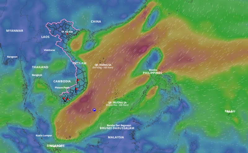
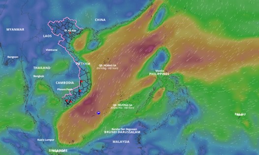
After a period of cold and dry weather with quite high temperatures, the weather in the North is changing due to the impact of cold air. Reporter of Lao Dong Newspaper had an interview with Mr. Nguyen Van Huong - Head of Weather Forecast Department, National Center for Hydro-Meteorological Forecasting about the development of the northeast monsoon in the coming days.

Sir, can you tell us when the cold air will be most active and how it will affect the weather in the North?
- Cold air has affected the mountainous and midland areas of the North. The time when the cold air has the strongest impact will be around the afternoon and night of January 10 to January 12. During this period, we forecast that the mountainous and midland areas of the North will likely experience severe cold, with some places experiencing severe cold.
Severe cold means the average daily temperature is below 15 degrees Celsius, and severe cold when the average daily temperature is below 13 degrees Celsius.
Frost and frost phenomena at the high mountain peaks of Fansipan and Mau Son are also likely to appear.
The lowest temperature in the Northern Delta region, Hanoi occurs from the night of January 10 to the night of January 11 - 12; at about 9 - 12 degrees Celsius.
Some northeast monsoons have caused prolonged heavy rains in the Central Central region. So will the Central region face heavy rains during this cold spell, sir?
- During this period, the cold air alone does not combine with the high altitude easterly wind, so the Central region has rain but the rainfall is at an average level. The rain is mainly concentrated in the area from Ha Tinh to Quang Ngai, Binh Dinh from January 9 to January 10-11.
The weather at sea in recent days has been affected by a low pressure trough connecting to a low pressure area. Is it forecast that the cold air will cause bad weather in the East Sea in the coming days, sir?
- This cold air mass is relatively strong, so in the North East Sea area (including the Hoang Sa archipelago), the northeast wind gradually increases to level 7, gusting to level 8 - 9, the sea is rough, waves are 3 - 5m high.
The sea area west of the South China Sea (including the sea area west of Truong Sa archipelago) and the sea area from Khanh Hoa to Binh Thuan will have strong northeast wind level 6, from tomorrow it will increase to level 7, gusting to level 8 - 9, rough seas, waves 2 - 4.5m high.
Gulf of Tonkin northeast wind gradually increases to level 6, sometimes level 7, gusts to level 8 - 9, rough seas, waves from 1.5 - 3.5m high; sea area from Quang Tri to Phu Yen and the central East Sea northeast wind gradually increases to level 6 - 7, gusts to level 8 - 9, rough seas, waves from 2 - 4.5m high.
The sea area from Ba Ria Vung Tau to Ca Mau has northeast wind gradually increasing to level 6, tomorrow there will be level 7 at times, gusting to level 8 - 9, rough sea, waves from 2 - 4.5m high.
What advice do you have for people, especially in the northern mountainous region?
- Severe cold accompanied by frost and frost often occurs in the winter months - January and February. These phenomena have a very negative impact on crops and livestock. People, especially in mountainous areas, need to pay attention to caring for livestock and protecting crops.
Cold weather also affects health, especially the elderly and children, so we need to take measures to keep warm.
Thank you very much!


