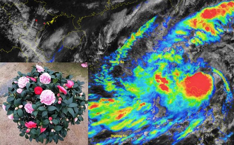
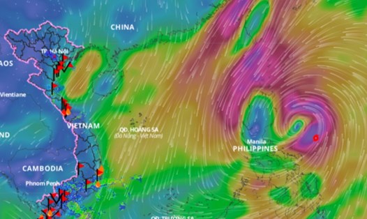
According to the National Center for Hydro-Meteorological Forecasting, currently, due to the impact of cold air, the northeastern sea area of the North East Sea has strong northeast winds of level 6 - 7. The Gulf of Tonkin has strong northeast winds of level 6, sometimes level 7, gusting to level 8.
The eastern sea area of the North East Sea, the central and southern East Sea area (including the sea area of Truong Sa archipelago), the sea area from Phu Yen to Ca Mau and the Gulf of Thailand have showers and thunderstorms.
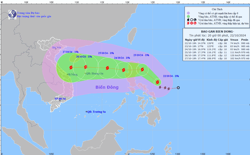
On the day and night of October 23, the eastern sea area of the North East Sea has strong winds of level 6 - 7, gusting to level 8 - 9. The sea is rough, with waves 4 - 6m high.
The Gulf of Tonkin, the western sea area of the North East Sea (including the waters of the Hoang Sa archipelago) has strong winds of level 6, sometimes level 7, gusting to level 8 - 9. The sea is rough, the wind gradually decreases at night. Waves are 3 - 5m high, in the Gulf of Tonkin the waves are 2 - 3.5m high.
The sea area from Quang Tri to Binh Thuan and the central East Sea area has strong winds of level 5, sometimes level 6, gusting to level 7 - 8. Rough sea, waves from 2 - 3.5m high; in the central East Sea area, waves from 3 - 5m high.
The eastern sea area of the southern East Sea has strong winds of level 5, sometimes level 6, gusting to level 7 - 8. Rough seas, waves 2 - 3m high.
The eastern sea area of the North East Sea, the central and southern East Sea (including the waters of the Truong Sa archipelago), the sea area from Binh Dinh to Ca Mau, Ca Mau to Kien Giang and the Gulf of Thailand will have scattered showers and thunderstorms. During thunderstorms, there is a possibility of tornadoes and strong gusts of wind of level 7 - 8.
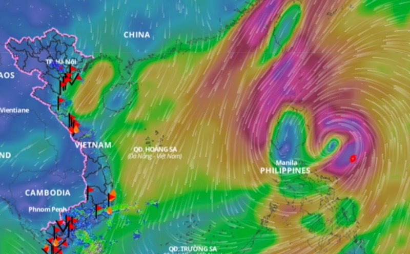
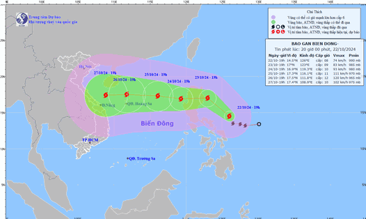
During the day and night of October 24, the North East Sea (including the Hoang Sa archipelago) will have strong north to northwest winds of level 6 - 7, gusting to level 8 - 9; rough seas. The eastern sea will have strong winds of level 8 - 9, near the storm's eye, winds of level 10 - 11, gusting to level 14; waves of 4 - 6m high, near the storm's eye, winds of 6 - 8m; rough seas.
The eastern sea area of the central East Sea has strong northwest to west winds at level 6 - 7, gusting to level 8 - 9; rough seas; waves 3 - 5m high.
The sea area from Quang Tri to Khanh Hoa has strong north to northwest winds at level 6, gusting to level 7 - 8; rough seas; waves from 2 - 4.5m high.
All vessels operating in the above areas are at high risk of being affected by cyclones, strong winds and large waves.