At 7:30 p.m. tonight, September 28, Mr. Mai Van Khiem - Director of the National Center for Hydro-Meteorological Forecasting, Department of Hydro-Meteorology provided the latest forecast information on the development of storm No. 10 Bualoi.
Mr. Mai Van Khiem, can you tell us the current location and intensity of storm No. 10 Bualoi up to this point?
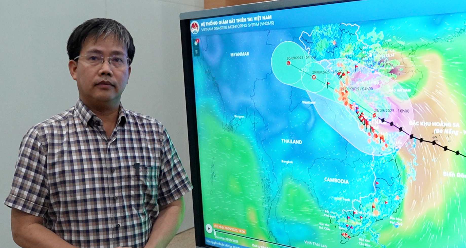
- Currently, the center of storm No. 10 Bualoi is located in the coastal area of Nghe An - Quang Tri. The storm has not shown any signs of weakening with the strongest wind near the storm center being level 12, gusting to level 15. The storm is moving west-northwest at a speed of 20 - 25 km/h.
It is forecasted that in the next 3 - 6 hours (about after 10:00 p.m. tonight, September 28), the storm will make landfall north of Quang Tri to Nghe An.
At 7:00 a.m. on September 29, the storm on land in Nghe An - Ha Tinh provinces was at level 8-9, gusting to level 11. It is forecasted that in the next 24 hours, the storm will move deep into the mainland, gradually weakening into a tropical depression, then a low pressure area. At 7:00 p.m. on September 29, the center of the low pressure area was over the Upper Laos area.
Sir, when is the impact of storm No. 10 Bualoi most dangerous in terms of strong winds and heavy rain?
- The area from Thanh Hoa to north of Quang Tri will have strong winds of level 7-9, the area near the storm's eye will have winds of level 10-12, gusting to level 14. In particular, the focus of strong winds is from the north of Quang Tri to Nghe An, there may be strong winds of level 10 - 12, gusting to level 15. The time of strong wind concentration after 9:00 p.m. tonight, September 28 to tomorrow morning, September 29.
The coastal areas from Quang Ninh to Ninh Binh will have strong winds of level 6 - 7, gusting to level 8 - 9, some places will have level 8, gusting to level 10.
So what about the impact of heavy rain, will the rain caused by storm No. 10 Bualoi last long or not, sir and could lead to major floods?
- The rain in the North Central and Northern regions has started from today, September 28, and will continue to rain heavily tonight and tomorrow.
From the night of September 28 to September 30, the Northern Delta, Phu Tho, the southern Son La, Lao Cai and the provinces from Thanh Hoa to northern Quang Tri will have heavy to very heavy rain, with total rainfall of 200 - 350 mm, some places over 500 mm.
Other places in the North have moderate rain, heavy rain, some places have very heavy rain, rainfall 100 - 250 mm, some places over 400 mm. Warning of the risk of heavy rain over 200 mm within 3 hours.
From the night of September 28 to the morning of September 29, the southern area of Quang Tri to Da Nang city will have moderate rain, heavy rain, total rainfall from 40 - 80 mm, some places over 150 mm.
The rain in the Central region may last until tomorrow, September 29, while the rain in the North will last until September 30.
With such heavy rain, the risk of flooding on some rivers in the North and North Central regions with the flood peak reaching alert level 2 - alert level 3, some rivers may be above alert level 3. With such a flood, the risk of flooding along rivers and downstream rivers is very high.
The risk of flash floods and landslides in mountainous areas is very high not only today but in the next 2-3 days.
Sincerely thank you!