Storm Tra Mi has entered the East Sea, becoming storm number 6 and having a strong intensity of level 9, gusting to level 11 on the evening of October 24.
Mr. Nguyen Van Huong - Head of Division Weather Forecast, National Center for Hydro-Meteorological Forecasting, Directorate of Hydro-Meteorological Forecasting - provided the latest comments on this storm.

Sir, what is the current status of storm number 6 Tra Mi and where is the storm forecast to head?
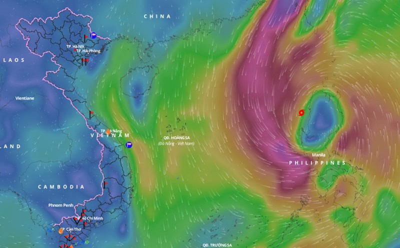
- At 4 p.m., the center of storm No. 6 Tra Mi was located in the eastern sea of the North East Sea. The strongest wind near the center of the storm was level 9 (75-88 km/h), gusting to level 11. The storm moved west at a speed of 15-20 km/h.
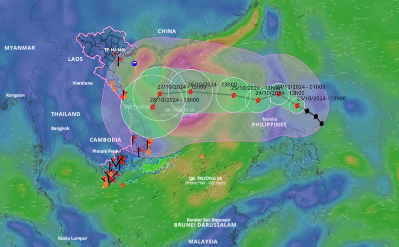
It is forecasted that in the next 48 hours, storm No. 6 will move mainly westward, with an average speed of about 15km/h and a tendency to gradually strengthen. When moving to the eastern area of Hoang Sa archipelago, the storm's intensity is likely to reach a maximum of about level 12, gusting to level 15.
Is there any possibility that storm No. 6 Tra Mi will have unusual changes in the coming days, sir?
- In the coming days, due to the simultaneous impact of a cold air system and the circulation of a newly formed storm off the eastern Philippines, the storm's direction of movement will continue to change abnormally.
Especially when passing through the Hoang Sa archipelago, reaching the sea off the Central Coast (after October 26), storm No. 6 is likely to slow down, weaken and change direction, the possibility of making landfall is still unclear, and needs to be monitored further.
So what are the most important points to note about the storm at this time, sir?
- In the next 2 days, it is necessary to pay attention to the dangers of strong winds and large waves at sea, including in the northern and central areas of the East Sea, the sea area of Hoang Sa island district from today onwards will have strong winds of level 6 - 7, the area near the storm center will have levels 8 - 9, then it will increase sharply as the storm intensifies. Even the southern area of the East Sea is affected by strong southwest monsoon level 6 causing rough seas.
The impact of strong winds on coastal areas will be monitored further in the next bulletin.
Thank you very much!