2 low pressure areas appear in the Philippines, may strengthen into storms

Khánh Minh |

According to the latest storm news, two low pressure systems formed near the Philippines on September 15, with the potential to strengthen into storms.

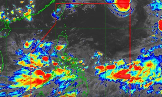
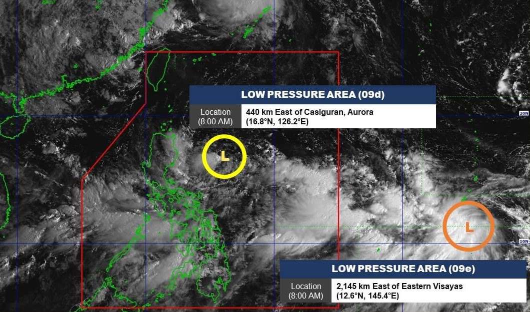
The Philippine Atmospheric, Geophysical and Astronomical Services Administration (PAGASA) said it is monitoring two new low pressure areas.

At 8:00 a.m. (local time) on September 15, the first low pressure center was located at about 16.8 degrees north latitude, 126.2 degrees east longitude, within the Philippine forecast area (PAR), 440 km east of Casiguran, Aurora.

Low pressure has a low chance of developing into a storm in the next 24 hours.

The center of the second low pressure area is located at about 12.6 degrees north latitude, 145.4 degrees east longitude, 2,145 km east of Eastern Visayas. This low pressure area has a moderate chance of developing into a storm.

Hai ap thap hinh thanh gan Philippines ngay 15.9, co kha nang manh len thanh bao. Anh: PAGASA
Two low pressure areas 09d and 09e formed near the Philippines on September 15, with the potential to strengthen into storms. Photo: PAGASA

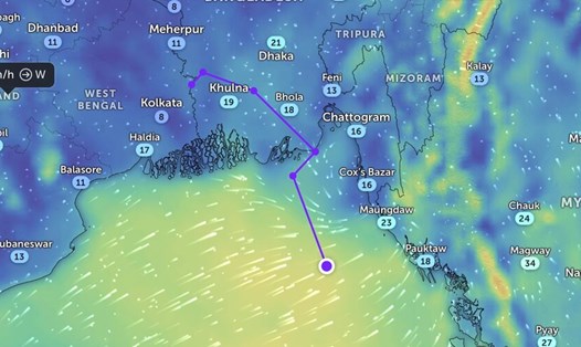
PAGASA's weather forecast bulletin stated that due to the influence of low pressure and southwest monsoon, rains will occur in most areas of the country throughout September 15 and throughout the rest of the week.

PAGASA also issued high wind warnings in several areas, with high waves of up to 3.7 to 4.5 meters expected: Occidental Mindoro, Palawan, Romblon, Western Visayas, Negros Island, Central Visayas, Southern Leyte, Leyte (Matalom, Bato, Hindang, Hilongos, Inopacan), Zamboanga del Norte, Camiguin, Dinagat Island, Surigao del Norte (San Francisco, Malimono, Surigao City).

Du bao  ngay 15.9.2024. Anh: PAGASA
Forecast of wind, currents and mean sea level on September 15, 2024. Photo: PAGASA

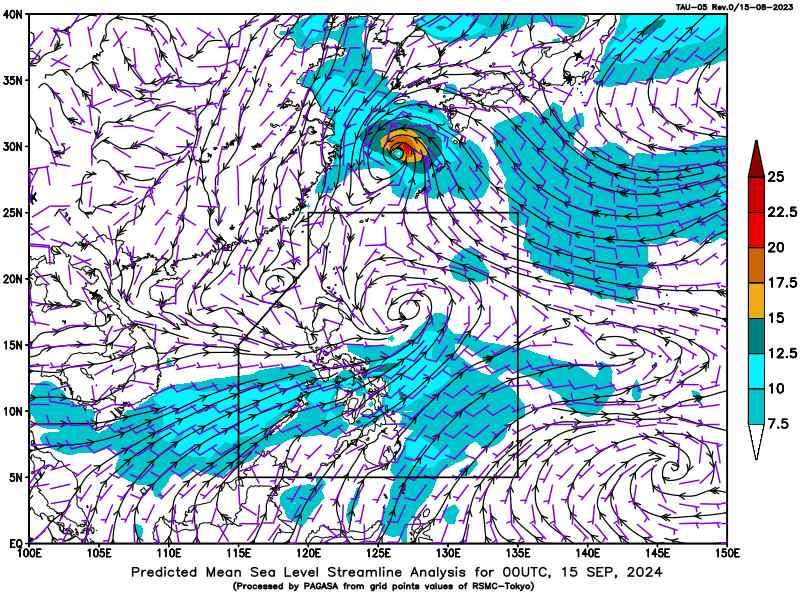
Previously, tropical storm Ferdie (storm Bebinca) left the PAR forecast area at 2:00 a.m. on September 14, just 8 hours after entering, with the strongest winds near the storm center of 85 km/h and gusts of 105 km/h.

Before entering PAR, Typhoon Bebinca reached severe tropical storm status, but then weakened to a tropical storm on the morning of September 13.

According to the September 15 storm forecast of the China Meteorological Administration, Typhoon Bebinca is expected to make landfall along the coast from Taizhou in Zhejiang to Qidong in Jiangsu (China) from the night of September 15 to the morning of September 16.

In early September, the Philippines also suffered from Typhoon Yagi (known in Vietnam as Typhoon No. 3). Typhoon No. 3 Yagi made landfall on the east coast of Luzon Island in the Philippines on September 2 with winds of 72km/h, then continued to make landfall in Wenchang City in Hainan Province, Xuwen County in Guangdong Province of China, and Quang Ninh and Hai Phong provinces in Vietnam.

Khánh Minh
RELATED NEWS

Typhoon No. 3 Yagi has just passed, China will face another strong storm tonight

|

Immediately after typhoon No. 3 Yagi, China is urgently responding to strong typhoon Bebinca expected to make landfall in southeastern provinces tonight.

Nearly 200 workers in Son La are waiting to be paid salaries near Tet

|

Son La - Nearly 200 workers in Chieng Khoong commune are waiting for the construction unit of the Primary - Secondary Inter-level Boarding School Project to pay wages on the eve of Tet.

Holding 1 million VND, still can't buy 1kg of Ca Mau crab on the eve of Tet

|

Some Ca Mau crabs have exceeded the 1 million VND/kg mark in the days leading up to the Binh Ngo Lunar New Year 2026.

Workers wake up at 4 am, excitedly returning to their hometowns on a trade union bus

|

Hai Phong - On the morning of February 14, hundreds of workers boarded a bus to return to their hometowns to celebrate Tet organized by the Trade Union of Yazaki Hai Phong Vietnam Co., Ltd.

Fishing boats dock at the end of the year, ready for the first spring sea trip

|

Can Tho - After many long days of sticking to the fishing grounds, fishermen's fishing boats have returned to shore to celebrate Tet and prepare for the first sea trip of the new year.

Rainy and cold weather in Hanoi due to cold air during the Binh Ngo Tet 2026

|

Forecast from the 27th to the 29th of Tet, Hanoi's weather during the day is quite warm. However, from the night of the 29th of Tet, the weather is likely to turn rainy and cold due to cold air.

Tan Son Nhat airport is crowded with people returning home for Tet on the 27th of Tet

|

Ho Chi Minh City - On February 14, Tan Son Nhat airport entered the peak period of the Lunar New Year with a record number of passengers, expected to be nearly 160,000 people.

2-story river bus combined with cultural performance attracts tourists during Tet

|

Ho Chi Minh City - During the 2026 Lunar New Year, the 2-story river bus on the Saigon River attracts people and tourists with the experience of both admiring the scenery and watching folk art.

Typhoon No. 3 Yagi has just passed, China will face another strong storm tonight

Song Minh |

Immediately after typhoon No. 3 Yagi, China is urgently responding to strong typhoon Bebinca expected to make landfall in southeastern provinces tonight.

Tàn dư bão Yagi hồi sinh, đang hướng thẳng tới Ấn Độ

Thanh Hà |

Bão Yagi, cơn bão số 3 ở Biển Đông gây thiệt hại nặng nề ở Việt Nam, dự báo mạnh lên thành áp thấp nhiệt đới, gây mưa lớn ở Ấn Độ trong tuần tới.

Dự báo vùng ảnh hưởng của bão Bebinca khi rời Philippines

Song Minh |

Theo tin bão mới nhất, bão Bebinca ở bên trong khu vực dự báo (PAR) của Philippines chỉ trong một thời gian ngắn.