Typhoon/low pressure bulletin from the US Joint Typhoon Warning Center (JTWC) said that low pressure 93W formed in the afternoon of January 26 in the east of Cateel, Davao Oriental (Philippines) and this bad weather area is moving west.
The possibility of low pressure 93W strengthening into a storm is low based on the direction of movement of this harsh weather region.
Currently, the low pressure trough has affected Davao, Eastern Visayas and Caraga.
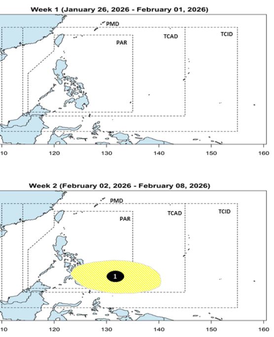
Meanwhile, the Philippine Atmospheric, Geophysical and Astronomical Services Administration (PAGASA) said that in the week from January 26 to February 1, 2026, no low pressure area appeared in the Philippine forecast areas.
However, in the week from February 2nd to February 8th, 2026, a low pressure area is expected to form in the southeast of the Philippine Forecast Area (PAR), with a low possibility of strengthening into a storm.
Meanwhile, on January 26, the remnant low pressure of tropical storm Nokaen (storm Ada) moved closer to the east of Visayas. The wind line intersecting with the above-mentioned low pressure area and northeast monsoon, east of Visayas and northeast of Mindanao is expected to have increased rainfall in the next 24 hours.
According to the Vietnam National Center for Hydro-Meteorological Forecasting, on January 25, the western sea area of the southern East Sea (including the western sea area of the Truong Sa special zone) has strong northeast winds at level 6, gusting at level 7-8; rough seas; waves 2.0-4.0m high.
From the night of January 25, the wind in the above sea areas tends to gradually decrease.
Ships operating in the above sea areas are at high risk of being affected by strong winds and big waves; it is necessary to closely monitor forecast and warning bulletins to proactively prevent and avoid.


