
The latest storm news on the afternoon of July 27th from the Japan Meteorological Agency (JMA) said that tropical depression 12W has strengthened into tropical storm Dolphin. This is storm number 13 named in the Western Pacific Basin (WPAC) in the 2026 storm season. Dolphin is also the 5th storm named to form in July.
As of July 27, the western Pacific basin recorded the highest number of named storms since the beginning of the year according to data from 1971.
Typhoon Dolphin's name was given by Hong Kong (China), referring to the white dolphin in China, a native species of the region and also one of the mascots of Hong Kong (China).
Most forecast models predict that the latest storm of the 2026 hurricane season may have a strength equivalent to a Category 5 super typhoon on the US scale from now until the beginning of next week.
Hurricane Dolphin will not pose any threat to any land area in the next 7 days.
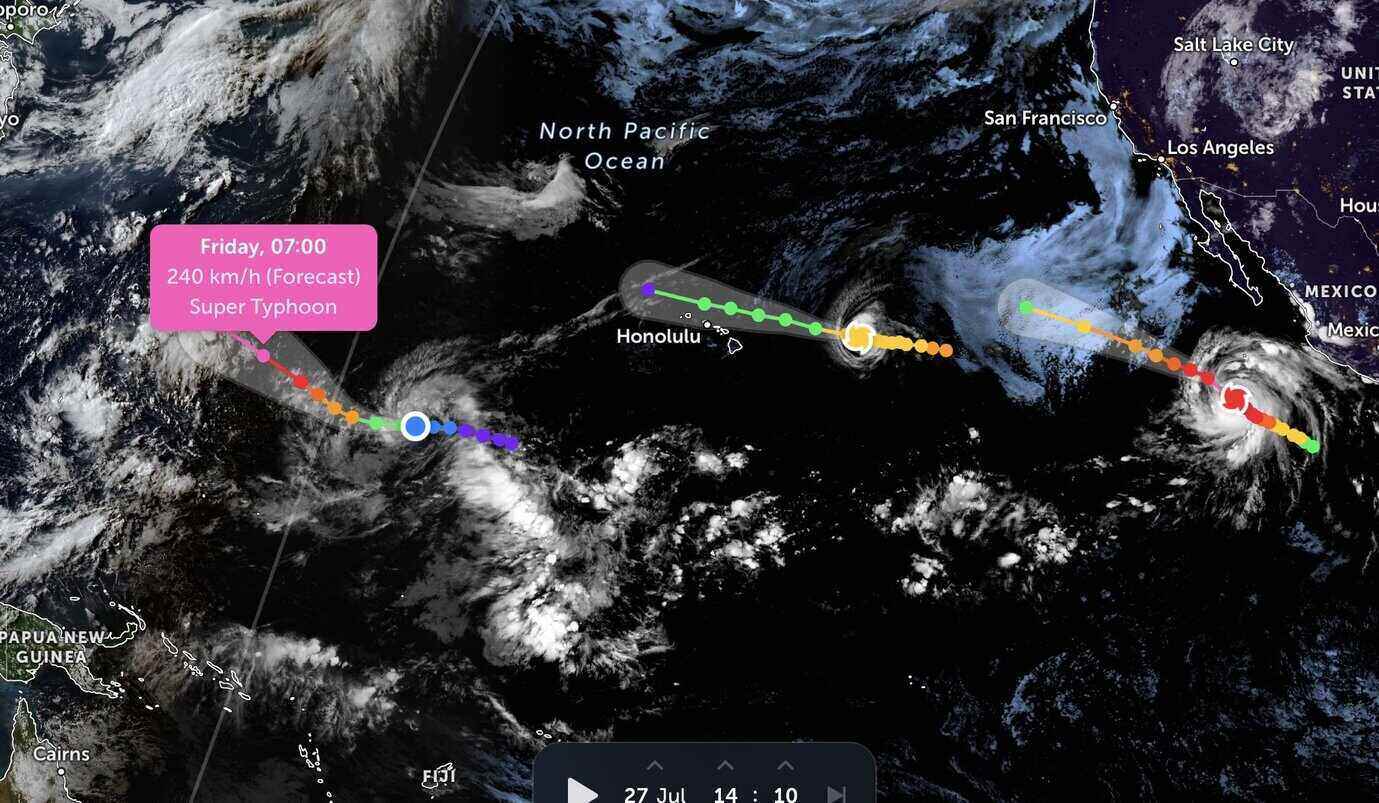
The latest typhoon and low pressure bulletin from the Central Pacific Basin Typhoon Center (CPHC) still calls Typhoon Dolphin a tropical depression 12W.
However, this system is well organized, in a favorable environment to become even stronger.
According to the forecast path of CPHC, this system will quickly strengthen into a tropical storm on July 27, then continue to strengthen to become a super typhoon on July 31, with winds up to 250 km/h.
The potential super typhoon Dolphin is forming in the context of the Pacific having 2 active storms, both moving west-northwest.
In which, Category 1 hurricane Fausto is in the process of weakening as it approaches the Hawaiian archipelago this week.
Meanwhile, Category 4 hurricane Genevieve in the eastern Pacific basin is continuing to strengthen rapidly, with satellite images showing the eye of the storm is very sharp. It is predicted that this storm is likely to reach maximum intensity, becoming a super typhoon in the next few hours when moving through an environment very favorable for intensification.


