The Philippine Atmospheric, Geophysical and Astronomical Services Administration (PAGASA) storm/low pressure forecast bulletin said that the low pressure area outside the Philippine forecast area (PAR) developed into a tropical depression at 8:00 p.m. on October 20.
At 5:00 a.m. on October 21, the tropical depression entered PAR and was named Kristine - the 11th storm of the Philippines in 2024.
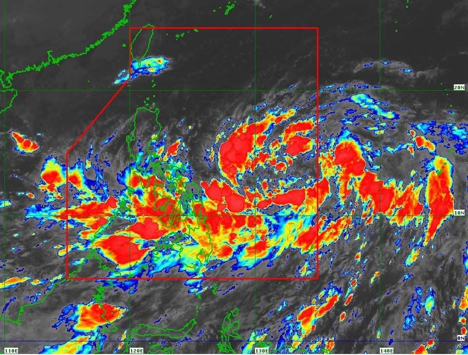
The center of storm Kristine is located at about 13.6 degrees north latitude, 133.9 degrees east longitude, about 1,050 km east of southeast Luzon.
Maximum winds near the center of the storm are 55 km/h with gusts of up to 70 km/h. The storm's area of influence extends 550 km from the center of the storm. Typhoon Kristine is moving southwest at a relatively fast speed of 30 km/h.
PAGASA issued Tropical Storm Wind Signal (TCWS) No. 1, warning of strong winds of level 6-7 in Luzon, Catanduanes, Visayas in the next 36 hours.
Sea conditions forecast for the next 24 hours: Moderately rough seas with waves up to 4 meters high in Isabela coast, northern coast of Aurora, Catanduanes, Northern Samar and eastern coast of mainland Cagayan.
Waves as high as 3.5 meters were recorded on the coast of Batanes, the remaining coasts of Cagayan and Aurora, the east coast of Quezon, the remaining east coast of Bicol Region and the east coast of Eastern Samar.
Waves as high as 3 meters were recorded on the coast of Ilocos Region, the coast of Dinagat Islands and the coast of Davao Region.
Small vessels are advised not to sail in these conditions.
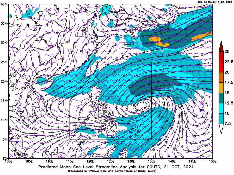
Storm Kristine is forecast to move westward through tomorrow morning (October 22) before turning west-northwest to northwest from tomorrow afternoon through the forecast period.
The tropical storm is forecast to make landfall in Northern Luzon on Friday afternoon (October 25).
Storm No. 11 may strengthen to severe storm level tomorrow afternoon or evening (October 22) and to typhoon level on Thursday afternoon or evening (October 24) before making landfall in the northeastern part of Cagayan.
As Typhoon No. 11 remains over the Philippine Sea, the possibility of further strengthening is high, given the favorable environmental conditions (high sea surface temperatures and low wind shear) for development.
Changes in the forecast track are also not ruled out, depending on the movement of mid-latitude weather systems in the coming days.
In light of these developments, the public and relevant disaster risk reduction and management offices are advised to take all necessary measures to protect lives and property.
People living in areas identified as highly vulnerable to these hazards are advised to follow evacuation instructions and other guidance from local officials.