Low pressure
World 24h: Low pressure enters the Philippines, forecast time for thunderstorms
|
World news 6. 5: Sweden will establish a new intelligence agency, likened to the UK's MI6; Low pressure enters the Philippines, forecasting the time for thunderstorms...
World 24h: Forecast of possibility of low pressure near the Philippines strengthening into a storm
|
Latest world news May 5th: Gold prices are still forecast to increase; 2 low pressures move towards the Philippines, possibly strengthening into Typhoon Caloy...
2 low pressure systems move towards the Philippines, possibly strengthening into Typhoon Caloy
|
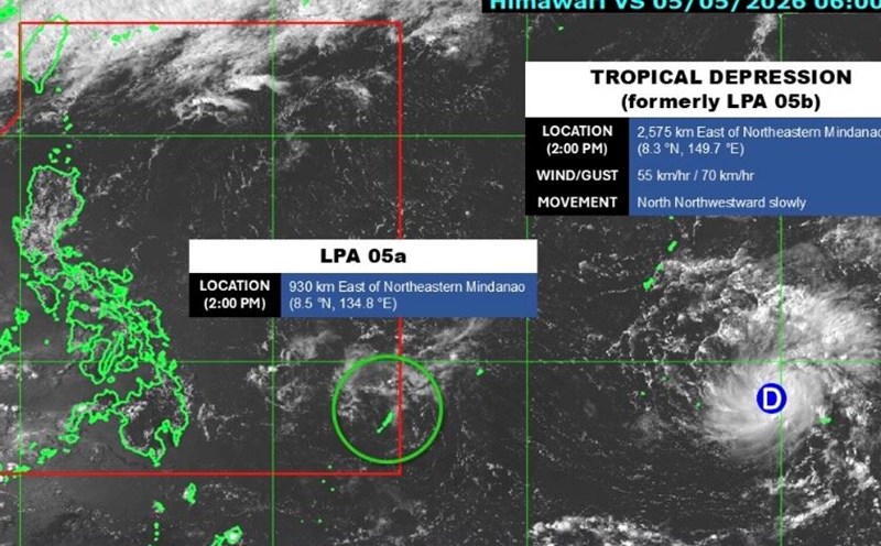
Two low pressure systems are moving towards the Philippines, one of which enters the forecast area on May 5, while the other low pressure system is strengthening.
World 24h: Forecast of low pressure connecting low pressure forming near the Philippines
|
World news May 4: 2 US soldiers missing during exercises in Morocco; Forecast of low pressure connecting low pressure forming near the Philippines...
Low pressure connects to low pressure formed near the Philippines, may strengthen into a storm
|
Two low pressure systems formed simultaneously off the coast of the Philippines, including 1 system that is likely to strengthen into a storm on May 5.
World 24h: Typhoon Sinlaku changes direction, rapidly intensifies
|
World News 12. 4: US wants to train gamers to become air traffic controllers; Typhoon Sinlaku changes direction, rapidly intensifies...
World 24h: Sinlaku may become the strongest storm at the beginning of the season
|
World news 10. 4: Russian steel exports accelerate, approaching records; Sinlaku may become the strongest storm at the beginning of the season...
World 24h: Forecast of new low pressure forming near the Philippines
|
World news 8: 4: New Zealand urges the US to deploy oil tankers to support the Pacific region; Forecast of new low pressure forming near the Philippines...
Cold air is about to cause thunderstorms in the North, risk of ice rain
|
Due to the influence of cold air compressing low pressure troughs from tonight, March 31, the Northern region needs to be wary of thunderstorms accompanied by tornadoes, lightning, hail and strong gusts of wind.
La Nina collapses rapidly, paving the way for super El Nino in 2026
|
La Nina is quickly ending, paving the way for an unusually strong El Nino, which may even reach the "super El Nino" level by the end of 2026.
Storm Nuri forms near the Philippines
|
The tropical depression near the Philippines has strengthened into tropical storm Nuri, the latest storm in March in the western Pacific basin.
Typhoon forecast near the East Sea from March to August
|
It is forecast that there will be about 6-14 storms near the East Sea in the next 5 months, in the context of weak La Nina officially ending.
World 24h: Forecast of the possibility of becoming a storm of low pressure near the Philippines
|
Latest world news 10:03: Gold prices fluctuate strongly; Tropical depression near the Philippines has the potential to strengthen into a storm...
Tropical depression near the Philippines has the potential to strengthen into a storm
|
The tropical depression in the east of the Philippines is being closely monitored as it is likely to strengthen into a storm in the next 24 hours.
New low pressure area formed near the Philippines, likely to strengthen
|
A new low pressure area has formed near the Philippines and is forecast to strengthen.


