The latest storm/low pressure forecast bulletin of the Philippine Atmospheric, Geophysical and Astronomical Services Administration (PAGASA) said that at 2:00 a.m. on October 20, low pressure 10c was located at about 13.9 degrees north latitude, 137.1 degrees east longitude, 1,395 km east of southeast Luzon.
According to PAGASA's storm forecast, the low pressure is currently likely to develop into a storm in the next 24 hours.
PAGASA weather forecaster Ana Clauren-Jorda said the depression could move deeper into the Philippine Forecast Area (PAR) on October 20 or 21 and intensify into a typhoon. The next storm in the Philippines will be locally named Kristine.
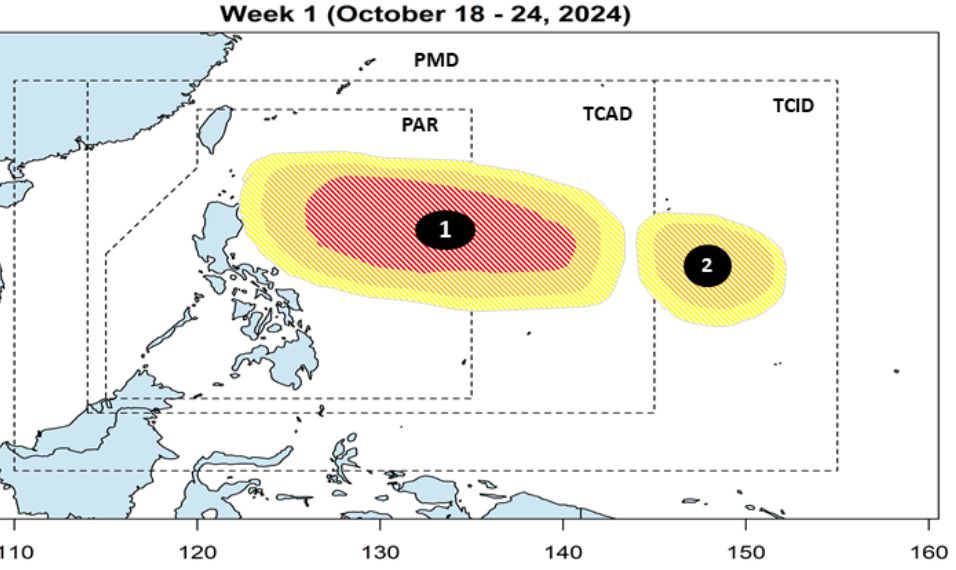
In the storm/low pressure warning bulletin on October 18, PAGASA forecasts two low pressure areas near the Philippines during the week of October 18-24, 2024, including low pressure 10c expected to move close to eastern Luzon. The remaining low pressure area is expected to form east of the Philippine typhoon information area (TCID) and is likely to strengthen into a storm.
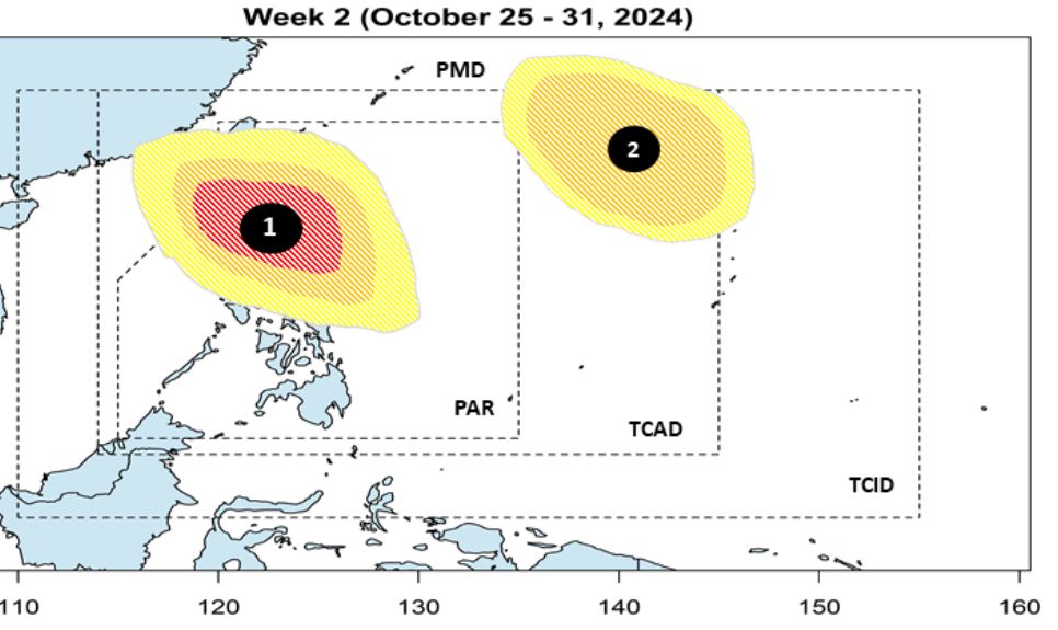
During the week of October 25-31, 2024, PAGASA's forecast models also show that the two aforementioned low pressure systems will continue to be active. Low pressure 10c continues to move north - the northernmost part of Luzon with a high possibility of strengthening into a storm. Meanwhile, the remaining low pressure system is expected to move mainly northwest and has a low to medium possibility of strengthening into a storm.
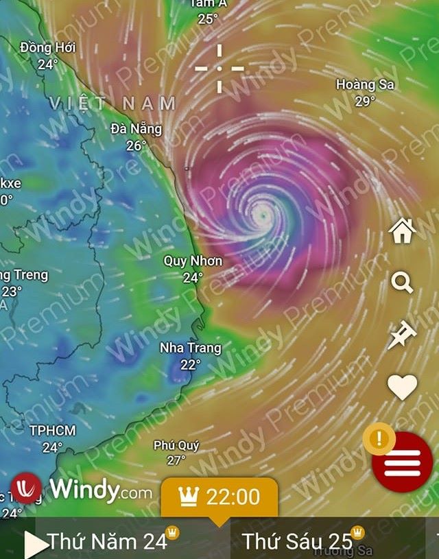
Meanwhile, according to the Vietnam National Center for Hydro-Meteorological Forecasting, from October 21 to 22, a tropical convergence zone is likely to form in the East Sea. Tropical cyclones may appear on this convergence zone.
By October 23-25, this tropical cyclone is likely to strengthen into a storm/tropical depression and operate in the East Sea.
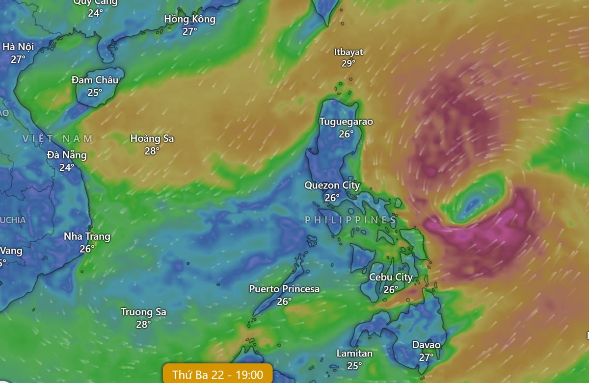
On October 20, due to the influence of cold air moving eastward, the northeast wind in the northern East Sea is gradually becoming stronger.
In the western sea area of the northern East Sea (including the waters of the Hoang Sa archipelago), the central East Sea area, the southern East Sea area (including the waters of the Truong Sa archipelago), the sea area from Quang Ngai to Khanh Hoa, from Ca Mau to Kien Giang and the Gulf of Thailand, there will be scattered showers and thunderstorms.
On the day and night of October 21, the northern East Sea, including the waters of the Hoang Sa archipelago, will have strong northeast winds of level 6, while the eastern sea will have winds of level 7 at times, gusting to level 8-9; rough seas, waves 3-5m high. The risk level for natural disasters due to strong winds at sea is level 2. All vessels operating in the above areas are at high risk of being affected by tornadoes, strong winds and large waves.