The latest storm/low pressure forecast bulletin of the Philippine Atmospheric, Geophysical and Astronomical Services Administration (PAGASA) said that at 2:00 a.m. on October 19, low pressure 10c was located at about 15.3 degrees north latitude, 135.2 degrees east longitude, entering the Philippine forecast area (PAR), 1,455 km east of southeast Luzon.
According to PAGASA's storm forecast, the low pressure currently has a "moderate chance" of developing into a tropical depression within the next 24 to 48 hours.
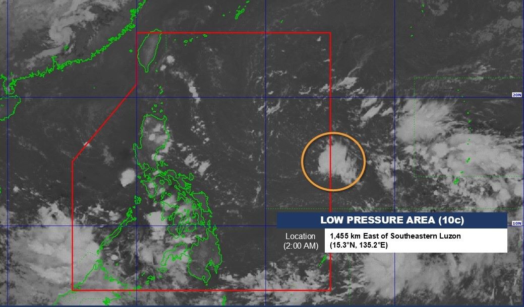
PAGASA weather forecaster Ana Clauren-Jorda said the depression could penetrate deep into PAR on October 20 or 21 and intensify into a typhoon. The next storm in the Philippines will be locally named Kristine.
Also related to low pressure 10c - which the US Joint Typhoon Warning Center (JTWC) calls 94W, the JTWC's October 19 forecast said that the low pressure is currently located in the middle of the Philippine Sea, north-northeast of Palau and is creating relatively limited shower activity.
This low pressure area is currently in the process of merging with a larger low pressure area to its east. As the two systems merge, environmental conditions are expected to be favorable for further development, with the system likely to become a tropical depression on October 20 or 21 as it moves erratically west-southwestward before turning west-northwestward early next week.
Currently, there are two scenarios forecast: the low pressure crosses Central Luzon towards the South China Sea or moves northwest to the east of Taiwan (China).
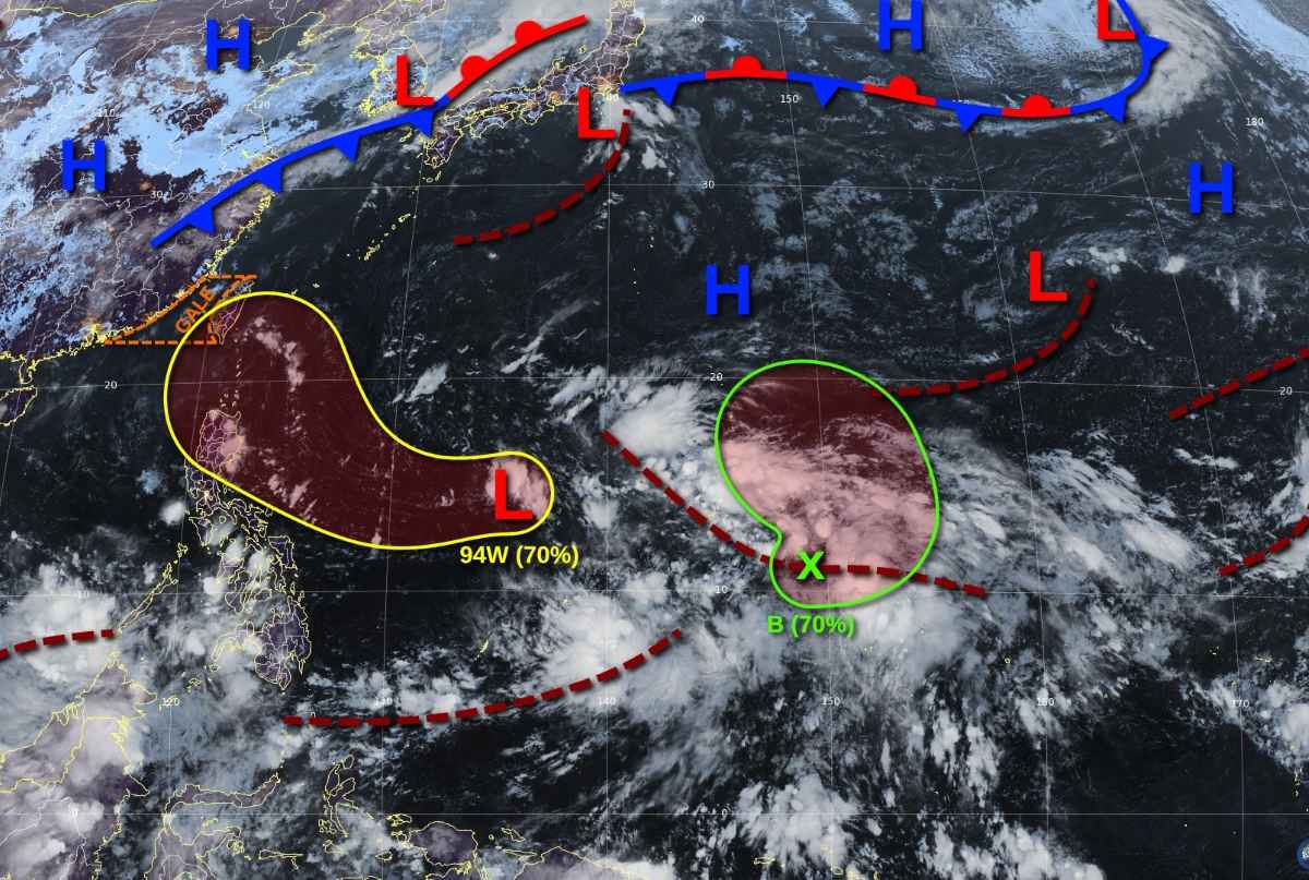
The JTWC advised the affected areas in the Philippines, especially northeastern Luzon, as well as southern Taiwan (China) to closely monitor the progress of the system. The JTWC assessed the chance of the low pressure system intensifying in the next 7 days as high as 70%.
Meanwhile, Windy.com's forecast model shows that around October 23, the tropical depression could become a storm, approaching Quezon City, Philippines.
Currently, on October 19, the tropical convergence zone is affecting Mindanao, causing rain and thunderstorms, which can lead to flash floods and landslides.
According to the Vietnam National Center for Hydro-Meteorological Forecasting, around October 21-22, there is a high possibility of a tropical convergence zone forming in the central East Sea.
This tropical convergence zone can develop into tropical cyclones. Therefore, from October 23 to 25, there is a high possibility of tropical depression or storm activity in the East Sea.
According to the Typhoon page in the Northwest Pacific, the development of tropical cyclones in the East Sea (if any) will be extremely complicated in terms of intensity and direction of movement, due to the possibility of interacting with another storm off the coast of the Philippines from October 23-24 onwards, and the northeast wind zone operating in the East Sea area. The worst scenario is that the storm moves quickly and heads towards the sea areas of the Central and South Central provinces of Vietnam.


