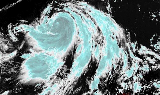
CNN's latest hurricane report says the Atlantic hurricane season has been quiet for more than three weeks since the deadly superstorm Beryl made landfall in Texas, USA.
Dry and dusty air has kept the Atlantic from the scene since Hurricane No. 3 Beryl. However, a complex area of showers and thunderstorms in the eastern Caribbean is forecast to see favorable atmospheric conditions this weekend and then strengthen into a tropical depression or tropical storm.
The newly formed storm will be the fourth storm of this year's Atlantic hurricane season and named Debby.
The system is expected to strengthen into a hurricane and move along the northern Caribbean until August 2 before appearing near the Bahamas or Florida, USA this weekend. The path through the Caribbean will determine when the system is likely to strengthen into storm No. 4.
Forecasters note that the system may not strengthen into a tropical depression or hurricane if it passes through the mountainous areas of Puerto Rico, Hispaniola and eastern Cuba.
The likelihood of strengthening into a typhoon will be enhanced if the system avoids those islands and terrain. Unusually hot sea temperatures in the Atlantic, Caribbean and Gulf of Mexico could strengthen the system as it moves here.
It is not yet clear which direction the weather system being closely monitored by Atlantic forecasters will move. A strong high pressure area over the Atlantic is expected to guide the storm from the eastern Gulf of Mexico to the southeastern coast of the United States over the weekend.
August is the beginning of the most active period of the Atlantic hurricane season because the sea water is very hot, the upper-level winds cause disruption while the air is dry and dusty, gradually decreasing.
However, during this year's hurricane season, temperatures across the Atlantic have not been normal and have clearly shown the potential impact on storms. Hurricane Beryl became the earliest Category 5 storm to be recorded in early July, in part due to the Caribbean Sea in July being as hot as it was during the peak of the hurricane season. Currently, some areas of the Caribbean and Atlantic are warmer than normal in early October - when ocean temperatures are at their peak.
Unusually high ocean temperatures are one of the reasons why many forecasters believe that the 2024 hurricane season will be very intense. Other reasons include the formation of La Nina, with few wind shear in the upper Atlantic.
The 2024 Atlantic hurricane season starts at near-average, with Hurricane No. 1 Alberto forming in mid-June - a typical time for the first storm of the season. However, the normal course of the hurricane season quickly disappeared as Hurricane Beryl formed.
The US National Hurricane Center notes that the first hurricane of the Atlantic hurricane season typically forms around August 11 and the first Category 3 or higher hurricane to form around September 1. However, Beryl has broken both records since July.
In addition to Alberto and Beryl, the Atlantic basin has also recorded a short-lived history of Tropical Storm Chris this year.


