On August 21, Gilma became the second hurricane of this year's East Pacific hurricane season and is expected to strengthen into a major storm this weekend while still far from land.
According to the latest storm information from the US National Hurricane Center (NHC), storm Gilma is currently at level 1 on the 5-level Saffir-Simpson storm scale and is located about 1,553 km from the southern tip of the Baja California peninsula, Mexico. west southwest.
Storm forecasters said the storm could become a Category 3 storm in the coming days. Gilma strengthened into a tropical storm on August 18. The storm is moving west at a speed of 11 km/h.
The strongest wind near the center of the storm is about 137 km/h. Strong hurricane winds spread up to 48 km from the center of the storm and strong tropical storm winds spread up to 225 km away.
The second storm of the 2024 East Pacific storm season appeared a month later. The average date for the second storm is July 15. The storm will peak in intensity in the next 72 hours as it moves west. By early next week, it could be near Hawaii.
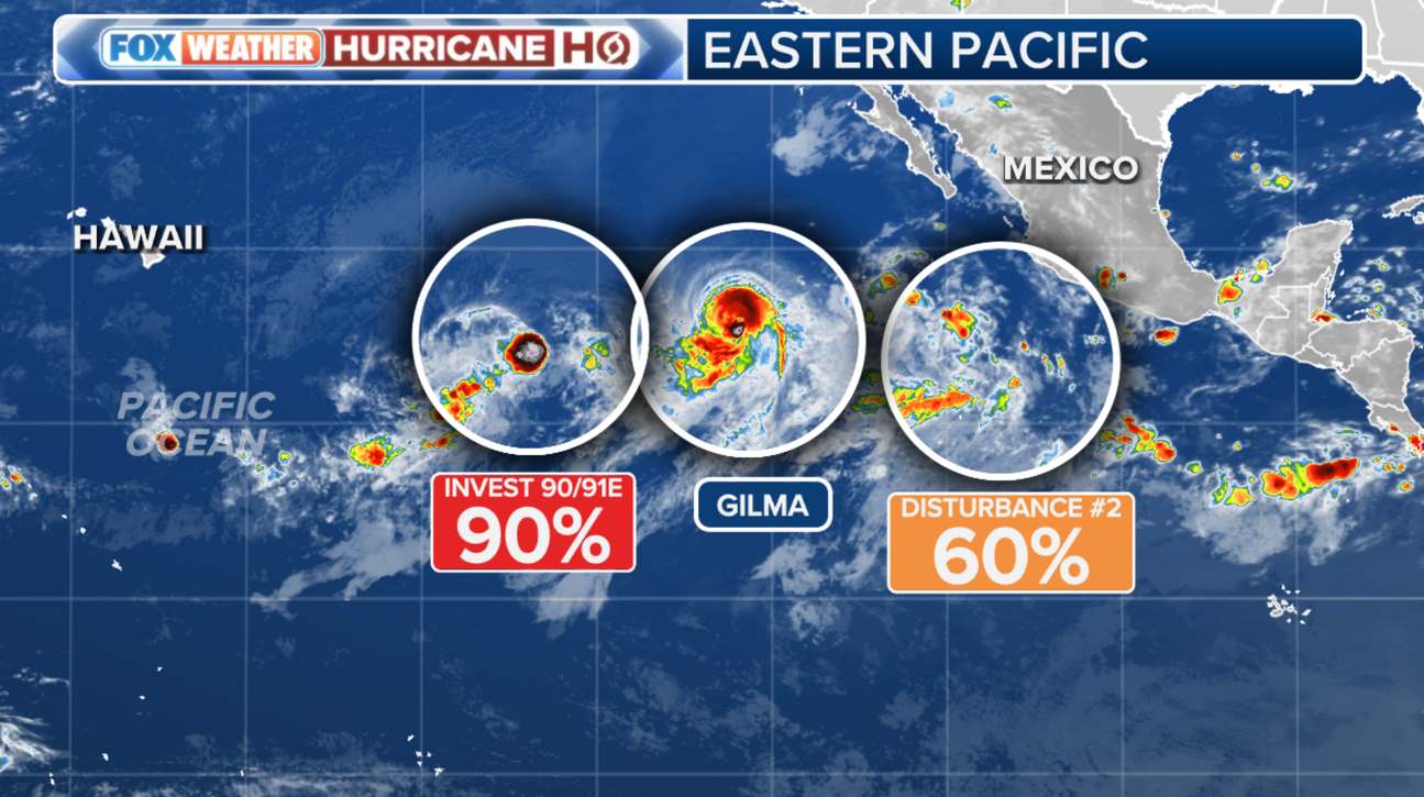
The FOX Weather Prediction Center is also monitoring depression 90/91E and another disturbance right next to Hurricane Gilma.
Storm forecast models show gradual development over the next few days, and a tropical storm is expected to form in the East or Mid-Pacific as the system moves west or west northwest.
Any impact from Gilma, depression Invest 90/91E, will occur during the last week of August, but given the time between now and closest approach, possible scenarios very different.
Both the presence of dry air and cooler nearshore water temperatures play important roles in the strength of tropical storms near the islands, according to FOX Weather's storm forecast .


